India

country taxonomy block

The government of the state of Andhra Pradesh in South India announced its considerations of employing satellite technology to provide rural areas with broadband services, including computer networks, television and internet access.

To this aim, a committee chaired by IT advisor J. Satyanarayana and composed of representatives from the National Remote Sensing Centre of the Indian Space Research Organisation (ISRO/NRSC), Intersat, Gilat Satellite Networks, Airtel and Hughes Communications India as well as by the planning department special chief secretary and IT department secretary was established.

The board of experts will explore the opportunities of the extension of satellite infrastructure in remote villages and agrarian regions of the country. Satellite technologies for delivering up to 2 mbps connectivity to remote villages that cannot be connected through fibre due to terrain constraints will be considered.

Among the potential benefits of an improved…

more
Publishing date 12/12/2014

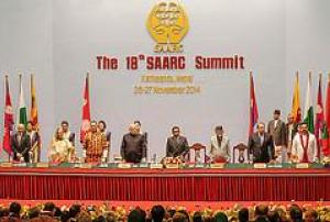
During the inaugural session of the 18th South Asian Association for Regional Cooperation (SAARC) in Kathmandu, Nepal, representatives of the eight member countries of SAARC discussed new ways of strengthening regional cooperation.

Among other things, the leaders highlighted the benefits an enhanced regional collaboration in the use and development of space-based technology could have for sustainable development of the region.

Addressing this issue, India's Prime Minister, Narendra Modi, announced that India is planning to develop and launch a SAARC satellite by 2016. According to him, the satellite will benefit the region in areas ranging from disaster response and resource management to weather forecasting and communication.

more
Publishing date 27/11/2014

On 22 October 2014, India and Mexico formally agreed on a cooperation in areas related to the peaceful use of the outer space, such as remote sensing and satellite communication. The pact was signed in New Delhi during the Joint Commission Meeting (JCM) presided by the Ministries of Foreign Affairs Sushma Swaraj and Jose Antonio Meade Kuribrena of India and Mexico, respectively.

The Ministries chaired the sixth meeting of the India-Mexico JCM, established in 1984 and formulated a Memorandum of Understanding committing the Indian Space Research Organisation ISRO and the Mexican Space Agency on space cooperation for peaceful purposes.

Besides space technologies, the meeting concerned wider bilateral relations between the two countries including political, economic, trade, and energy issues.

Publishing date 23/10/2014

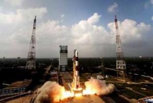
On 16 October 2014, India successfully sent its third navigation satellite IRNSS-1C into orbit on board of a Polar Satellite Launch Vehicle (PSLV). The launch was on schedule at 01:32 local time from the Satish Dhawan Space Centre.

IRNSS-1C is the third satellite of the seven satellite constellation of the Indian Regional Navigation Satellite System (IRNSS), an array of geosynchronous satellites that the Indian Space Research Organisation (ISRO) has been usying to gather navigation data of the Indian region.

Publishing date 16/10/2014

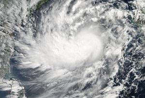
Andhra Pradesh Chief Minister Chandrababu Naidu has directed the Hyderabad National Remote Sensing Centre (NRSC) to use GIS, GPS and remote sensing instruments to detect the detrimental effects caused by Cyclone Hudhud in the region. The NRSC employed geo-tagging to create a map of the damages, in order to facilitate the action of the national disaster response forces (NDRF) deployed to provide support relief.

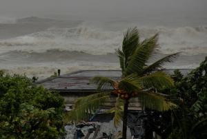
The cyclone hit India's eastern coast on the weekend, with heavy rains and winds at 170/180 km ph of speed. Although evacuation plans have been implemented after NASA's cyclone alert on 8 October, the storm generated severe consequences, including property and live losses and communication systems' disruption. According to Naidu "the government was able to reduce loss of life due to the precautionary measures taken".

Additionally, India has received relevant satellite-based…

more
Publishing date 13/10/2014

The Indian Space Research Organisation ISRO will launch a navigation satellite on 10 October, as the news agency ANI reported. The satellite IRNSS 1C is the third one to be launched in a formation of seven. Together, the seven satellites will form the Indian Regional Navigation Satellite System.

ANI further reported: "IRNSS will provide Standard Positioning Service and Restricted Service with a position accuracy of better than 20 meters in the 1500 kilometers area covering the Indian peninsula.This will provide terrestrial, aerial and marine navigation accurately and help disaster management, vehicle tracking and fleet management, mobile phone tracking, mapping of terrain as well as air and sea navigation."

Publishing date 29/09/2014

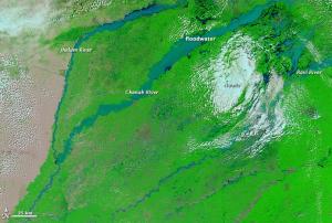
Following heavy floods and landslides in Pakistan's Punjab and Kashmir provinces, the International Charter: Space and Major Disasters was activated to provide satellite-based disaster maps. The mechanism was triggered by UNITAR/UNOSAT on behalf of UNOCHA.

The International Charter reported: "The Punjab and Kashmir Provinces, on the border with India, have suffered the worst of the flooding, and the majority of the deaths in Pakistan took place in Punjab. After the heavy rain, rivers - including the Chenab - in Pakistan and India rose and flooded, sweeping downstream. The surge of water inundated villages and agricultural areas, as well as parts of nearby cities, destroying thousands of homes. Residents had little warning of the rapidly developing flood, which accounted for much of the initial death toll when people were caught in their homes in the night."

The satellite image products will be published on the…

more
Publishing date 15/09/2014

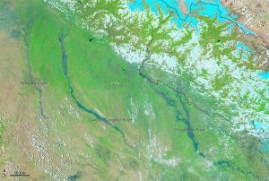
On 18 August 2014 the International Charter: Space and Major Disasters was activated for floods in Uttar Pradesh, northern India, at the request of NRSC / ISRO in order to provide space-based product.Heavy rains in the Himalayas have triggered flooding in many parts of India with up to 1500 villages affected, a death toll of over 60 and many more people missing. Major rivers and tributaries in the area have risen to dangerous levels, triggering an unprecedented flood situation.A standard operating procedure (SOP) is in place, but the situation will be normal only if it stops raining in the catchment areas in both Nepal and India. Rescuers have been attempting to reach the villages via submerged roads, but local authorities are concerned by the lack of clean drinking water, food and sanitation.Satellite-based products and maps created through the mechanism will be published on the International Charter's website as soon as they become available.

Publishing date 20/08/2014
Regional Support Offices mentioned:

On 12 August 2014, MDA’s Information Systems group (MDA) signed a contract to continue to provide RADARSAT satellite data to the National Remote Sensing Centre (NRSC) of India.

This agreement, valid until June 2015, represents for MDA the continuation of a long-term relationship with NRSC, as well as with the Indian Space Research Organisation ISRO and the Government of India, as India has been using RADARSAT information since 1998.

For NRSC, the versatility of the RADARSAT-2 satellite makes it ideal for obtaining information for disaster management and monitoring programmes, within its 12-24 hours programming lead time for routine acquisition and the 4-12 hours lead time for emergency acquisition. RADARSAT-2 has global high-resolution surveillance capabilities, frequent re-visit imaging options and wide-area coverage, regardless of the time of day or weather condition. It is supported by ground receiving stations that provide near real-time processing and product…

more
Publishing date 13/08/2014

K Radhakrishnan, chairman of the Indian Space Research Organisation (ISRO), announced on 10 August 2014 that the Organisation plans to acquire the latest satellite platforms and payload technologies to develop and launch next generation communication satellites.

ISRO is looking for foreign partners and industrial alliances to acquire the technology and upgrade their current satellite platforms, allowing the space agency to meet the growing demand for broadband internet and rural telecom connectivity in India. The organisation also intents to replace aging satellites and enhance the observation capability to the level of 0.25 m spatial resolution.

Among other programmes, India is currently working with the Jet Propulsion Laboratory of NASA to develop a dual frequency microwave imaging satellite: a satellite system meant for disaster management and others, set for launch in 2019-20.

Publishing date 11/08/2014

At the sidelines of the Sixth BRICS Summit, India and Brazil signed an agreement on 16 July 2014 which will facilitate Brazilian earth stations to receive and process data from Indian Remote Sensing satellites (IRS), as Geospatial World reported.

In his official statement, India's Prime Minister Narendra Modi laid out the details of the agreement: "This Implementing Arrangement provides for the reception of data from AWiFS and LISS-III payloads of IRS satellites, including but not limited to the Resourcesat-2 at Cuiabá earth station in Brazil on a Government-to-Government cooperation basis."

The implementing agencies of the agreement are the Indian Space Agency (ISRO) and its executive agency (National Remote Sensing Centre) on the Indian side and the National Institute for Space Research…

more
Publishing date 18/07/2014

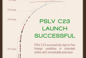
After the successful launch of the Polar Satellite Launch Vehicle PSLV-23 carrying a payload of five satellites into orbit from Satish Dhawan Space Center in Sriharikota by the Indian Space Research Organization ISRO, India's Prime Minister Narendra Modi has set out a proposal for a satellite to be developed and tasked exclusively for operation in Southern Asia. The aim of such a satellite would be to strengthen the South Asian Association for Regional Cooperation (SAARC).

ISRO’s successful launch of payloads developed in France, Germany, Singapore and Canada was seen as a “global endorsement of India’s space capabilities,” as the Prime Minister stressed, and consequently suggested the development of a SAARC satellite, which would be used to support disaster management and sustainable development in the region. "We would dedicate this satellite to our neighborhood as India’s gift… We should share the fruit of this with our…

more
Publishing date 07/07/2014

The Indian Polar Satellite Launch Vehicle (PSLV) has successfully launched the French SPOT-7 imaging satellite on 30 June 2014 from the Satish Dhawan Space Centre.

The Earth Observation satellite SPOT-7 was constructed by Airbus Defence and Space (formerly EADS Astrium). It has an expected life span of ten years. The first SPOT satellite was launched in February 1986.

The  launch vehicle also carried five other smaller satellites along with SPOT-7: Canada’s CanX-4 and CanX-5, Germany’s AISSat-1, and Singapore’s two-satellite experiment VELOX-1." Various political leaders congratulated ISRO on the successful launch.


more
Publishing date 01/07/2014

Kerala Port Department, India, announced that a digital map of its entire coastline will be created before 2015. This map would be a consistent tool for many government agencies, including Kerala State Disaster Management Authority.

The project aims to create maps with multiple layers, including terrain features, depth of coastal waters and photos of landmarks in the area. The accessibility of complete measurements of the 580 kilometers long coastline would also represent a considerable gain in managing land disputes and protecting natural resources, besides improving navigation and security.

Publishing date 26/06/2014

The Indian Space Research Organization (ISRO) has announced that it will launch its next rocket PSLV C23 carrying the French remote sensing satellite SPOT 7, along with four others from Sriharikota spaceport at the end of June.

SPOT 7 is an Earth observing satellite, similar to Indian Remote Satellite System (IRSS). ISRO would use the core-only edition of the launch vehicle PSLV, the agency said. The satellites would be integrated with the launch vehicle on June 16 and heat shield check would be performed on June 18.

Publishing date 20/06/2014

On 23 April, the Indian Space Research Organization (ISRO) reported the successful orbital arrival of the second inclined geosynchronous orbiting (IGSO) satellite RNSS-1B. This satellite is part of the Indian Regional Navigation Satellite System (IRNSS), which will eventually include seven satellite constellations. IRNSS-1B was part of a payload launched on board India’s Polar Satellite Launch Vehicle (PSLV) from the Satish Dhawan Space Center on 4 April 2014.

The first satellite of this constellation IRNSS-1A was launched in July 2013. With two more satellites proposed to be launched later this year, the system will be operational after the instillation of four satellites.

Data from India’s Regional Navigation Satellite System (IRNSS) will be open to all users through the Standard Positioning Service.  

more
Publishing date 06/05/2014

The India meteorological spacecraft INSAT 3D - launched on 26 July 2013 - was declared operational on 15 January 2014.

The satellite carries a multi-spectral Imager, 19 channel sounder, Data Relay Transponder and Search and Rescue Transponder. The instruments are mainly used for meteorological purposes as well as for search and rescue. 

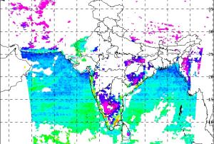
Now, the Indian Meteorological Department made available first sets of data and derived products and maps from the satellite on its website. The data include temperature profiles, sea surface temperature maps, humidity profiles and rainfall maps.

more
Publishing date 06/02/2014

The Odisha Space Application Centre (ORSAC) will use remote sensing to review the damages caused by tropical storms and flood on the paddy fields in India. The agency is using for the first time remote sensing application to evaluate damages on crops. The National Remote Sensing Centre (NRSC) is supplying ORSAC with data.

The study is expected to provide a clear image of the losses and publish conclusion in two months. ORSAC is also proposing an infrastructure damage study in the Phailin-hit districts in collaboration with the national agency.

Publishing date 09/12/2013

On 21 November 2013, UN-SPIDER participated in 18th Governing Board meeting of the Centre for Space Science and Technology Education for Asia and the Pacific (CSSTEAP), affiliated to the United Nations, in Bangalore, India. The meeting approved the performance report and audit report of CSSTEAP for 2013, as well as its programme of work and budget for 2014. The governing board welcomed CSSTEAP's decision to increase its budget by 10% despite austerity measures by the Government and ratified several other decisions which includes organising special courses upon request of the member countries in respective countries, conducting short courses requested by the UN, hosting CSSTEAP alumni meetings in a number of countries and appealed member states to support (cash and in-kind) CSSTEAP.

The governing board was informed that CSSTEAP has trained 1,260 students from 35 countries in Asia and the Pacific and 29 students from outside Asia-Pacific region. A total of 115 students have…

more
Publishing date 04/12/2013

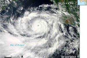
In mid-October, effective disaster planning, government cooperation, preparedness at the community level and early warning communication contributed to a minimal death toll in the wake of the strongest cyclone to hit India in 14 years, Cyclone Phailin. Early warning alerts, disseminated four days before Phailin struck land in October 12, 2013 led to the evacuation of nearly 1.2 million people and the relocation of more than 30,000 animals.

Ultimately, a total of 21 lives were lost as a result of the cyclone and an additional 23 lives due to the severe flash flooding. Moreover the impacts of Cyclone Phailin and ensuing floods also affected more than 13.2 million people and caused hundreds of millions of dollars in damage to homes, schools, crops and the fishing industry. However, this aftermath resulted in a much lower death toll than a catastrophic cyclone of similar strength that struck India in 1999, Cyclone 05B, which had a much more devastating outcome: more than 10,000…

more
Publishing date 26/11/2013

During the recent CEO’s Forum on Space Technology Applications for National Development in Sri Lanka, India’s National Remote Sensing Centre Deputy Director Dr. P.G. Diwakar highlighted the important impact that satellite technologies have in various sectors of development in India. This includes agriculture, transport, navigation, environmental protection, resource mapping, meteorology, disaster management and surveying. He named India as a success story in applying such technologies to development processes.

The Daily Mirror quoted Diwakar: "India has used satellite imaging technology to improve national and regional level planning across several sectors through improved information availability. In the field of infrastructure development in Bangalore, several projects have been carried out using satellite imaging with multiple layers of information and allowing growth to be systematic. Using this technology, the Indian government was able to gain a better…

more
Publishing date 23/10/2013

India is building a tsunami early warning system in the South China Sea, which is likely to be operational in the next 10 months, as The Economic Times reported. The need for the establishment of such a system had become very obvious during the 2004 tsunami in the Indian Ocean causing widespread destruction.

The Economic Times reported: "Two years ago, the issue of having such a system in the South China Sea was raised in a meeting with the Regional Integrated Multi-Hazard Early Warning System for Africa and Asia (RIMES), a Bangkok based 18-member multi-governmental organisation, of which India is also a member. It was suggested that India should build capabilities of issuing early warning in an event of tsunami in the South China Sea, which was agreed upon by India. The South China Sea countries are also members of this organisation.

more
Publishing date 17/10/2013

The Indian Space Research Organisation (ISRO) and the United States National Aeronautics and Space Administration (NASA) will jointly build and launch an all-weather satellite to support disaster and risk management, understanding movement of tectonic plates to climate change and estimation of crop and tree cover, as reported the Deccan Chronicle.

“It is the turning point in India-US relations,” Dr K. Radhakrishnan, the chairman of ISRO, told the newspaper, adding that the new satellite will be the precursor for joint space missions in future. “It is a recognition of our ability to build and launch satellites,” he said.

The satellite will be launched onboard an Indian rocket in 2019 or 2020.

more
Publishing date 04/10/2013

In a combined action to provide decision making tools, the National Remote Sensing Centre (NRSC) of Indian Space Research Organisation (ISRO) and the Forest Department of Himachal Pradesh, a north Indian state, have developed a new portal that brings all the spatial data on forests in Himachal Pradesh under a platform. This portal provides a SMS gateway, which facilitates communication between the Forest Department and the group of users from forest guard to the Headquarters level, helping for example, to check wildfires by sending bulk messages to the lowest field functionaries.

The ultimate goal of this portal is to provide information on governance, planning and implementation of HP State Compensatory Afforestation Fund Management and Planning Authority (CAMPA).

Publishing date 20/08/2013

The Indian state of Gujarat is planning a project to set up a satellite-linked disaster warning system along Gujarat's coastline to alert fishermen during adverse weather conditions. According to the statements made on 3 August 2003 by V Thiruppugazh, the executive director of Gujarat State Disaster Management Authority, the government is already working in the implementation of this project.

Thiruppugazh stated that this project would help the government coordinate with other agencies effectively during adverse weather conditions.

more
Publishing date 13/08/2013