Summary
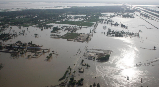
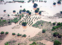
Floods are a recurring problem worldwide, causing devastating impacts on communities, particularly in developing countries where infrastructure and resources are vulnerable. Developing flood early warning systems is essential to help minimize the impacts of floods. In response to this need, UN-SPIDER has brought together several international, regional, and national partners to implement the pilot project entitled Flood early warninG systems Using Impact-baseD forEcasts (Flood GUIDE). Partners include the Global Flood Awareness System (GloFAS) of the Copernicus progamme, AIRBUS Defence and Space, the Centre for Remote Sensing of Land Surfaces of the University of Bonn (ZFL), and national space, disaster management, and hydrological agencies from Ghana, Guatemala, Nigeria, Peru, and South Africa. The project's objective is to enhance flood early warning systems incorporating the routine use of "impact-based" forecasts.
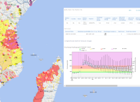
To achieve this goal, the Flood GUIDE project will use a combination of GloFAS, hydraulic modelling, historical data on flood impacts, and information on the vulnerability of exposed elements to deduct the potential impacts of floods on communities, various sectors of development and critical infrastructure. These potential impacts will be incorporated into impact-based forecasts to provide more accurate and timely information to those who need it.
The project aims to provide decision-makers a better understanding of the potential impacts of floods and help them make informed decisions about how to best prepare for and reduce the impacts of potential floods. This pilot effort will serve as a prototype for future initiatives to support flood preparedness efforts in developing countries.
Regional Implementation
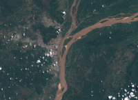
The pilot project will be implemented in specific regions (study areas) of selected rivers in Ghana, Guatemala, Nigeria, Peru and South Africa.
Partners
International Level:
- Global Flood Awareness System (GloFAS)
- Airbus Defence and Space (Airbus)
- Center for Remote Sensing of Land Surfaces of the University of Bonn (ZFL)
Ghana (study area):
- National Disaster Management Organization (NADMO)
Guatemala (study area):
Nigeria (study area):
- National Space Research and Development Agency (NASRDA)
- National Emergency Management Agency (NEMA)
- National Hydrological Services Agency (NIHSA)
Peru (study area):
- National Commission for Aerospace Research and Development (CONIDA)
- National Civil Defense Institute (INDECI)
South Africa (study area):
 |
Background Information The Flood GUIDE project is a pilot effort carried out by different organizations such as UN-SPIDER, GloFAS of the Copernicus Disaster Management Service, AIRBUS and ZFL, in partnership with national agencies from Ghana, Guatemala, Nigeria, Peru, and South Africa. The project aims to improve flood early warning systems by incorporating the use of "impact-based" forecasting as part of the system. |
 |
Technical Information The project includes a methodology, comprised of several steps and the utilization of different tools. The methodology and the expected outcome is explained on this page. |
 |
Study Areas The pilot project will be implemented in specific regions of selected rivers in Ghana, Guatemala, Nigeria, Peru and South Africa. Further details on these study areas can be found on this page. |