China

country taxonomy block

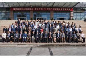
UN-SPIDER participated in the International Seminar on Application of Communication Technology in Disaster Reduction and Prevention organized by the International Civil Defence Organisation (ICDO) in Suzhou, China from 26 to 29 May 2014. UN-SPIDER's expert Ms Longfei Liu gave a lecture on space-based information for disaster assessment and prevention.

19 participants from 16 ICDO member countries and more than 10 international experts attended the seminar. It mainly aimed to enhance the understanding and practical experience of the communication technology for supporting disaster risk reduction. The seminar introduced theories and applications of modern communication through lectures, technical analysis, case studies and simulation exercises focusing on the application of mobile, satellite and…

more
Publishing date 30/05/2014

On 8 and 9 May 2014, UN-SPIDER participated in the International Symposium of Integrated Disaster Risk Governance in Beijing. The event was jointly organized by the United Nations International Strategy for Disaster Reduction (UNISDR), the China National Commission for Disaster Reduction (NCDR), the Ministry of Civil Affairs of China, and the Ministry of Education of China.

The symposium is part of the on-going multi-level and multi-theme consultations for the inputs to the post-2015 Framework for Action. It brought together government officials and scientists to share achievements and experience, to identify challenges and bottlenecks in the implementation of the current Hyogo Framework for Action for Disaster Risk Reduction (HFA).

UN-SPIDER's expert Shirish Ravan chaired Session 2 of the symposium on "Government Role and Governance". He also gave a presentation entitled "Is Space Technology Contributing Enough to DRR - Challenges with Respect to Implementation of HFA…

more
Publishing date 14/05/2014

The application phase for the “United Nations International Conference on Space-based Technologies for Disaster Management - "Multi-hazard Disaster Risk Assessment" is now open. The conference will take place from 15 to 17 September 2014 in Beijing, China and is organized by the UN-SPIDER Beijing Office jointly with the Ministry of Civil Affairs of the People’s Republic of China.

Application is only possible online through this weblink. The final deadline for application is 29 June 2014. The organisers will be able to offer support to a limited number of participants from Member States and organisations engaged in developing or intending to develop a partnership with the UN-SPIDER programme. The support will defray the cost of travel (round-trip ticket – most economic fare – between the airport of international departure in their country…

more
Publishing date 06/05/2014

UN-SPIDER's Regional Support Office in Nepal, the International Centre for Integrated Mountain Development (ICIMOD), and the Chinese Academy of Sciences (CAS) are strengthening their collaboration. In early April, Prof Bai Chunli, CAS, and an eight-member delegation visited ICIMOD to discuss ways to strengthen the collaboration between the two institutions.

ICIMOD reported on its website that ICIMOD and CAS have been strategic partners for decades, working in the areas of scientific research and knowledge sharing for sustainable mountain development. "CAS looks forward to strengthened collaboration with ICIMOD to address issues of common interest in the countries of the region," said Prof Chunli.

To mark the ongoing cooperation, a memorandum of understanding was signed between the Third Pole Environment programme of CAS and ICIMOD that will help further scientific understanding of climate change in the Hindu Kush Himalayas and bolster cooperation among countries in the…

more
Publishing date 28/04/2014

Two UNOOSA/UN-SPIDER experts participated in the Project Manager (PM) training for the International Charter: Space and Major Disasters from 10 to 11 April in Beijing, China.

The PM training is one of the most important efforts to improve the effective operation of the Charter mechanism. The aim of the training was to provide a deeper understanding of the whole process of coordinating Charter activations to effectively take advantage of this mechanism during emergencies.

UN-SPIDER also presented at the 31st Board Meeting of International Charter on 17 April 2014. UN-SPIDER appraised the board members about efforts of UN-SPIDER to promote Charter and cooperation opportunities. During the meeting from 13 to 17 April 2014, the China National Space Administration (CNSA) took over the role of secretariat from the Argentinean Space Agency (CONAE) for the next six months.

Publishing date 12/04/2014

UN-SPIDER visited the office of the Asia-Pacific Space Cooperation Organization (APSCO) in Beijing, China on 13 March 2014 to discuss further joint activities in 2014.

The Asia-Pacific Space Cooperation Organization (APSCO) is an inter-governmental organisation aimed at promoting and strengthening the collaboration on space programmes and technologies among its Asian Member States. APSCO and UN-SPIDER have been cooperating closely since UN-SPIDER opened its office in Beijing in 2010.

For example, APSCO has been a collaborating partner in the last three United Nations International Conferences on Space based technologies for Disaster Management organised by the UN-SPIDER Beijing Office and the Ministry of Civil Affairs of People's Republic of China. In 2013, UN-SPIDER, APSCO and NDRCC have organised various joint training programme on specific themes.

In 2014, APSCO will support the 4th annual United Nations International Conference on Space based technologies…

more
Publishing date 20/03/2014
The International Charter: Space and Major Disasters was activated yesterday to provide satellite images and image products in search of the missing Malaysia Airlines Flight MH370. The international mechanism was triggered by China Meteorological Administration, which will also do the project management for the activation.

Malaysia Airlines Flight MH370 disappeared from radar over the South China Sea on 7 March 2014. The jet was carrying 239 people (12 crew and 227 passengers) and has yet to be found despite a multi-national search.

more
Publishing date 12/03/2014

UN-SPIDER, represented through Mr. Shirish Ravan of the UN-SPIDER Beijing Office, participated in the 13th ASEAN Regional Forum Inter-Sessional Meeting on Disaster Relief and presented the topic "Role of space based information in Disaster Risk Reduction: UN-SPIDER Interventions". In his presentation, Mr Ravan underscored the importance of relaying early warning messages of impending disasters to residents.

The 13th ASEAN Regional Forum Inter-Sessional Meeting on Disaster Relief took place from 26 to 28 February 2014 in Chengdu, China. Participants discussed early warning and assessment of risks, military-civil coordination, humanitarian assistance stockpiles management, damage assessment, recovery and reconstruction, and the future direction of regional disaster relief cooperation including preparations for the ASEAN Regional Forum Disaster Relief Exercises in…

more
Publishing date 03/03/2014

According to a study conducted by NASA’s Jet Propulsion Laboratory and Texas A&M University, the air pollution in Asia is affecting global climate and weather patterns.

The researchers used air pollution and meteorology data from the last 30 years and concluded that the air pollution originating from Asia has an impact on the upper atmosphere and can potentially strengthen storms and cyclones.

Big manufacturing factories, industrial plants, power plants and other industrial facilities release small particles in the atmosphere and the situation worsens through coal burning, car emission and stagnant weather. Satellite information helps track the impacts of the pollution on cloud formations, storm intensity and other factors that eventually impact the climate globally.

more
Publishing date 27/01/2014

China is planning to expand its homegrown Beidou navigation system by 2020 and make it accurate to within centimeters. Up until now the Chinese system has 16 satellites and it is expected to grow to 30 by 2020.

Currently the system reaches an error margin as low as 5 meters. With the improvements China hopes to be able to compete with the US GPS. The system serves the Asia-Pacific region a year now and hopes to expand coverage to other Asian countries.

Beidou is the only satellite navigation system that offers telecommunication services. That means that, apart from giving users location and time information, Beidou can also send users' information to other people and communicate with users via text messages.

Publishing date 07/01/2014

China's high definition Earth Observation satellite Gaofen-1 has been officially put in service on Monday, 30 December 2013, according to the State Administration of Science, Technology and Industry for National Defence (SASTIND), as the News Agency Xinhua reported. Gaofen-1 has successfully undergone eight months of in-orbit tests after being launched on April 26 and has sent high definition photos to Earth. China's use of remote-sensing satellite has entered a new phase, said Xu Dazhe, head of the SASTIND.

The satellite will help in geographic and resources surveys, environment and climate change monitoring, precision agriculture, disaster relief and city planning. During the test period, Gaofen-1 already provided data…

more
Publishing date 03/01/2014

The Moderate Resolution Imaging Spectroradiometer (MODIS) on NASA’s Terra satellite captured an image of the haze spreading from Beijing to Shanghai on 7 December 2013. The expansion of the smog to the south of China is not that common as for the northeast.

The fog has distinguishing features that makes it appear grey and smooth on the images. Ground-based sensors reported a level Particulate Matter smaller than 2.5 microns in the air to be as high as 480 and 355 per cubic meter of air in Beijing and Shanghai. WHO considers levels below 25 to be safe. The Air Quality Index was also with more than 800% above what is considered good.

In some cities, authorities ordered school children to stay indoors, pulled government vehicles off the road, and halted construction in an attempt to reduce the smog, according to news reports.

Publishing date 12/12/2013

On 20 November 2013 China successfully launched the Yaogan XIX, a remote-sensing satellite. Yaogan XIX was sent into scheduled orbit on the back of a Long March 4C carrier rocket from the Taiyuan Satellite Launch Center in Taiyuan, capital of north China's Shanxi Province.

According to the Taiyuan Satellite Launch Center, the satellite will be used to aid in preventing and reducing natural disasters, conduct scientific experiments, carry out land surveys and monitor crop yields.

This launch marks the 184th mission for the nation's Long March rocket family.

Publishing date 28/11/2013

From 21 to 22 October 2013, the UN-SPIDER Beijing office will organize an interactive training session in Beijing, China to strengthen the capacity of the National Disaster Reduction Centre of China (NDRCC) to effectively embed Space technologies in their activities. The training focused on disaster risk assessment (especially flood and drought), relief needs assessment, situation analysis, early warning systems, and international standards related to disaster prevention. Experts from the Delta University (United States), UN OCHA Thailand, University of Twente (Netherlands), International Water Management Institute (Sri Lanka) and Bureau for Crisis Prevention and Recovery (BCPR) of UNDP shared their experience and best practices in using space technology and geospatial information in disaster management.

The NDRCC was established to serve the China’s needs in the field of disaster prevention and reduction. A comprehensive operational system is now working efficiently at…

more
Publishing date 01/11/2013

From 27-31 October 2013, the UN-SPIDER Beijing Office organized a capacity building programme in Beijing, China to strengthen the capacity of the countries in Asia, Africa and Latin America. 26 participants from Bangladesh, Bhutan, Cameroon, Ghana, Indonesia, Iran, Kenya, Malawi, Mongolia, Mozambique, Pakistan, Peru, Thailand, Turkey and Vietnam participated in the training.

The training was organized jointly with Asia Pacific Space Cooperation Organisation (APSCO) and National Disaster Reduction Centre of China (NDRCC). It was conducted by experts from the UN-SPIDER Beijing Office, the University of Twente (Netherlands), the International Water Management Institute (Sri Lanka) and NDRCC. During the training course, hands-on sessions were offered on flood risk assessment, global and regional flood risk monitoring, remote sensing based flood risk models and drought monitoring and risk assessment.

The training course was organized back-to-back with the…

more
Publishing date 01/11/2013

The United Nations International Conference on Space-based Technologies for Disaster Management - "Disaster Risk Identification, Assessment and monitoring“ was successfully inaugurated on 23 October 2013 in Beijing, China. This conference held from 23 to 25 October 2013 is co-organized by UNOOSA and the Ministry of Civil Affairs of the People’s Republic of China (PRC), in collaboration with the Department of Treaty and Law, Ministry of Foreign Affairs of PRC, the Department of Social Security, the Ministry of Finance of PRC, the Department of System Engineering, China National Space Administration of PRC, the Asia Pacific Space Cooperation Organization and with the support of DigitalGlobe.

163 participants from 27 countries representing more than 60 organizations including 7 international/regional organizations, government agencies, universities, private companies and NGOs are participating in the conference. The conference brings together numerous countries…

more
Publishing date 23/10/2013

China has established a national emergency geospatial data system to provide first-responders with detailed maps within two hours after a disaster, as the Chinese news agency Xinhua reported. The data system is based on satellite data, as well as information collected by unmanned planes and surveying instruments. It uses Map World (the Chinese version of Google Earth).

Xinhhua reported: "The national geospatial data system was established after April 20, when a magnitude-7.0 earthquake rocked Ya'an, Sichuan province. Only two hours after the quake, the National Administration of Surveying, Mapping and Geoinformation produced its first detailed map of the region. That set in motion a wave of support for the national agency from the central government. By comparison, it took nearly nine hours for a map to be produced after the 2008 Wenchuan earthquake, which means mapping technology at the national agency has…

more
Publishing date 22/10/2013

In late September, China's Long March 4C launch vehicle has launched the Fengyun 3C meteorological satellite from the Taiyuan Satellite Launch Center.

SpaceFlight101 reported: "The Fengyun 3C (=Wind & Clouds) satellite is the third in China's second-generation of operational low-orbiting meteorological satellites built by the Shanghai Academy of Space Technology. The FY-3 platform is three-axis stabilized with precise pointing capability.

FY-3 satellites carry a single sun-tracking solar array and feature a satellite bus capable of carrying a number of payloads to provide global all-weather Earth observations in multiple spectral bands. The satellites also support three dimensional imaging."

more
Publishing date 08/10/2013

The United Nations Statistics Division (UNSD), as the Secretariat for the Committee of Experts on Global Geospatial Information Management (UN-GGIM), in collaboration with the Government of China, through the Ministry of Natural Resources and the Zhejiang Provincial Government, will be hosting the United Nations World Geospatial Information Congress (UNWGIC) in Deqing, Zhejiang Province, China from 19-21 November 2018.

The convening of the UNWGIC arises out of the mandate from the United Nations Economic and Social Council (ECOSOC) to the Committee of Experts to convene global forums to promote comprehensive dialogue on global geospatial information management with all relevant governments, non-governmental organizations and the private sector.

With an overarching theme "The Geospatial Way to a Better World" the UNWGIC will be a truly global event bringing together all stakeholders at the highest level to address and ensure that…

more

Introduction/background


From 22 to 25 November 2011, UN-SPIDER successfully organised the conference “United Nations International Conference on Space-based Technologies for Disaster Risk Management - Best Practices for Risk Reduction and Rapid Response mapping” in Beijing, China. The office organised a subsequent conference from 7 to 9 November 2012 entitled: United Nations International Conference on Space-based Technologies for Disaster Management - "Risk Assessment in the Context of Global Climate Change"

The aim of the conference was to offer a forum for disaster management communities and experts to strengthen their capabilities in using space based information to assess, monitor and respond to climate change related disaster risks and integrate space technology into long-term disaster risk reduction efforts. Increased storms and floods in the coasts of Asia and the Pacific, receding glaciers in the Himalayas, the Alps and the…

more


The Office for Outer Space Affairs conducted the “United Nations International Conference on Space-based Technologies for Disaster Risk Reduction – ‘Understanding Disaster Risk’” in Beijing  from 19 to 21 September 2016.   The conference was organised by the UN-SPIDER Beijing Office and follows five conferences held since 2011.Previous conferences covered the themes of “Best practices for risk reduction and rapid response mapping” in 2011, “Risk assessment in the context of global climate change” in 2012, “Disaster risk identification, assessment and monitoring” in 2013, “Multi-hazard disaster risk assessment” in 2014 and “A consolidating role in the implementation of the Sendai Framework on Disaster Risk Reduction 2015-2030” in 2015. These conferences offered a forum for disaster management communities and experts to strengthen their capabilities in using space-based information to identify, assess,…

more

The United Nations Office for Outer Space Affairs is pleased to announce the 9th Annual UN-SPIDER Conference in Beijing United Nations International Conference on Space-based Technologies for Disaster Risk Reduction – A Policy Perspective”, to be held from 11 to 12 September 2019. This conference will also celebrate 10 years of the United Nations Platform for Space-based Information for Disaster Management and Emergency Response (UN-SPIDER) in Beijing, China – the UN-SPIDER Beijing Office.

The occasion will be used for acknowledging the achievements of the countries and efforts of its partners in utilizing space-based and geospatial information in disaster management and emergency response.


Presentations

Day 1 - 11 September 2019

more

To bridge the gap between great successes of remote sensing technology and challenging applications in tropical and subtropical region, this conference aims at providing facilitation and communication between experts from multidisciplinary domains so that they are able to discuss key issues about how to make full use of remote sensing technology to promote its comprehensive and effective applications in this region with a focus on the developing world.

The main conference topics will include but are not limited to: Urban Environment, Tropical Rainforest, Atmosphere, Land Use/Land Cover Change, 

more

Organized by the United Nations Office for Outer Space Affairs (UNOOSA) and the China National Space Administration (CNSA), the "United Nations/China Forum on Space Solutions: Realizing the Sustainable Development Goals" will take place in Changsha, China, from 24 to 27 April 2019. By bringing together providers and users of space solutions, the Forum aims to forge new partnerships, enhance international space cooperation and contribute to the attainment of the SDGs.

Specific objectives

  • Overviewing the current status and future trends of space contributing to the SDGs
  • Contributing to identifying Member States’ needs for space, space solutions for the SDGs, and gaps between needs and solutions
  • Enhancing existing partnerships and buildingnew partnerships among multi-stakeholders and contributingdirectly to SDG 17
  • Contributing to the building-up of the Belt and Road Space Information Corridor
  • Promoting the important role of space…
more