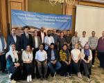
FOSS4G 2021 Buenos Aires

This is event is available for participation on an ongoing basis

Organized by OSGeo and with more than 15 years of experience, this international anual gathering of location enthusiasts is the largest global gathering for geospatial software.

FOSS4G brings together developers, users, decision-makers and observers from a broad spectrum of organizations and fields of operation. Through six days of workshops, presentations, discussions, and cooperation, FOSS4G participants create effective and relevant geospatial products, standards, and protocols.

0
0
No certificate issued or not known
0.00
USD
09/27/2021, 12:00am - 10/02/2021, 12:00am
not visible
Buenos Aires

The Open Source Geospatial Foundation (OSGeo)

Esri User Conference

This is event is available for participation on an ongoing basis

The 2021 Esri Use Conference (Esri UC) is a fully virtual experience. The Plenary Session will feature Esri president Jack Dangermond, as well as Esri staff experts and special guests. The technical sessions will explain how to use the latest tools. The user presentations and the Virtual Map Gallery will spark inspiration.

0
0
No certificate issued or not known
0.00
USD
07/12/2021, 12:00am - 07/15/2021, 12:00am
not visible

Esri

1

Fifth Arab Regional Platform for Disaster Risk Reduction

This is event is available for participation on an ongoing basis

Hosted by the Government of Morocco, the Fifth Arab Regional Platform for Disaster Risk Reduction will be organized under the theme “From Risk to Resilience: Accelerating Local Action for Disaster Risk Reduction” from 11 to 14 October 2021.

The UNDRR (ROAS) will call upon UN agencies and international NGOs to lead side sessions in the Fifth Arab Regional Platform for Disaster Risk Reduction to lead the discussion on how to accelerate local action for disaster risk reduction.

0
0
No certificate issued or not known
0.00
USD
10/11/2021, 12:00am - 10/14/2021, 12:00am
not visible

• United Nations Office for Disaster Risk Reduction - Regional Office for Arab States

• Government of Morocco

• League of Arab States

Harmful Algal Blooms: The Importance of Early Satellite Detection

Harmful algal blooms endanger the health of both humans and animals through poor water quality and can cause economic loss to coastal communities. Such algal blooms are composed of an excess of cyanobacteria, which becomes dangerous when subjected to certain conditions, such as extended sunlight exposure, stagnant water, and the increased presence of various nutrients from fertilizers. Under such circumstances, cyanobacteria aggressively multiply, causing water to have a viscous, green appearance, discernible from space.

Africa-Europe Space Earth Observation High-Level Forum

This is event is available for participation on an ongoing basis

The Africa-Europe Space Earth Observation High-Level Forum is a hybrid event that will take place in Lisbon, on 10-11 June 2021, organised in the framework of the Portuguese Presidency of the Council of the European Union and the Ministry of Science, Technology and Higher Education of Portugal, with the support of the European Commission.

0
0
No certificate issued or not known
0.00
USD
06/10/2021, 12:00am - 06/11/2021, 12:00am
not visible

• The Portuguese Presidency of the European Union

• The Ministry of Science, Technology and Higher Education of Portugal

• African Union

• The Air Centre

• Portugal Space

• The Directorate-General for Research and Innovation of the European Commission

• EUMETSAT

• The European Space Agency

• Business Bridge Europe

Increased Volcanic Activity in Guatemala in 2021: Fuego and Pacaya

In Guatemala there are two volcanoes which have been more active recently: Fuego and Pacaya. These volcanoes pose a prominent threat to the lives of the inhabitants of the highly populated surrounding areas. This threat is evidenced by the 2018 eruption of Fuego, which caused the deaths of nearly 200 people, and the recent activity of Pacaya volcano since the beginning of the year, that has impacted communities located in its foothills, and which forced authorities to close Guatemala's international airport in Guatemala City due to ash fall from its activity.

Amazônia-1

No

Amazônia-1 is the first Earth Observation satellite completely designed, integrated, tested and operated by Brazil. It features the optical Advanced Wide Field Imager (AWFI), with swath width 850 km and 60 m resolution, capturing images in 3 visible bands and 1 near-infrared (NIR) band. It has a high revisit period of 5 days, which is important for increasing the probability of capturing useful images over frequently overcast areas including the Amazon region.

4years

The non-COVID-19 disasters in the year 2020

Undoubtedly, the year 2020 will be remembered as the year when COVID-19 began to impact societies worldwide as a truly trans-boundary health hazard, manifesting the vulnerability of people in developed and in developing countries alike.  The news about the COVID-19 pandemic blurred news related to other disasters triggered by natural, technological and biological hazards.  One of those was the very large locust outbreak that began in the Horn of Africa late in 2019, and later migrated through the Middle East to Southern Asia.