Flood
Definition
Facts and figures
Further information
UN-SPIDER Regional Support Offices with hazard-specific expertise
Related content on the Knowledge Portal
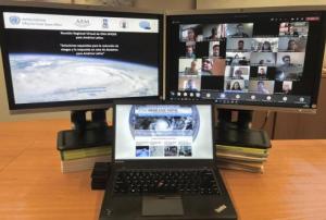
In order to discuss and promote the use of space technologies in addressing natural hazards such as forest fires and landslides in Latin America, UN-SPIDER conducted a virtual regional expert meeting on the topic of “Space-based Solutions for Disaster Risk Reduction and Emergency Response in Latin America” from 22 to 24 September 2020. The meeting was jointly organized with UN-SPIDER Regional Support Offices from Argentina (National Space Activities Commission, CONAE), Brazil (Federal University of Santa Maria, UFSM), Colombia (Geographic Institute Agustin Condazzi, IGAC), and Mexico (Mexican Space Agency, AEM).
In Latin America, UN-SPIDER and its Regional Support Offices have regularly carried out regional expert meetings, training courses and other joint efforts since 2011. The last Regional Expert Meeting took place in 2017 in Mexico.
The meeting, which consisted of three two-hour-long sessions, brought together a total of over 200 disaster management stakeholders…
read more28/09/2020En décadas recientes muchas comunidades en América Latina y el Caribe han experimentado desastres ocasionados por inundaciones, sequías, deslizamientos, terremotos, erupciones volcánicas y maremotos o tsunamis que han erosionado los logros asociados a procesos de desarrollo. Además, en este año 2020 la pandemia ocasionada por el virus COVID-19 ha impactado a muchos países del mundo, forzando a los gobiernos, al sector privado, a la sociedad civil y a organismos regionales e internacionales a modificar sus planes de trabajo. De manera paralela, varios países del Este de África, del Sudoeste de Asia y de América Latina están experimentando los impactos de la plaga de langosta.
Convencidos que las tecnologías espaciales pueden jugar un papel preponderante en apoyar los esfuerzos que llevan a cabo las instituciones en materia de gestión para la reducción de riesgos, la preparación, la respuesta y la recuperación en caso de desastres; la Asamblea General de las…
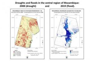
read moreRegional Support Offices mentioned:The Federal University of Santa Maria of Brazil (UFSM), in its role as a UN-SPIDER Regional Support Office (RSO), and UN-SPIDER joined forces to conduct a virtual seminar on the use of the UN-SPIDER Recommended Practices to process satellite imagery to map the geographic extent of floods, and to elaborate a series of maps that allow government agencies, as well as regional and international organizations, to assess the severity of droughts in particular years in comparison to droughts in other years. The webinar, conducted on 4 August 2020, brought together more than 30 officers of government agencies of Mozambique, as well as researchers, faculty members and students from various universities.
During the event, researchers from UFSM made participants aware of efforts by the space community to develop drought indices extracted from satellite imagery that assess the impacts of drought on vegetation. They also gave participants a brief introduction to the use of…
read moreThe Argentinean SAOCOM 1B satellite [was successfully launched](https://www.argentina.gob.ar/noticias/argentina-lanzo-el-satelite-saocom-1b-y-completo-la-mision-espacial-mas-importante-del-pais) into orbit on 30 August 2020. Developed by the National Argentinean Space Commission (CONAE), this new satellite will join SAOCOM 1A and four Italian COSMO-SkyMed to complete the joint Italian-Argentinean Satellite System for Emergency Management (SIASGE). Like its predecessor, SAOCOM 1B was built in Argentina through a joint effort with private companies and universities. It will operate at an elevation of 620 kilometers above the surface of the Earth. A SpaceX Falcon 9 booster launched the satellite from Space Launch Complex 40 at Cape Canaveral Air Force Station in Florida, United States of America. The SAOCOM 1B satellite has been fitted with a Synthetic Aperture Radar (SAR) sensor that makes use of microwaves in the electromagnetic L-band, which goes through clouds and works without…
read more14/09/2020The training date is in the past. However, videos and resources of the training can be accessed here.
Synthetic Aperture Radar (SAR) data can be acquired day and night, even in cloudy conditions, providing a dense time-series suitable for trend analysis and change detection. Environmental applications for SAR data include:
- forest inventory, biomass estimation and condition monitoring
- emergency response to floods and landslides
- habitat and crop mapping
- soil moisture monitoring
- offshore infrastructure and vessel monitoring
- detection of pollution such as oil spills and illegal waste
The Joint Nature Conservation Committee (JNCC) is organising a series of online training sessions on understanding, accessing…
read moreAccording to the latest issue of an annual disaster statistics report, floods were the deadliest type of disasters in 2019, followed by extreme temperature, while storms affected the highest number of people. Published by the Centre for Research on the Epidemiology of Disasters (CRED), “Natural disasters 2019 - Now is the time to not give up” draws on data recorded in the Emergency Events Database (EM-DAT), which saw the addition of 396 disasters that affected a total of 95 million and caused $103 billion in economic losses around the world.
Accounting for 40 per cent of disaster events, Asia suffered the highest impact with 45 per cent of deaths and 74 per cent of total affected. India, which saw cyclone Fani cause destruction in 2019, was the country most…
read more20/08/2020The International Centre for Integrated Mountain Development (ICIMOD) is leveraging space-based information to support government and humanitarian agencies in the Hindu Kush Himalayan (HKH) region with timely information for flood early warning and inundation mapping. The efforts, which consist of developing a streamflow prediction system for flood early warning and of providing near real-time flood maps for disaster response, come as the monsoon floods in the region are worsening and compunding the impacts of the COVID-19 pandemic.
Based at ICIMOD, the streamflow prediction system to support flood early warning is being developed through the SERVIR-HKH initiative, which benefits from technical assistance from NASA and the Bringham Young University. The system provides 15-day streamflow predictions…
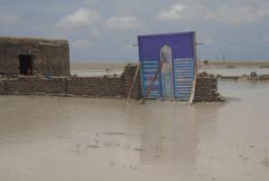
read more19/08/2020Heavy rains in Sudan have intensified over the past week, causing flooding, destruction of infrastructure, houses and livelihoods, and leading to displacement in multiple locations across the country. According to the United Nations Office for the Coordination of Humanitarian Affairs (UNOCHA) at least 1,100 people have been displaced (600 in North Darfur, and 500 in White Nile State) and more than 50,000 people affected. In addition, media report 10 deaths, 3 injured and more than 3,000 houses destroyed or damaged. Humanitarian needs are rapidly increasing, as the country faces multiple shocks, including the economic crisis, recent floods, violence and disease outbreaks. COVID-19 transmissions also continue and over 12,000 people have contracted the virus as of 11 August 2020.
To…
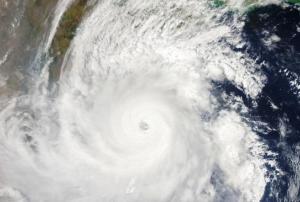
read moreIn recent years, Mozambique has suffered severe floods and droughts that have impacted urban and rural communities throughout the country. In the March and April 2019, tropical cyclones Idai and Kenneth triggered major floods in Mozambique, Malawi, Zimbabwe, and Comoros. The Port of Beira was hard hit, as cyclone Idai destroyed transmission lines and bridges, leaving the port without access to these lifelines for several days. In contrast the powerful El Niño event of 2016 triggered major droughts that affected most of the country. Thousands of farmers lost their crops and their cattle and had to rely on humanitarian assistance to cope with the impacts of this event.
Taking into consideration the benefits of the use of satellite imagery to map the geographic extent of floods and to monitor the effects of drought on vegetation; the Federal University of Santa Maria of Brazil (UFSM), in its role as a UN-SPIDER Regional Support Office (RSO); and UN-SPIDER…
read more10/08/2020

