‘Beyond the Visible – Introduction to Hyperspectral Remote Sensing‘.
In this course, you will learn the basics of imaging spectroscopy. No matter if you are a student or a professional or whatever continent you are from, this course was designed for you and we hope to provide some helpful background information, process understanding and applications that relate to your area of interest or expertise.
At the request of the Minister of Emergency Situations of the Republic of Armenia, UN-SPIDER is conducting a Technical Advisory Mission (TAM) to Armenia from 27 June to 1 July 2022. With this mission, UN-SPIDER together with experts aims to assist Armenia in improving disaster risk management and emergency response by the utilization of the space-based technologies and geospatial information, thereby helping to achieve the Sustainable Development Goals (SDGs).
The expert team is comprised of experts from the following institutions:
This is event is available for participation on an ongoing basis
Bhuvan is a Geo-Platform of ISRO launched in 2009 showcasing Multi sensor, Multi-platform and Multi temporal Satellite Imagery from 56m to 1m spatial resolution data for the entire country. It also has rich thematic data - Land Use/Land Cover, Waste Land, Geomorphology, Urban Land Use, Lineaments, Water Bodies, etc. Apart from the above, Bhuvan also provides rich & diverse data like Hydrological Boundaries, Climate and Environment, Disaster, Forestry,Tourism, Water, Urban, Agriculture, etc.
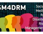
The European Commission’s new algorithm developed by the Joint Research Centre (JRC) can segment social media messages to identify, verify and help manage disaster events -such as floods, fires or earthquakes- in real-time.
This is event is available for participation on an ongoing basis
Save our Ocean, Protect our Future
The Ocean Conference, co-hosted by the Governments of Kenya and Portugal, comes at a critical time as the world is seeking to address many of the deep-rooted problems of our societies laid bare by the COVID-19 pandemic and which will require major structural transformations and common shared solutions that are anchored in the SDGs. To mobilize action, the Conference will seek to propel much needed science-based innovative solutions aimed at starting a new chapter of global ocean action.
This is event is available for participation on an ongoing basis
These webinars are available for viewing at any time. They provide basic information about the fundamentals of remote sensing, and are often a prerequisite for other ARSET trainings.
Implementing science to save lives: A Decade of the Copernicus Emergency Management Service
The Copernicus Emergency Management Service (CEMS) celebrates a decade of operation as a world leader in emergency mapping, early warning tools and open-access disaster information.
For the past ten years, CEMS has provided a global service as a fully operation emergency mapping service at no cost to users and with open access data.
Some highlights on the contribution of CEMS in global disaster risk management activities:
Google and the World Resources Institute (WRI) created a new near realtime land cover dataset, called "Dynamic World".
Powered by Google Earth Engine and AI Platform, Dynamic World provides global, near real-time land cover data at a ten-meter resolution, giving high level of detail about what's on the land and how it's being used.
With this information, users can monitor and understand land and ecosystems so they can make more accurate predictions and effective plans to protect our planet in the future.