Skip to main content
English
Español
Français
United
Nations
Office for Outer Space Affairs
UN-SPIDER Knowledge Portal
Search
Home
About Us
What is UN-SPIDER?
About UNOOSA
Publications
Jobs
Meet the Team
Contact
Space Application
Satellite Technology
Emergency Mechanisms
Recovery Mechanisms
International Asteroid Warning Network
Space Mission Planning Advisory Group
International Space Weather Initiative
Space Technologies in the UN
User Stories
Links & Resources
Data Applications
Disaster Recovery
Data Sources
GIS and Remote Sensing Software
Online Learning Resources
Institutions
Risks & Disasters
Disaster Risk Management
Early Warning Systems
Emergency and Disaster Management
Natural Hazards
Sendai Framework
The UN and Disaster Risk Management
The UN and Early Warning
The UN and Disaster Management
Advisory Support
Advisory Missions
Emergency Support
Virtual Advisory Support
Recommended Practices
Training Activities
Practical Uses
Network
Regional Support Offices
GP-STAR
MHEWS
IWG-SEM
Projects
SPEAR
SEWS-D
EvIDENz
Flood GUIDE
CommonSpace Initiative
Tonga Pilot Project
News & Events
News
Events Calendar
UN-SPIDER Events Archive
Breadcrumb
Home
News and Events
View Active News
View active news
View active news
Search news by keyword
Filter by Country / Region
- Any -
Americas
Northern America
-Canada
-United States
-United States of America
Latin America and Caribbean
-South America
--Argentina
--Bolivia (Plurinational State of)
--Brazil
--Chile
--Colombia
--Ecuador
--Guyana
--Paraguay
--Peru
--Suriname
--Uruguay
--Venezuela (Bolivarian Republic of)
-Central America
--Belize
--Costa Rica
--El Salvador
--Guatemala
--Honduras
--Mexico
--Nicaragua
--Panama
-Caribbean
--Antigua & Barbuda
--Bahamas
--Barbados
--Cuba
--Dominica
--Dominican Republic
--Grenada
--Haiti
--Jamaica
--Saint Kitts and Nevis
--Saint Lucia
--Saint Vincent and the Grenadines
--Trinidad & Tobago
Türkiye
Middle Africa
-Angola
-Cameroon
-Central African Republic
-Chad
-Congo
-Democratic Republic of the Congo
-Equatorial Guinea
-Gabon
-Sao Tome and Principe
Europe
-Eastern Europe
--Belarus
--Bulgaria
--Czech Republic
--Hungary
--Poland
--Republic of Moldova
--Romania
--Russian Federation
--Slovakia
--Slovenia
--Ukraine
-Northern Europe
--Denmark
--Estonia
--Finland
--Iceland
--Ireland
--Latvia
--Norway
--Sweden
--United Kingdom of Great Britain and Northern Ireland
-Southern Europe
--Albania
--Andorra
--Bosnia and Herzegovina
--Croatia
--Cyprus
--Greece
--Holy See
--Italy
--Malta
--Montenegro
--Portugal
--San Marino
--Serbia
--Spain
--North Macedonia
-Western Europe
--Austria
--Belgium
--France
--Germany
--Liechtenstein
--Lithuania
--Luxembourg
--Monaco
--Netherlands
--Switzerland
Asia
-Central Asia
--Kazakhstan
--Kyrgyzstan
--Tajikistan
--Turkmenistan
--Uzbekistan
-Western Asia
--Armenia
--Azerbaijan
--Bahrain
--Georgia
--Iraq
--Israel
--Jordan
--Kuwait
--Lebanon
--Oman
--Qatar
--Saudi Arabia
--State of Palestine
--Syrian Arab Republic
--Turkey
--United Arab Emirates
--Yemen
-Eastern Asia
--China
--Democratic People's Republic of Korea
--Japan
--Mongolia
--Republic of Korea
-South-eastern Asia
--Brunei Darussalam
--Cambodia
--Indonesia
--Lao People’s Democratic Republic
--Malaysia
--Myanmar
--Philippines
--Singapore
--Thailand
--Timor-Leste
--Viet Nam
-Southern Asia
--Afghanistan
--Bangladesh
--Bhutan
--India
--Iran (Islamic Republic of)
--Maldives
--Nepal
--Pakistan
--Sri Lanka
Africa
-Sub-Saharan Africa
--Eastern Africa
---Burundi
---Comoros
---Djibouti
---Eritrea
---Ethiopia
---Kenya
---Madagascar
---Malawi
---Mauritius
---Mozambique
---Rwanda
---Seychelles
---Somalia
---South Sudan
---Uganda
---United Republic of Tanzania
---Zambia
---Zimbabwe
--Western Africa
---Benin
---Burkina Faso
---Cabo Verde
---Côte d'Ivoire
---Gambia
---Ghana
---Guinea
---Guinea-Bissau
---Liberia
---Mali
---Mauritania
---Niger
---Nigeria
---Senegal
---Sierra Leone
---Togo
--Southern Africa
---Botswana
---Lesotho
---Namibia
---South Africa
---Swaziland
-Northern Africa
--Algeria
--Egypt
--Libya
--Morocco
--Sudan
--Tunisia
Global
Oceania
-Polynesia
--Samoa
--Tonga
--Tuvalu
-Melanesia
--Fiji
--Papua New Guinea
--Solomon Islands
--Vanuatu
-Micronesia
--Kiribati
--Marshall Islands
--Micronesia (Federated States of)
--Nauru
--Palau
-Australia and New Zealand
--Australia
--New Zealand
Asia Pacific
Antarctica
View only UN-SPIDER news
- Any -
True
False
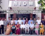
UN-SPIDER supports space applications workshop in India
13 Apr 2012
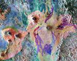
Keeping an eye – from the sky – on volcanoes
28 Mar 2012
U.A.E. Ministry of the Interior as Principle Member of OGC
27 Mar 2012
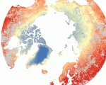
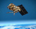
Satellites reveal thawing permafrost
27 Mar 2012
Esri and GeoEye Developing Global Crisis Response Service
26 Mar 2012
GIS to revolutionise flood insurance
26 Mar 2012
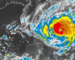
NOAA Announces Modification to Hurricane Scale
26 Mar 2012
SPACEBEL Signs Contract for Vietnam Earth Observation Satellite
23 Mar 2012
Munich Summit Charts Progress of GPS, GLONASS, Galileo, Beidou GNSSes
23 Mar 2012
UN-SPIDER Mission to Myanmar
20 Mar 2012
UN-SPIDER Mission to Tonga
20 Mar 2012
USA: Social media as a disaster management tool
19 Mar 2012
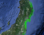
Sansa launched mosaic of satellite imagery of South Africa
15 Mar 2012
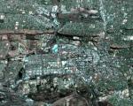
Google Maps publishes new imagery of Japan's disaster areas
13 Mar 2012
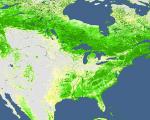
Remote sensing project to track and predict climate change
12 Mar 2012
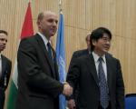
Karoly Robert University of Hungary joins UN-SPIDER as an RSO
12 Mar 2012
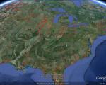
Find the freshest imagery with Google's "imagery updates" KML
8 Mar 2012
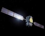
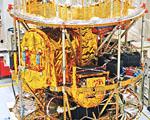
MSG-3 satellite ready to continue weather-monitoring service
8 Mar 2012
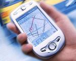
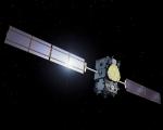
Galileo Will Be Used for Emergency Management
8 Mar 2012
UK’s new rapid response network will activate ‘within hours’ of a natural disaster
8 Mar 2012
UN kicks off talks on new blueprint for disaster risk reduction
8 Mar 2012
Pagination
First page
« First
Previous page
‹‹
…
Page
112
Page
113
Page
114
Page
115
Current page
116
Page
117
Page
118
Page
119
Page
120
…
Next page
››
Last page
Last »
more