![]()
United
Nations
Tsunami
 and the Ohio State University (OSU) used satellite altimeters to observe “merging tsunamis”. The image comes from a data-based computer model that shows Tohoku-oki tsunami waves propagation. Waves peaks are depicted in red-brown, while depressions in sea surface appear in blue-green. Grayscale outlines show the location of mid-ocean ridges, peaks, and islands. Image: NASA.")
Definition
Facts and figures
Further information
UN-SPIDER Regional Support Offices with hazard-specific expertise
Related content on the Knowledge Portal

According to the latest issue of an annual disaster statistics report, floods were the deadliest type of disasters in 2019, followed by extreme temperature, while storms affected the highest number of people. Published by the Centre for Research on the Epidemiology of Disasters (CRED), “Natural disasters 2019 - Now is the time to not give up” draws on data recorded in the Emergency Events Database (EM-DAT), which saw the addition of 396 disasters that affected a total of 95 million and caused $103 billion in economic losses around the world.
Accounting for 40 per cent of disaster events, Asia suffered the highest impact with 45 per cent of deaths and 74 per cent of total affected. India, which saw cyclone Fani cause destruction in 2019, was the country most…
read more20/08/2020
On 22 December 2018 a large chunk of the Anak Krakatau volcanic island collapsed into the ocean, causing a tsunami that swept across Indonesia’s Sunda Strait. Because tsunami early warning systems are exclusively equipped to detect tsunamis that are generated by earthquakes, this volcanic collapse-caused tsunami took place without a warning. In the coastal regions of Java and Sumatra, where people were struck off guard, the tsunami killed 400 people and injured many more.
A recent research study published in Nature Communications and led by the German Research Centre for Geosciences (GFZ) has detected deformations in Anak Krakatau leading up to the tsunami that could serve as an early warning system for future volcanic collapses. Satellite data plays a key role in developing such early warning systems by providing monitoring capabilities. As early as late June 2018, the Moderate Resolution Imaging…
read more13/11/2019, processed by Planetek Rheticus Service.")
In September 2018, the Indonesian island of Sulawesi was hit by a 7.5 magnitude earthquake. The impact, combined with the tsunami, landslides, and soil liquefaction that followed, “... claimed well over 2000 lives, destroyed homes, buildings, infrastructure and farmland in several districts,” according to the European Space Agency (ESA).
Ten months later, response efforts are now moving into the recovery and rebuilding phase, with satellite information offering important insights to local officials. For example, through a collaboration with the Asian Development Bank, ESA is providing Indonesian officials with hazard-mapping tools derived from Earth observation data, and training in how to most effectively use these resources. “The main purpose of sharing these information products is to help the…
read more06/08/2019
In the past year, “there were 315 natural disaster events recorded with 11,804 deaths, over 68 million people affected, and US$131.7 billion in economic losses around the world.” This is according to the Centre for Research on the Epidemiology of Disasters (CRED) in its recently released 2018 Natural Disasters Report.
While these 2018 natural disaster values represent a decrease when compared with the annual averages from 2008 to 2017, some geographic areas still experienced great losses of life and damages due to natural hazards. Indonesia was most adversely impacted in terms of lives claimed, with earthquakes in August and September 2018 that left a total of 4,904 people dead or missing, according to the CRED. Earthquakes also accounted for the greatest number of deaths among natural disasters worldwide in 2018. And among all types of natural hazards, floods affected the greatest number of people during the…
read more01/07/2019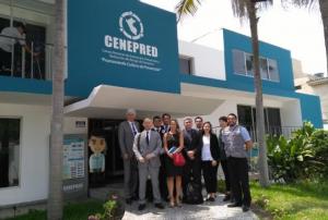 ,
,  ,
, 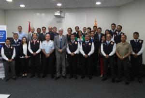
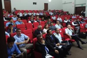
As part of it advisory support activities, UN-SPIDER is carrying out out a Technical Advisory Mission (TAM) to Peru from 1 to 5 April to evaluate the current and potential use of space-based information in all aspects of disaster management. Based on exchanges with a wide range of stakeholders, UN-SPIDER will provide recommendations as to how to strengthen the use of space-based information in disaster risk management and emergency response in the country.
The team of experts led by UN-SPIDER is conducting multiple activities and institutional visits in Lima. The team is comprised of eight experts from UN-SPIDER; the German Aerospace Centre (DLR); the Argentinian National Space Activities Commission (CONAE); the Mexican Space Agency (AEM); the Agustin Codazzi Geographic Institute of Colombia (IGAC); the Santa Maria…
read moreRegional Support Offices mentioned:01/04/2019
Following a tsunami that hit coastal areas around the Sunda strait between the Indonesian islands of Sumatra and Java on 22 December, the United Nations Office for Outer Space Affairs (UNOOSA) has requested the activation of the International Charter Space and Major Disasters on behalf of the National Institute of Aeronautics and Space (LAPAN) of Indonesia. LAPAN is a UN-SPIDER Regional Support Office (RSO).
According to the Indonesian National Disaster Management Agency (BNPB), 281 people have been killed, 1,016 people injured, and an estimated 11,700 people displaced as a result of the tsunami. The waves struck after volcanic activity from the Anak Krakatau volcano likely set off undersea landslides than in turn caused the surges.
…
read moreRegional Support Offices mentioned:24/12/2018![Copernicus Emergency Management Service (© 2018 European Union), [EMSR317] Palu - Indonesia, Grading Map.](/sites/default/files/styles/w300_h202_covid_19_detail/public/Copernicus_EMSR317_07PALU_02GRADING_MAP_v2_100dpi.png?itok=k1oGg1mR "Copernicus Emergency Management Service (© 2018 European Union), [EMSR317] Palu - Indonesia, Grading Map.")
The International Charter “Space and Major Disasters” and the Copernicus Emergency Management Service Mapping have been activated on 29 September after a 7.5 magnitude earthquake in the central Indonesian Island of Sulawesi.
At least 844 people have been killed and 64,000 displaced according to reports.
The cities of Palu and Donggala are the worst affected areas by the earthquake and a tsunami with waves as high as six metres.
The International Charter was activated by the Asian Disaster Reduction Centre (ADRC) on behalf of the Indonesian National Institute of Aeronautics and Space (LAPAN). Both institutions are UN-SPIDER Regional Support Offices (RSO). Mapping products made available under the activation are available on the…
read moreRegional Support Offices mentioned:01/10/2018
As part of the Tsunami Inundation Maps project (CITSU), the Hydrographic and Oceanographic Service of the Chilean Navy (SHOA) made available information related to the occurrence of tsunamis on the Chilean coast. SHOA, which is responsible for the operation and maintenance of the national tsunami warning system, established the CITSU project in 1977 to define probable flood levels for the main urban areas and ports along the coast in the case of approaching tsunamis. As a result of the CITSU project, more than thirty maps have been produced since its launch.
One of the main objectives of these maps is to display the impact of tsunamis to support local authorities who are in charge of urban planning and to develop evacuation plans for the protection of the population. The availability of such information allows different agencies and public bodies to improve their decision-making process and thus to prevent the loss of human lives and high costs of material…
read more20/06/2018
UN-SPIDER Regional Support Offices with hazard-specific expertise
![]()