![]()
United
Nations
Forest Fire
, processed by ESA, CC BY-SA 3.0 IGO.")
Definition
Facts and figures
Further information
UN-SPIDER Regional Support Offices with hazard-specific expertise
Related content on the Knowledge Portal
 The Copernicus Atmosphere Monitoring Service (CAMS) uses near-real-time observations of the location and intensity of active wildfires to estimate the emissions of pollutants. This is done through its Global Fire Assimilation System (GFAS). This allows active fires to be monitored and their estimated emissions to be used in the CAMS forecasts to predict the transport of the resulting smoke in the atmosphere. The forecasts are used in air quality apps, to help people limit their exposure to pollution, and by policymakers and local authorities to manage the impact of fires.Publishing institution:
-
The Copernicus Atmosphere Monitoring Service (CAMS) uses near-real-time observations of the location and intensity of active wildfires to estimate the emissions of pollutants. This is done through its Global Fire Assimilation System (GFAS). This allows active fires to be monitored and their estimated emissions to be used in the CAMS forecasts to predict the transport of the resulting smoke in the atmosphere. The forecasts are used in air quality apps, to help people limit their exposure to pollution, and by policymakers and local authorities to manage the impact of fires.Publishing institution:
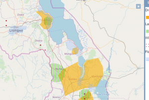 GIS Malawi is a webmapper which provides various vector and raster layers covering a broad range of topics including natural hazards.Publishing institution:
 The Global Ecosystem Dynamics Investigation (GEDI) produces high resolution laser ranging observations of the 3D structure of the Earth. GEDI’s precise measurements of forest canopy height, canopy vertical structure, and surface elevation greatly advance our ability to characterize important carbon and water cycling processes, biodiversity, and habitat. GEDI’s data on surface structure are valuable for weather forecasting, forest management, glacier and snowpack monitoring, and the generation of more accurate digital elevation models.Publishing institution:
 Global and regional syntheses which enable the examination of broad-scale patterns in paleofire activity, creating a framework for exploring the linkages among fire, Human, climate and vegetation at centennial-to-multi-millennial time scales and allowing for evaluation of fire model simulations at regional to global scalesPublishing institution:
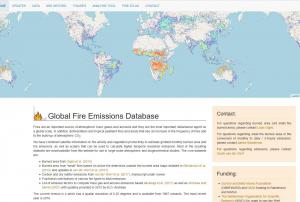 Fires are an important source of atmospheric trace gases and aerosols and they are the most important disturbance agent on a global scale. In addition, deforestation and tropical peatland fires and areas that see an increase in the frequency of fires add to the build-up of atmospheric CO2.
GFED have combined satellite information on fire activity and vegetation productivity to estimate gridded monthly burned area and fire emissions, as well as scalars that can be used to calculate higher temporal resolution emissions. Most of the resulting datasets are downloadable from this website for use in large-scale atmospheric and biogeochemical studies. The core datasets are:
- Burned area
- Burned area from "small" fires based on active fire detections outside the burned area maps
- Carbon and dry matter emissions
- Fractional contributions of various fire types to total emissions
- List of emission factors to compute trace gas and…Publishing institution: ESA's Earth Observation Thematic Exploitation Platform (TEP) is a browser for satellite imagery and specific products on an environmental topic. The TEP platforms are divided into 7 categories: Coastal; Forstry; Geohazards; Hydrology; Polar; Urban; and Food Security. Each platform is a collaborative, virtual work environment providing access to EO data and the tools, processors and Information and Communication Technology resources required to work with them. TEP aims to bridge the gap between the users and the data and tools.Publishing institution:
 Pleidas, TerraSar-X, SPOT and Elevation data available commercially from airbus, certain sample data sets at various locations available for free.Publishing institution:
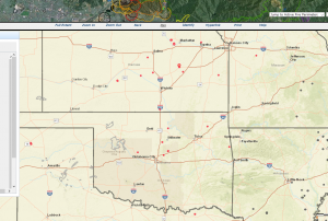 The GEOMAC Wildland Fire Support includes layers on: point-layer of past years fires, fire boundaries/ perimeter, current firest, satellite-based fire detection: MODIS VIIRS HMS, wildland-urban interface,Publishing institution:
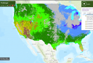 Vegetation-based fire indicators: expected number of fires per predictive service area: number of fires predicted (1000+ acres west, 500+ acres east) or the coming 7 days, with a probability estimate for exceeding the prediction.
Publishing institution:
UN-SPIDER Regional Support Offices with hazard-specific expertise
![]()