![]()
United
Nations
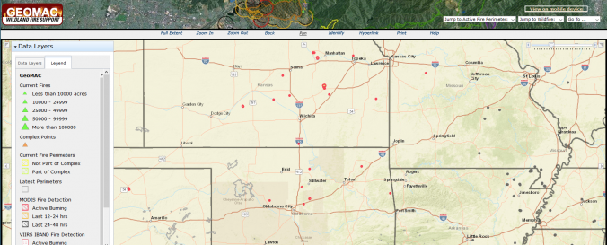
GEOMAC Wildland Fire Support (USGS)
| Data provided by: | United States Geological Survey (USGS) |
| Data accessibility: | visualization of data (e.g. web GIS or real time monitoring) |
| Link to the data: | |
| Data type: | hazard specific data |
| Hazard: | Forest Fire |
| Disaster cycle phase: | Disaster Risk Management, Response, Recovery |
| Space-based Information: | The GEOMAC Wildland Fire Support includes layers on: point-layer of past years fires, fire boundaries/ perimeter, current firest, satellite-based fire detection: MODIS VIIRS HMS, wildland-urban interface, |
| Spatial coverage: | United States of America |
| Spatial resolution: | 250m, geolocated points |
| Temporal coverage: | Archive, Near-real time |
| Content dates: | 2002-Present |
| Technical Specifications: | |
| Costs: | free |
| Contact: | GEOMAC About |
Provider
![]()