Advanced Webinar: Using Earth Observations for Pre- and Post-Fire Monitoring

This is event is available for participation on an ongoing basis

The training date is in the past. However, videos and resources of the training can be accessed here.

0
0
No certificate issued or not known
0.00
USD
not visible

NASA ARSET

1

Introductory Webinar: Fundamentals of Remote Sensing

This is event is available for participation on an ongoing basis

These webinars are available for viewing at any time. They provide basic information about the fundamentals of remote sensing, and are often a prerequisite for other ARSET trainings.

0
0
No certificate issued or not known
0.00
USD
not visible

NASA ARSET

1

Intermediate Webinar: Using NASA Remote Sensing for Disaster Management

This is event is available for participation on an ongoing basis

The training date is in the past. However, videos and resources of the training can be accessed here.

0
0
No certificate issued or not known
0.00
USD
not visible

NASA ARSET

1

Introductory Webinar: Overview of the Global Disaster Alert and Coordination System (GDACS)

This is event is available for participation on an ongoing basis

The training date is in the past. However, videos and resources of the training can be accessed here.

0
0
No certificate issued or not known
0.00
USD
not visible

NASA ARSET

1

Introductory Webinar: Introduction to Synthetic Aperture Radar

This is event is available for participation on an ongoing basis

A limitation of optical satellite remote sensing is that it depends on cloudless, well-illuminated areas to produce quality data. This is especially problematic for collecting data during nighttime, around storms, and in densely-forested areas. Synthetic Aperture Radar (SAR) is a solution for many of these obstacles. SAR can observe the Earth's surface day and night, through most weather conditions, and the signal can penetrate the vegetation canopy. There are a number of existing SAR datasets from current and past airborne and satellite missions, as well as exciting upcoming missions.

0
0
No certificate issued or not known
0.00
USD
not visible

NASA ARSET

1

Advanced Webinar: Techniques for Wildfire Detection and Monitoring

This is event is available for participation on an ongoing basis

The training date is in the past. However, videos and resources of the training can be accessed here.

0
0
No certificate issued or not known
0.00
USD
not visible

NASA ARSET

1

Introductory Webinar: Monitoring Urban Floods Using Remote Sensing

This is event is available for participation on an ongoing basis

The training date is in the past. However, videos and resources of the training can be accessed here.

0
0
No certificate issued or not known
0.00
USD
not visible

NASA ARSET

1

Advanced Webinar: Radar Remote Sensing for Land, Water, & Disaster Applications

This is event is available for participation on an ongoing basis

The training date is in the past. However, videos and resources of the training can be accessed here.

0
0
No certificate issued or not known
0.00
USD
not visible

NASA ARSET

1

Copernicus Emergency Management Service (CEMS) Celebrates a Decade of Operation

Implementing science to save lives: A Decade of the Copernicus Emergency Management Service

The Copernicus Emergency Management Service (CEMS) celebrates a decade of operation as a world leader in emergency mapping, early warning tools and open-access disaster information.

For the past ten years, CEMS has provided a global service as a fully operation emergency mapping service at no cost to users and with open access data.

Some highlights on the contribution of CEMS in global disaster risk management activities:

New Data Source for Near-Realtime Land Cover: Dynamic World by Google and World Resources Institute

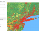
Google and the World Resources Institute (WRI) created a new near realtime land cover dataset, called "Dynamic World".

Powered by Google Earth Engine and AI Platform, Dynamic World provides global, near real-time land cover data at a ten-meter resolution, giving high level of detail about what's on the land and how it's being used.

With this information, users can monitor and understand land and ecosystems so they can make more accurate predictions and effective plans to protect our planet in the future.