• English
  • Español
  • Français

United
Nations


Office for Outer Space Affairs
UN-SPIDER Knowledge Portal

  • Home
  • About Us
    • What is UN-SPIDER?
    • About UNOOSA
    • Publications
    • Jobs
    • Meet the Team
    • Contact
  • Space Application
    • Satellite Technology
    • Emergency Mechanisms
    • Recovery Mechanisms
    • International Asteroid Warning Network
    • Space Mission Planning Advisory Group
    • International Space Weather Initiative
    • Space Technologies in the UN
    • User Stories
  • Links & Resources
    • Data Applications
      • Disaster Recovery
    • Data Sources
    • GIS and Remote Sensing Software
    • Online Learning Resources
    • Institutions
  • Risks & Disasters
    • Disaster Risk Management
    • Early Warning Systems
    • Emergency and Disaster Management
    • Natural Hazards
    • Sendai Framework
    • The UN and Disaster Risk Management
    • The UN and Early Warning
    • The UN and Disaster Management
  • Advisory Support
    • Advisory Missions
    • Emergency Support
    • Virtual Advisory Support
    • Recommended Practices
    • Training Activities
    • Practical Uses
  • Network
    • Regional Support Offices
    • GP-STAR
    • MHEWS
    • IWG-SEM
  • Projects
    • SPEAR
    • SEWS-D
    • EvIDENz
    • Flood GUIDE
  • News & Events
    • News
    • Events Calendar
    • UN-SPIDER Events Archive

Breadcrumb

  • Home
  • News and Events
  • View Active News
  • IGAC: Development of a Spectral Library
  • IGAC: Development of a Spectral Library

IGAC: Development of a Spectral Library

Internal Working Group of Remote Sensing and Spectroscopy of CIAF-IGAC (2013/201Internal Working Group of Remote Sensing and Spectroscopy of CIAF-IGAC (2013/2014)

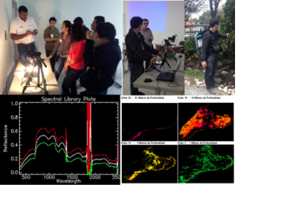
UN-SPIDER's Regional Support Office in Colombia, the Geographic Institute Agustín Codazzi (IGAC), through their Research and Investigation Centre (CIAF), has been working on a spectral library project. It includes research on spectrometry applied to the analysis of land cover (water bodies, soil and minerals, vegetation and island areas), in order to build spectral libraries for each type of land cover. The project will result in a large database of spectral signatures, which can be used in digital processing of remote sensing images.

By characterizing the spectral response of each of the cover types studied, the project opens a wide range of geomatics applications in the area of risk management, environmental characterization, monitoring of vegetation cover, precision agriculture, and many others.

The spectral data will be accessible through a web application or web viewer, which allows for consultation and exchange of information with other national and international research groups.

Contact: Alexander Ariza (PhD candidate), Sergio Rojas (Specialist Remote Sensing Group) and Mauricio Ramirez (Department Leader - hmramirez@igac.gov.co).

Wed, 26 Mar 2014 - 14:00
Colombia
Colombia Regional Support Office

Footer menu

  • Contact
  • Terms of Use

User account menu

  • Log in