The training date is in the past. However, videos and resources of the training can be accessed here.
According to a UN report, between 1998 and 2017, the U.S. alone lost $944.8 billion USD from disasters. Between 1978 and 2017, losses from extreme weather events rose by 251 percent. It is critical to develop disaster management strategies to reduce and mitigate disaster risks. A major factor in regional risk assessment is evaluating the vulnerability of lives and property to disasters. Environmental information about disasters, their spatial impact, and their temporal evolution can play an important role as well.
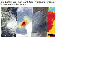
This webinar series will focus on Earth observation (EO) data useful for disaster risk assessment. The series will cover disasters including tropical cyclones, flooding, wildfires, and heat stress. The training will also cover access of socioeconomic and disaster damage data. Sessions 3 & 4 will cover case studies and operational applications of EO for disaster risk assessment.
By the end of this training, attendees will:
Learn about available NASA remote sensing and socioeconomic data and how to combine them for assessing risk
Understand how to apply these data for assessing risk from floods and tropical cyclones in specific regions
Learn how operational agencies are using NASA data for risk management
The audience for this training are local, regional, state, federal, and international entities, including public and private sector organizations, engaged in disaster management, emergency responders, urban and infrastructure planners.