![]()
United
Nations
QGIS
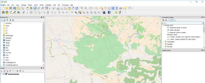
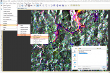
| Description: | QGIS is a visualization and processing tool for geographic data built on Open Source software. Data of various types (raster and vector) and formats can be edited, analyzed, exported and used for map creation. Supported formats include: spatially-enabled tables and views using PostGIS, SpatiaLite and MS SQL Spatial, Oracle Spatial, vector formats supported by the installed OGR library -including ESRI shapefiles, MapInfo, SDTS, GML and many more. GDAL (Geospatial Data Abstraction Library) raster and imagery formats are supported such as GeoTIFF, ERDAS IMG, ArcInfo ASCII GRID, JPEG and PNG. |
| Software type: | Desktop GIS |
| Website: | http://www.qgis.org/ |
| Accessibility: | Install only |
| Computer System: | Windows, MacOSX, Linux |
| Scope: | Image processing, Modelling, Visualisation |
| Vector/Raster: | Vector, Raster |
| Optical data or radar data format: | Optical, Radar |
| Graphical user interface: | Yes |
| Costs: | Free |
![]()