Tunisia - Technical Advisory Mission

At the request of, and in coordination with the National Civil Protection Office of Tunisia, UN-SPIDER is conducting a Technical Advisory Mission to Tunisia from 4 to 6 March 2020 to identify the needs of the country to fully take advantage of space-based information for disaster management. In order to discuss the use of space-based information for risk and disaster management to subsequently make recommendations on improvements, the expert team meets with key disaster management authorities in the country.

The mission is conducted with the support of experts from the Algerian Space Agency (ASAL); the Romanian Space Agency (ROSA); the United Nations Economic Commission for Africa (UNECA); the National Observatory of Athens (NOA); and an expert on the Copernicus Emergency Management Service. The mission team is also benefiting from the support of the Chief of Space Applications of the United Nations Office for Outer Space Affairs.

As part of the mission, the team of experts will visit several institutions including the National Office of Civil Protection; the Directorate General for Forests of the Ministry of Agriculture; the Faculty of Sciences of Tunis, University of Tunis El Manar; the National Agronomic Institute of Tunisia; the National Institute of Meteorology; as well as at the Ministry of Local Affairs and Environment. Meetings will also be conducted with representatives of the National Cartographic and Remote Sensing Centre of Tunisia and other organizations. In addition, the TAM team will meet the United Nations Country Team in Tunisia, which supports disaster management efforts in the country.

During the TAM, a workshop with over 20 participants from nine institutions will take place in order to present the UN-SPIDER programme to Tunisian counterparts involved in disaster management, and encourage inter-institutional cooperation and sharing of geospatial information among them.

UN-SPIDER aims at ensuring all countries have the capacity to use all types of space-based information to support risk and disaster management efforts. To make sure that all interested stakeholders can benefit from this information in the most effective way possible, UN-SPIDER provides Technical Advisory Support to Member States through missions such as this one.

The Algerian Space Agency (ASAL), the Romanian Space Agency (ROSA) and the National Observatory of Athens (NOA) are UN-SPIDER Regional Support Office.

On request of the Tunisian Government and immediately after the technical advisory mission, UN-SPIDER conducted a three-day hands-on training on the use of Sentinel-1 radar data for flood mapping. In order to further strengthen the capacity of Tunisia to use space technologies for disaster management, UN-SPIDER will continue to encourage the participation of Tunisian institutions in its conferences and expert meetings. In addition, together with its regional and international partners, UN-SPIDER will provide training on forest fire mapping in the medium term. 

-
National Office for Civil Protection (ONPC), Ministry of the Interior of Tunisia
  • Alexandru Badea, Romanian Space Agency (ROSA)
  • Kamel Tichouiti, Algerian Space Agency (ASAL)
  • Alexia Tsouni, National Observatory of Athens (NOA)
  • Francoise Villette, Expert on Earth observation and disaster management, and on Copernicus EMS
  • Luc St-Pierre, United Nations Office for Outer Space Affairs (UNOOSA)
  • Coen Bussink, UN-SPIDER (Head of Delegation)
  • Radu Botez, UN-SPIDER

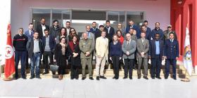
Three-day mission with a stakeholder workshop that brought together 21 participants from 13 Tunisian institutions, in addition to the mission team.

During the mission, the team was able to observe the common use of GIS by the consulted institutions, including ONPC, for the visualization of statistics on risks and occurrences of disasters. In addition, some institutions already regularly use satellite images, for example to analyze burnt areas after forest fires, while universities provide advanced training in geomatics. With regard to disaster risk reduction, space data and technologies are included in a draft DRR strategy, which is currently in the process of being adopted. By becoming an authorized user of the International Charter “Space and Major Disasters” and by benefiting from maps floods in the area of Nabeul in 2018 created by the Copernicus Emergency Management Service (Copernicus EMS), Tunisia is mobilizing relevant international networks and mechanisms to access information products based on satellite data during disasters.

The recommendations made by the team aim to further encourage the institutionalization of the use and sharing of satellite data and images through disaster risk management in Tunisia. The recommendations are described in more detail in the corresponding sections of this report and are in short:

Policy and coordination

  • Strengthen the legal framework and collaboration for geospatial information
  • Finalize the project for the creation of a national infrastructure for geographic information (INIG)

Access, availability and sharing of data

  • Create an archive of available satellite images and accelerate their exploitation for disaster management purposes
  • To deepen risk analysis in the territory by expanding and integrating the data repository and the tools used to publish the data more effectively
  • Prepare information for rapid response disaster mapping
  • Strengthen disaster risk reduction through mapping exercises

Capacity-building and institutional strengthening

  • Ensure the presence of adequate human resources
  • Use local and international geomatics training resources for capacity building 

Strengthening early warning

  • Establish a legal framework for early warning
  • Ensure coordinated and cooperative early warning
  • Strengthen emergency response
  • Make field data collection more efficient and accurate
  • Use international mechanisms and regional partnerships to obtain relevant maps and satellite imagery during disasters
Attachment Size
Tunisia TAM - Data sources booklet (969.11 KB) 969.11 KB