From 12 to 16 May 2013, as a follow-up to the UN-SPIDER technical advisory mission to Bangladesh in 2011, UN-SPIDER conducted a Institutional Strengthening Mission and organized a capacity-building programme on the topic of space technology for flood hazard mapping, flood forecasting and rapid mapping in Bangladesh. The programme was jointly organized with the Comprehensive Disaster Management Programme of the Ministry of Disaster Management and Relief.
-
Bangladeshi Comprehensive Disaster Management Programme, Bangladeshi Space Research and Remote Sensing Organization (SPARRSO)
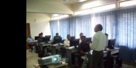
The training that was part of the Institutional Strengthening Mission and took place from 12 to 16 May 2013 covered a wide range of topics such as an overview of the role of Earth Observation in disaster management, the regional plan of action on promoting Space and GIS applications for disaster risk management and sustainable development, global and regional flood hotspot assessment, flood hazard/risk mapping, multi-hazard risk and assessment, flood inundation mapping using multi-resolutionsatellitedata, flood response rapid mapping etc. Participants were also offered hands-on sessions to develop skills in mapping and modelling floods. A total of 20 officials from 17 government departments in Bangladesh participated in the programme.