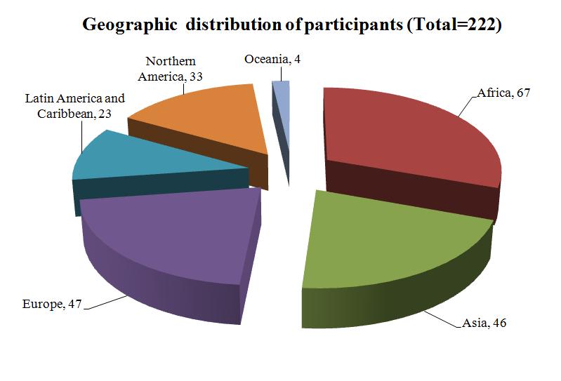
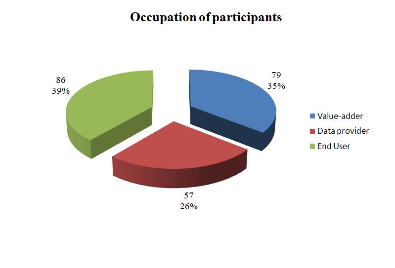
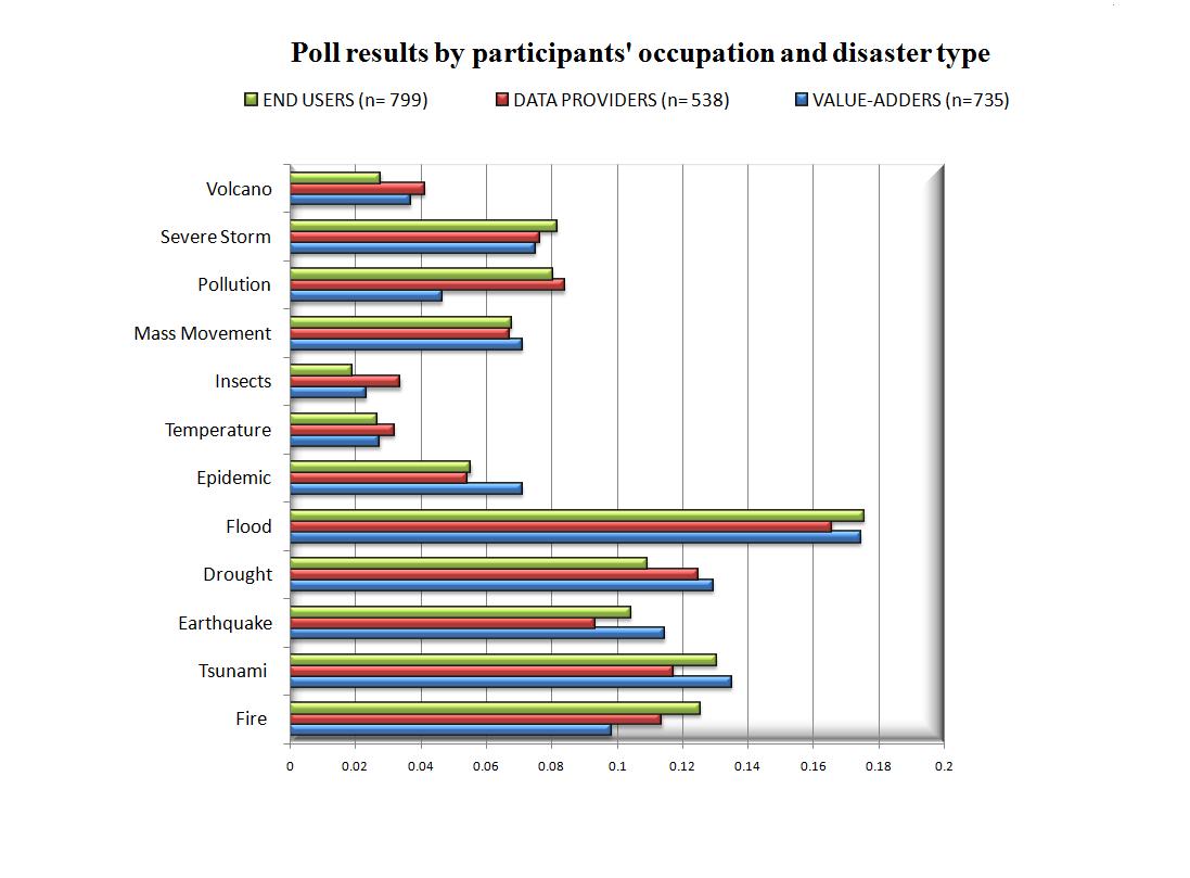
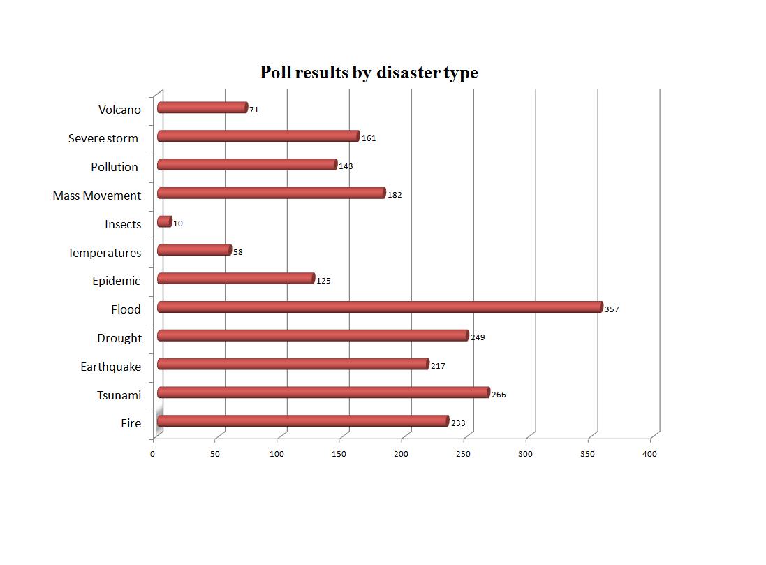
A web-based poll was carried out on the UN-SPIDER Knowledge Portal, where all stakeholders were given the opportunity to identify the 10 most important geodata products on a longlist containing 51 items, such as hazard-specific risk maps, vulnerability maps, damage assessment maps, and monitoring systems. Selection of these longlist items was based on content collected in the “Best Practices Booklet” and the Space Application Guides section on the UN-SPIDER Knowledge Portal. The poll was opened for 1 month during the annual Gi4DM – Geo-information for Disaster Management – conference in Antalya, Turkey, and announced at a special side event there on 4 May 2011. In addition, the call for participation was also disseminated via E-mail distribution several international organizations, such as the United Nations Geographical Information Working Group (UNGIWG), UN-SPIDER, and the Open Geospatial Consortium (OGC). 222 participants from all the continents checked the longlist for the 10 most important items, resulting in a total of 2,122 ticks. The participants represented data providers, value adders and end users. In terms of disaster types addressed, the evaluators’ professional role had no major effect on the outcome.
This way, a reference set of 10 top-priority geoinformation products and systems has been identified, highlighting the global community’s concern about flood, earthquake, drought, fire, and landslide hazards, as well as the importance of risk analysis and monitoring.
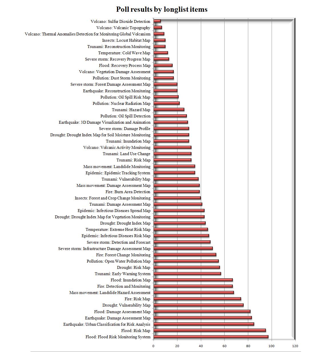
Top 10 geoinformation items for disaster and risk management:
| Product/System | Counts |
| Flood Risk Monitoring System | 97 |
| Flood Risk Map | 95 |
| Flood Damage Assessment Map | 82 |
| Inundation Map | 67 |
| Urban Classification for Earthquake Risk Analysis | 85 |
| Earthquake Damage Assessment Map | 83 |
| DroughtVulnerability Map | 76 |
| Fire Risk Map | 74 |
| Fire Detection and Monitoring System | 67 |
| Landslide Hazard Assessment | 68 |
There is a marked step in the number of votes below these top-10 items, highlighting their priority from the stakeholders’ point of view.
This reference set is currently being described in technical detail in cooperation with leading geosciences associations and will be soon disseminated to the global end-user community for a standardized benefit appraisal, with emphasis on impacts on operational as well as administrative and political issues, and on the criticality of specific product features. It will be an exciting exercise to finally compare the results of this differentiated user appraisal with the outcome of the socio-economic analysis.
The overall results of VALID are envisaged to be published as a booklet in summer 2013.