WMO publishes State of the Global Climate report for 2022

The World Meteorological Organization (WMO) has launched its "State of the Global Climate 2022" annual report on April 21, 2023. The report focuses on key climate indicators, such as greenhouse gases, sea level rise, temperatures, ocean heat and acidification, sea ice and glaciers, and highlights the impacts of climate change and exteme weather. 

Anticipatory Action in 2022: A Global Overview

The Anticipation Hub has published this week the "Anticipatory Action in 2022: A Global Overview" annual report that captures for the first time the scale of anticipatory action worldwide. The report discusses how the scope of anticipatory action expanded in 2022, in terms of hazards, triggers in place, and anticipatory actions implemented. It also shows how 35 countries implemented anticipatory actions in 2022 and are ready to act ahead of forecast hazards.

Webinar on Remote Sensing for Flood Risk and Hazard Management
This is event is available for participation on an ongoing basis
nuria.alonso Fri, 28 Apr 2023 - 09:36

The Multidisciplinary Digital Publishing Institute (MDPI) is organizing a continuation of the EO&GEO Series with the online webinar "Remote Sensing for Flood Risk and Hazard Management", taking place online on May 11. In this webinar, three internationally recognized experts will present some of the great developments in the areas of hydrology and flood management, discussing recent advances in topography, flood modeling, discharge measurements, and flood disaster mapping.<

0
0
No certificate issued or not known
0.00
USD
05/11/2023, 12:00am
not visible
1

Singapore Technologies Engineering Launches Satellite to Monitor Natural Disasters and Climate Change

ST Engineering has launched its first polarimetric synthetic aperture radar (PolSAR) satellite, TeLEOS-2, in partnership with Singapore's Defence Science and Technology Agency. The satellite is capable of capturing high-resolution day and night images under all-weather conditions, with full polarimetry for a wider range of satellite data applications, offering enhanced and wider coverage of major shipping routes and disaster-prone regions. TeLEOS-2 weighs 750kg and was successfully launched at 4.50 pm Singapore time from Satish Dhawan Space Centre SHAR, Sriharikota, India.

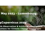
AI4Copernicus 2023: Earth Observation & Artificial Intelligence Solutions for Climate Change Challenges
This is event is available for participation on an ongoing basis
nuria.alonso Mon, 24 Apr 2023 - 11:15

The Copernicus Relays of Luxembourg and Belgium have the pleasure of inviting you to the 3rd edition of the AI4Copernicus event, focussing on “Earth Observation & Artificial Intelligence solutions for climate change challenges”, which will take place on May 25 onsite (Mondorf-les-Bains, Luxembourg) and online.

The event will touch upon several topics, such as: 

0
0
No certificate issued or not known
0.00
USD
05/25/2023, 12:00am
Visible
Mondorf-les-Bains
Space Cooperation: Copernicus Capacity Support Action Programme for the Philippines

The first space cooperation agreement taking place in South-East Asia, the Copernicus Capacity Support Action Programme for the Philippines (CopPhil), launched this week, on 24 April 2023. The contribution agreement was signed by the European Commission and the European Space Agency, with the aim to build a natio

nuria.alonso Mon, 24 Apr 2023 - 10:44

1st Access to Space for All Initiative Expert Meeting

This is event is available for participation on an ongoing basis

The United Nations Office for Outer Space Affairs (UNOOSA) launched the Access to Space for All initiative in 2018.It is a joint Initiative of UNOOSA and space agencies, research institutions and industry aimed at developing technical know-how, engineering processes and infrastructure of the United Nations Member States in the areas of hypergravity and microgravity experimentation, satellite development and space exploration.

0
0
No certificate issued or not known
0.00
USD
05/15/2023, 12:00am - 05/17/2023, 12:00am
Visible
1

Blending Multi-Satellite Data to Improve Hurricane Forecasting

Tropical cyclones are one of the most powerful and destructive natural hazards. The interaction of various hazards during tropical cyclones, such as extreme winds, tornadoes, lighting, flooding, or storm surge, substantially increases the potential for life and property damage.

UN/Austria Symposium: Space for Climate Action: Space Applications and Technologies for Sustainability on Earth

This is event is available for participation on an ongoing basis

The 2023 UN/Austria Symposium "Space for climate action: space applications and technologies for sustainability on Earth" will take place in September 12 - 14 both on-site (Graz, Austria) and online.

0
0
No certificate issued or not known
0.00
USD
09/12/2023, 12:00am - 09/14/2023, 12:00am
Visible
Technische Universität Graz
Graz
1

Türkiye Launches First Domestic High-resolution Earth Observation Satellite into Space

Türkiye has launched IMECE, its first high-resolution Earth-observation satellite into space. IMECE has been entirely designed and developed by TÜBİTAK Space Technologies Research Institute (TÜBİTAK UZAY), and will provide Türkiye with high resolution imagery for different purposes, such as disaster management, mapping, environment and agricultural practices, urbanisation, and defence.