The United Nations Platform for Space-based Information for Disaster Management and Emergency Response (UN-SPIDER) in collaboration with the German Aerospace Centre (DLR), the Global Flood Awareness System (GLOFAS) of the Copernicus Programme of the European Commission, and the University of Bonn’s Centre for Remote Sensing of Land Surfaces (ZFL), conducted an international training workshop on space-based technologies for flood management. The workshop was held at the UN Bonn Campus on 20-22 February 2023.
This is event is available for participation on an ongoing basis
Geospatial technologies and remote sensing are valuable resources to monitor the United Nation's Sustainable Development Goals (SDGs) and their corresponding targets and indicators. They allow for unbiased observation and analysis across borders, administrative boundaries, and nations. Furthermore, geospatial information and technologies are particularly critical to strengthening urban and rural resilience, where economic, agricultural, and various social sectors intersect.
Turkey and Syria recently experienced two devastating earthquakes of magnitude 7.8 and closely followed by a magnitude 7.5, resulting in extensive damage and destruction. The International Charter 'Space and Major Disasters' was activated by Turkish authorities, the United Nations, and the International Federation Red Cross & Red Crescent Societies in response to the earthquakes. The Charter provided more than 350 crisis images from 17 space agencies worldwide, which were used to create damage and situation maps to estimate the hazard impact and support relief actions.
UNDRR published a report detailing the main findings and recommendations of the midterm review of the implementation of the Sendai Framework for Disaster Risk Reduction 2015-2030. The report provides valuable insights into the progress made towards achieving the Sendai Framework's goals and identifies key areas for action moving forward. The findings and recommendations are likely to be of interest to policymakers, disaster risk management practitioners, and others working in the field of disaster risk reduction.
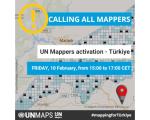
UN Mappers calls all mappers to support the Turkish Open Street Map community following the earthquake that hit southern Turkey and northern Syria on Monday 6 February.
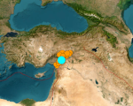
A major earthquake of magnitude 7.8 struck Turkey with epicentre on 23 kilometres east of Nurdagi (Gaziantep Province) on February 6, 2023. By the activity spreading to adjacent faults, the region was hit by a 6.7- magnitude and a 7.5- magnitude aftershocks respectively. The earthquake also affected neighbouring Syria.
On January 24, 2023, the U.S. Ambassador to Thailand, together with the Executive Director of the Asian Disaster Preparedness Center (ADPC), and the NASA Earth Science Division Director, launched SERVIR-Southeast Asia (SERVIR-SEA). The project is an $11.2 million ADPC-USAID-NASA initiative to help communities across Southeast Asia adapt to regional and transboundary climate issues and mitigate the impacts of climate change and disasters.
This is event is available for participation on an ongoing basis
The International Conference on Geographical Information Systems Theory, Applications and Management (GISTAM) aims at creating a meeting point for researchers and practitioners that address new challenges in geo-spatial data sensing, observation, representation, processing, visualization, sharing and managing, in all aspects concerning both information communication and technologies as well as management information systems and knowledge-based systems.
This is event is available for participation on an ongoing basis
The EU Agency for the Space Programme (EUSPA) will organize the "Copernicus for Anticipatory Humanitarian Action" online workshop on February 15. The workshop will bring together relevant stakeholders from the anticipatory humanitarian action field to understand their needs and present the capabilities and value propositions of Copernicus -the Earth Observation Programme of the European Union- in relevant applications and understand how joint action plans could be developed moving forward.