This is event is available for participation on an ongoing basis
It is well-documented that there are approximately 24,000 worldwide fatalities from lightning each year, with about 10 times more being injured from lightning (NIH-NCBI). In addition, lightning strikes are one of the leading causes of wildfire ignition. During storms, lightning strikes on trees, utility poles, and infrastructure, can damage power lines resulting in power outages. Lightning flashes also generate electromagnetic fields (Sferics) that interfere with electrical devices on ground.
This is event is available for participation on an ongoing basis
Introduction
In recent decades, communities in Africa have experienced disasters triggered by floods, droughts, landslides, forest fires, Ebola pandemics, and locust plagues that have eroded hard-won development gains. Taking note of advances in space technologies and other technological innovations, the African Union indicated in its 2017 African Space Policy that space represented a unique opportunity for cooperation in using and sharing enabling infrastructure and data towards the proactive management of, inter alia, responses to natural hazards and disasters.
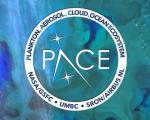
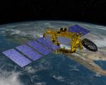
NASA's latest satellite mission, the Plankton, Aerosol, Climate, ocean Ecosystem (PACE), has been launched into orbit, marking a significant step in understanding crucial aspects of Earth's health and climate dynamics. PACE's primary objective is to examine the interplay between various components of Earth's systems, focusing on oceans, atmosphere, and climate.
This is event is available for participation on an ongoing basis
From 12-13 June 2024, the 3rd International Conference on Natural Hazards and Risks in a Changing World: Addressing Compound and Multi-Hazard Risk will take place in Amsterdam, the Netherlands. The conference is organised by MYRIAD-EU, Risk KAN and NatRiskChange.
The United Nations Office for Outer Space Affairs (UNOOSA), in collaboration with the Space Generation Advisory Council (SGAC), launched the fifth edition of the Space4Youth Essay Competition! The Competition targets students and young professionals with the aim to highlight governance practices and experiences on the sustainable use of outer space to address the needs of the present in a manner that protects the interests of future generations.
Scientists at the University of Glasgow have pioneered a method for monitoring river flows using satellite analysis, offering an advanced early warning system for flood risk. Current methods rely on expensive and challenging-to-install stream gauges, limiting coverage, especially in remote areas. The Glasgow researchers utilized video footage from a Chinese satellite to measure river discharge during a February 2022 flood along a 12-mile section of Australia's Darling River.
This is event is available for participation on an ongoing basis
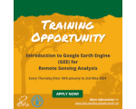
Google Earth Engine (GEE) is an example of a cloud-based image service that combines an extensive archive of satellite imagery, historical and current, with application programming interfaces (APIs) that allow analysis to be performed on this imagery without having to move it to the user’s desktop.
Want to learn more about this?
The AgroInformatics Team from the Digitalization and Informatics Division (CSI) of the FAO is launching a new series of interactive trainings, on “Introduction to Google Earth Engine (GEE) for remote sensing analysis”.
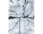
The Global Risks Report explores some of the most severe risks we may face over the next decade, against a backdrop of rapid technological change, economic uncertainty, a warming planet and conflict. As cooperation comes under pressure, weakened economies and societies may only require the smallest shock to edge past the tipping point of resilience.