  • English
  • Español
  • Français

United
Nations


Office for Outer Space Affairs
UN-SPIDER Knowledge Portal

  • Home
  • About Us
    • What is UN-SPIDER?
    • About UNOOSA
    • Publications
    • Jobs
    • Meet the Team
    • Contact
  • Space Application
    • Satellite Technology
    • Emergency Mechanisms
    • Recovery Mechanisms
    • International Asteroid Warning Network
    • Space Mission Planning Advisory Group
    • International Space Weather Initiative
    • Space Technologies in the UN
    • User Stories
  • Links & Resources
    • Data Applications
      • Disaster Recovery
    • Data Sources
    • GIS and Remote Sensing Software
    • Online Learning Resources
    • Institutions
  • Risks & Disasters
    • Disaster Risk Management
    • Early Warning Systems
    • Emergency and Disaster Management
    • Natural Hazards
    • Sendai Framework
    • The UN and Disaster Risk Management
    • The UN and Early Warning
    • The UN and Disaster Management
  • Advisory Support
    • Advisory Missions
    • Emergency Support
    • Virtual Advisory Support
    • Recommended Practices
    • Training Activities
    • Practical Uses
  • Network
    • Regional Support Offices
    • GP-STAR
    • MHEWS
    • IWG-SEM
  • Projects
    • SPEAR
    • SEWS-D
    • EvIDENz
    • Flood GUIDE
  • News & Events
    • News
    • Events Calendar
    • UN-SPIDER Events Archive

Breadcrumb

  • Home
  • VRSS-1 / Francisco de Miranda
  • VRSS-1 / Francisco de Miranda

VRSS-1 / Francisco de Miranda

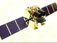
VRSS-1 is Venezuela's first remote sensing satellite.
On May 26, 2011, a contract for the manufacture and launch of the VRSS-1 spacecraft was signed in Caracas, Venezuela, between the government of Venezuela (the Ministry of People’s Power for Science, Technology and Intermediate Industries) and CGWIC (China Great Wall Industry Corporation), a subsidiary of CASC (China Aerospace Science & Technology Corporation).
After launch, the VRSS-1 satellite was renamed in honor of Sebastián Francisco de Miranda (1750-1816), a Venezuelan revolutionary hero, known as ‘Generalissimo’ Francisco de Miranda, who had planned the independence of the Spanish colonies in South America.
Partner organizations in the VRSS-1 program: ABAE is the Space Agency of Venezuela, subordinated and funded by the Venezuelan Ministry of People’s Power for Science, Technology and Innovation (MPPCTI). ABAE is in charge of in-orbit operations, management and application of the VRSS-1 satellite mission. The VRSS-1 satellite launched September 20, 2012.

Instruments:
High Resolution Camera (PMC)
Wide-swath Multispectral Camera (WMC)
 

20 Sep 2012
3years
Low Earth
Providing resource studies (high-resolution land and vegetation observations - to assess Venezuela's soil and water resources, collecting images to help urban planners, monitoring illegal mining and drug activities, and strengthening national defense), support of disaster monitoring
Drought
Landslide
Tsunami
Earthquake
Extreme Temperature
Flood
Forest Fire
Volcanic Eruption
Mass Movement
No
Information about VRSS-1 on ABAE web page

Footer menu

  • Contact
  • Terms of Use

User account menu

  • Log in