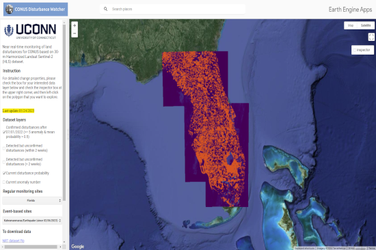
Researchers at the University of Connecticut Global Environmental Remote Sensing (GERS) Laboratory have been making progress on achieving near real-time post-disaster monitoring and evaluation. For the last few years, they have been developing a tool that uses machine learning to identify land disturbances around the continental United States.
Using decades worth of Landsat data, the researchers are able to train the tool to filter out the visual noise and seasonal change that occurs over large scales throughout a year, and then identify areas of notable change and possible damage. The outputs and training provided by older datasets can be then used to create a model to recognize land disturbances earlier, and help to inform emergency response. These techniques and the platform of which they are showcased in have been previously used in the days following hurricane Ian, and were able to identify damaged areas throughout Southern Florida with approximately 84% accuracy.