• English
  • Español
  • Français

United
Nations


Office for Outer Space Affairs
UN-SPIDER Knowledge Portal

  • Home
  • About Us
    • What is UN-SPIDER?
    • About UNOOSA
    • Publications
    • Jobs
    • Meet the Team
    • Contact
  • Space Application
    • Satellite Technology
    • Emergency Mechanisms
    • Recovery Mechanisms
    • International Asteroid Warning Network
    • Space Mission Planning Advisory Group
    • International Space Weather Initiative
    • Space Technologies in the UN
    • User Stories
  • Links & Resources
    • Data Applications
      • Disaster Recovery
    • Data Sources
    • GIS and Remote Sensing Software
    • Online Learning Resources
    • Institutions
  • Risks & Disasters
    • Disaster Risk Management
    • Early Warning Systems
    • Emergency and Disaster Management
    • Natural Hazards
    • Sendai Framework
    • The UN and Disaster Risk Management
    • The UN and Early Warning
    • The UN and Disaster Management
  • Advisory Support
    • Advisory Missions
    • Emergency Support
    • Virtual Advisory Support
    • Recommended Practices
    • Training Activities
    • Practical Uses
  • Network
    • Regional Support Offices
    • GP-STAR
    • MHEWS
    • IWG-SEM
  • Projects
    • SPEAR
    • SEWS-D
    • EvIDENz
    • Flood GUIDE
    • CommonSpace Initiative
  • News & Events
    • News
    • Events Calendar
    • UN-SPIDER Events Archive

Breadcrumb

  • Home
  • News and Events
  • View Active News
  • Satellites Are Measuring The Volume of The Sea-ice Cover
  • Satellites are measuring the volume of the sea-ice cover

Satellites are measuring the volume of the sea-ice cover

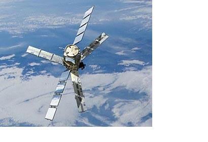
The Soil Moisture and Ocean Salinity (SMOS)

This year, satellites saw the extent of Arctic sea ice hit a record low since measurements began in the 1970s. ESA's SMOS and CryoSat satellites are now taking a deeper look by measuring the volume of the sea-ice cover. Measurements from Soil Moisture and Ocean Salinity (SMOS) mission show that ice has thinned significantly in the seasonal ice zones, with extensive areas less than half a metre thick.  Although not originally designed for looking at ice, the SMOS satellite's data are being evaluated to monitor Arctic sea ice. The results reveal that radiation emitted by the ice allows SMOS to penetrate the surface, yielding ice-thickness measurements down to 50 cm - mainly the thinner and younger ice at the edge of the Arctic Ocean. This allows improved evaluation of the volume of the young ice, which is the basis of old ice in subsequent years. 

It is important to keep a close watch on the Arctic because this inaccessible and very sensitive ecosystem is rapidly changing. The disappearance of ice has a major effect on the northern hemisphere. ESA will continue to monitor the Arctic with the upcoming Sentinel series of Earth-observing satellites for Europe’s Global Monitoring for Environment and Security (GMES) programme.
ESA
Tue, 9 Oct 2012 - 15:14
Europe

Footer menu

  • Contact
  • Terms of Use

User account menu

  • Log in