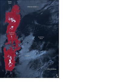
Satellite imagery helps scientists investigate underwater waves. Internal waves can tower hundreds of feet and have great impact on climate and ocean’s ecosystems.
Giant underwater waves are invisible for the eye. They build in the boundary between two layers of water – cold and salty below and warm and less salty above. These differences in temperature and salinity can be seen only instrumentally. Due to different factors – depth, ocean surface – the boundary level where the waves build can be really thick and are able to move enormous masses of water, mixing temperatures and salinity.
In laboratories in the Philippines and Hawaii a team of scientists involving MIT and several other institutions, and coordinated by the Office of Naval Research (ONR), conducted research on internal waves. They detected that underwater waves can be as high as 700 meters (ca. 550 feet). The waves have significant importance mostly because they transfer heat from Upper Ocean to the depths. Satellite data has helped determine exactly why and how the waves are generated.
For example, images from Space delivered views on the giant waves in the Luzon Strait between Thailand and the Philippines. Now, the scientists have access to the full 12-hour periodicity of the waves. Satellites could further help to define the differences between waves, their impact on region’s biology and the turbulence they produce.

