• English
  • Español
  • Français

United
Nations


Office for Outer Space Affairs
UN-SPIDER Knowledge Portal

  • Home
  • About Us
    • What is UN-SPIDER?
    • About UNOOSA
    • Publications
    • Jobs
    • Meet the Team
    • Contact
  • Space Application
    • Satellite Technology
    • Emergency Mechanisms
    • Recovery Mechanisms
    • International Asteroid Warning Network
    • Space Mission Planning Advisory Group
    • International Space Weather Initiative
    • Space Technologies in the UN
    • User Stories
  • Links & Resources
    • Data Applications
      • Disaster Recovery
    • Data Sources
    • GIS and Remote Sensing Software
    • Online Learning Resources
    • Institutions
  • Risks & Disasters
    • Disaster Risk Management
    • Early Warning Systems
    • Emergency and Disaster Management
    • Natural Hazards
    • Sendai Framework
    • The UN and Disaster Risk Management
    • The UN and Early Warning
    • The UN and Disaster Management
  • Advisory Support
    • Advisory Missions
    • Emergency Support
    • Virtual Advisory Support
    • Recommended Practices
    • Training Activities
    • Practical Uses
  • Network
    • Regional Support Offices
    • GP-STAR
    • MHEWS
    • IWG-SEM
  • Projects
    • SPEAR
    • SEWS-D
    • EvIDENz
    • Flood GUIDE
  • News & Events
    • News
    • Events Calendar
    • UN-SPIDER Events Archive

Breadcrumb

  • Home
  • News and Events
  • View Active News
  • Report Launch: The Value of Geo-Information For Disaster and Risk Management (VALID)
  • Report launch: The Value of Geo-Information for Disaster and Risk Management (VALID)

Report launch: The Value of Geo-Information for Disaster and Risk Management (VALID)

On 3 September 2013, UNOOSA/UN-SPIDER presented a new report which shows the economic, humanitarian and organizational benefits of applying geoinformation to disaster management. The report "The Value of Geo-Information for Disaster and Risk Management (VALID): Benefit Analysis and Stakeholder Assessment" was edited by Professor Orhan Altan of the Istanbul Technical University and Member of the Executive Board of the International Council for Science. The publication aims to raise awareness and to help set priorities in research and development.

The VALID report is a follow-up publication to the Joint Board of Geospatial Information Societies (JBGIS) and UNOOSA/UN-SPIDER published ‘Geoinformation for Disaster and Risk Management – Examples and Best Practices’, a compilation of case studies that provides information on what can be done with geoinformation in support of disaster and risk management – methods, systems, applications, experiences. It analyses cases and offers an expert stakeholder assessment.

Speakers at the presentation included Mazlan Othman, Director of UNOOSA, Prof. Orhan Altan of Istanbul Technical University as well as Robert Backhaus and Luc St-Pierre of UN-SPIDER. Photos of the launch are available on Flickr.

Download the publication (9.85 Mb)
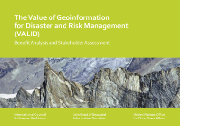
Publication: The Value of Geoinformation for Disaster and Risk Management (VALI…
Tue, 3 Sep 2013 - 14:49
Austria

Footer menu

  • Contact
  • Terms of Use

User account menu

  • Log in