• English
  • Español
  • Français

United
Nations


Office for Outer Space Affairs
UN-SPIDER Knowledge Portal

  • Home
  • About Us
    • What is UN-SPIDER?
    • About UNOOSA
    • Publications
    • Jobs
    • Meet the Team
    • Contact
  • Space Application
    • Satellite Technology
    • Emergency Mechanisms
    • Recovery Mechanisms
    • International Asteroid Warning Network
    • Space Mission Planning Advisory Group
    • International Space Weather Initiative
    • Space Technologies in the UN
    • User Stories
  • Links & Resources
    • Data Applications
      • Disaster Recovery
    • Data Sources
    • GIS and Remote Sensing Software
    • Online Learning Resources
    • Institutions
  • Risks & Disasters
    • Disaster Risk Management
    • Early Warning Systems
    • Emergency and Disaster Management
    • Natural Hazards
    • Sendai Framework
    • The UN and Disaster Risk Management
    • The UN and Early Warning
    • The UN and Disaster Management
  • Advisory Support
    • Advisory Missions
    • Emergency Support
    • Virtual Advisory Support
    • Recommended Practices
    • Training Activities
    • Practical Uses
  • Network
    • Regional Support Offices
    • GP-STAR
    • MHEWS
    • IWG-SEM
  • Projects
    • SPEAR
    • SEWS-D
    • EvIDENz
    • Flood GUIDE
  • News & Events
    • News
    • Events Calendar
    • UN-SPIDER Events Archive

Breadcrumb

  • Home
  • News and Events
  • View Active News
  • Remote Sensing Technologies Employed To Conduct Rapid Damage Assessment After The 2011 US Tornadoes
  • Remote sensing technologies employed to conduct rapid damage assessment after the 2011 US Tornadoes

Remote sensing technologies employed to conduct rapid damage assessment after the 2011 US Tornadoes

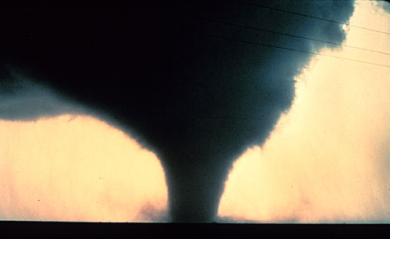
Within days after devastating tornadoes struck Alabama and Missouri, the damage experts at ImageCat and New Light Technologies produced a rapid building damage assessment database to estimate losses from the event. This work was done through the use of high-resolution pre- and post- event NOAA aerial photography, Google Earth satellite imagery and engineering expertise.

Over 400 sq miles of area was analyzed in Tuscaloosa (Alabama), Birmingham (Alabama) and Joplin (Missouri). 17,000 + properties were identified with damage ranging from limited to catastrophic. The results from this damage assessment were intended to provide actionable information that FEMA could use in its Individual Assistance (IA) Program.

In addition to the rapid building damage assessment database a distribution of damaged building by occupancy was developed. The building occupancy damage analysis played a key role in identifying the owners of damaged building and in supporting the housing assistance program.

With the availability of very high-resolution aerial imagery, the damage assessment for the spring tornadoes of 2011 provided an accurate account of catastrophic damage levels in the impacted areas. The development of a damage protocol for tornadoes using a combination of several damage classification schemes ensured the production and delivery of a consistent damage assessment database to FEMA.
GISuser.com
Tue, 16 Aug 2011 - 15:17

Footer menu

  • Contact
  • Terms of Use

User account menu

  • Log in