  • English
  • Español
  • Français

United
Nations


Office for Outer Space Affairs
UN-SPIDER Knowledge Portal

  • Home
  • About Us
    • What is UN-SPIDER?
    • About UNOOSA
    • Publications
    • Jobs
    • Meet the Team
    • Contact
  • Space Application
    • Satellite Technology
    • Emergency Mechanisms
    • Recovery Mechanisms
    • International Asteroid Warning Network
    • Space Mission Planning Advisory Group
    • International Space Weather Initiative
    • Space Technologies in the UN
    • User Stories
  • Links & Resources
    • Data Applications
      • Disaster Recovery
    • Data Sources
    • GIS and Remote Sensing Software
    • Online Learning Resources
    • Institutions
  • Risks & Disasters
    • Disaster Risk Management
    • Early Warning Systems
    • Emergency and Disaster Management
    • Natural Hazards
    • Sendai Framework
    • The UN and Disaster Risk Management
    • The UN and Early Warning
    • The UN and Disaster Management
  • Advisory Support
    • Advisory Missions
    • Emergency Support
    • Virtual Advisory Support
    • Recommended Practices
    • Training Activities
    • Practical Uses
  • Network
    • Regional Support Offices
    • GP-STAR
    • MHEWS
    • IWG-SEM
  • Projects
    • SPEAR
    • SEWS-D
    • EvIDENz
    • Flood GUIDE
  • News & Events
    • News
    • Events Calendar
    • UN-SPIDER Events Archive
  • Admin
    • SAM Items

Breadcrumb

  • Home
  • News and Events
  • View Active News
  • New On The Knowledge Portal: Links and Resources
  • New on the Knowledge Portal: Links and Resources

New on the Knowledge Portal: Links and Resources

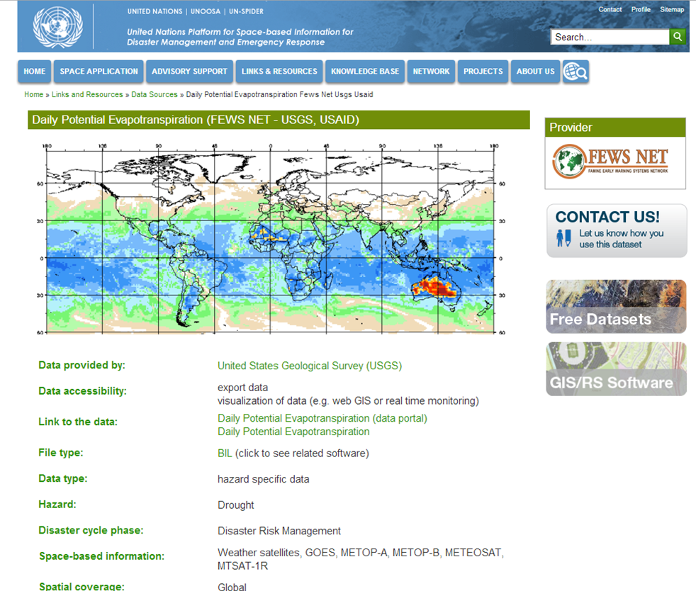
It is UN-SPIDER’s mandate to enable all countries to access and use space-based information for disaster management and disaster risk reduction. The team has therefore launched a new section on the UN-SPIDER Knowledge Portal which contains a database on freely available, archived satellite imagery and derived products.

The new section also hosts a database on available GIS and Remote Sensing software, both freely available and paid. Users can search both databases by relevant criteria, such as hazard, file type, resolution, cost, data format, etc. Since tools and data need to be complemented with methods to effectively use spacebased information, “Links and Resources” also contains an overview of training opportunities, including academic training courses and web-based training courses.

All databases are continously being amended and updated. If you have any suggestions or comments on datesets, software or training courses, please feel free to get in touch with us via the contact buttons or by email (un-spider@unoosa.org).

Links and Resources
Wed, 12 Feb 2014 - 14:12

Footer menu

  • Contact
  • Terms of Use

User account menu

  • Log in