• English
  • Español
  • Français

United
Nations


Office for Outer Space Affairs
UN-SPIDER Knowledge Portal

  • Home
  • About Us
    • What is UN-SPIDER?
    • About UNOOSA
    • Publications
    • Jobs
    • Meet the Team
    • Contact
  • Space Application
    • Satellite Technology
    • Emergency Mechanisms
    • Recovery Mechanisms
    • International Asteroid Warning Network
    • Space Mission Planning Advisory Group
    • International Space Weather Initiative
    • Space Technologies in the UN
    • User Stories
  • Links & Resources
    • Data Applications
      • Disaster Recovery
    • Data Sources
    • GIS and Remote Sensing Software
    • Online Learning Resources
    • Institutions
  • Risks & Disasters
    • Disaster Risk Management
    • Early Warning Systems
    • Emergency and Disaster Management
    • Natural Hazards
    • Sendai Framework
    • The UN and Disaster Risk Management
    • The UN and Early Warning
    • The UN and Disaster Management
  • Advisory Support
    • Advisory Missions
    • Emergency Support
    • Virtual Advisory Support
    • Recommended Practices
    • Training Activities
    • Practical Uses
  • Network
    • Regional Support Offices
    • GP-STAR
    • MHEWS
    • IWG-SEM
  • Projects
    • SPEAR
    • SEWS-D
    • EvIDENz
    • Flood GUIDE
  • News & Events
    • News
    • Events Calendar
    • UN-SPIDER Events Archive

Breadcrumb

  • Home
  • News and Events
  • View Active News
  • Nepal: Raising Awareness To Fight Fires Through Satellite Imagery
  • Nepal: Raising awareness to fight fires through satellite imagery

Nepal: Raising awareness to fight fires through satellite imagery

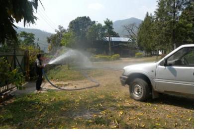
A firefighter demonstrates water hose in Makwanpur district (Image: ICIMOD)A firefighter demonstrates water hose in Makwanpur district (Image: ICIMOD)

The SERVIR-Himalaya Initiative of the International Centre for Integrated Mountain Development (ICIMOD), Regional Support Office of UN-SPIDER, in collaboration with the Department of Forests (DoF) of Nepal, has conducted an awareness campaign at field level in the most fire prone districts of Nepal. 

The awareness campaign took place during the week of 16 to 23 March 2015 in six different districts of the Terai region: Kanchanpur, Kailali, Bardia, Chitwan, Makwanpur, and Parsa. More than 290 participants including forest range officers, Nepal Army, local fire fighters, and media learned the working process of the Forest Fire Monitoring and Detection System, developed by ICIMOD under the SERVIR-Himalaya framework.

ICIMOD elaborated: “The Forest Fire Detection and Monitoring System developed by ICIMOD under the SERVIR-Himalaya framework uses satellite imagery to detect and locate forest fires. The system generates and disseminates three products: short message system (SMS) alerts, email notifications, and a web application for visualizing the latest fire data as well as historical data. The web application can also be exported to a PDF fire map. Currently, the system sends SMS alert to District Forest Officers and focal person of different community forest user groups.“

The region of Terai is affected by long dry summers that produce high number of forest fires, reaching around 30 per day from April to June. 

"Recently, there was a forest fire near my locality and we were able to mobilize everyone to control the fire on time due to this SMS system. Compared to other systems, this SMS system is very efficient for community mobilization," said Tara Dhungana, Community Forest Advisor.  
ICIMOD
Wed, 15 Apr 2015 - 15:34
Nepal
International Centre for Integrated Mountain Development (ICIMOD)

Footer menu

  • Contact
  • Terms of Use

User account menu

  • Log in