
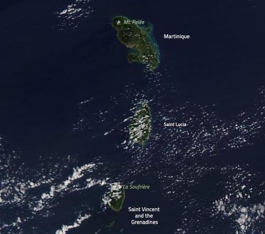
Recently, two volcanoes in the Caribbean indicated increased activity: Mount Pelée on Martinique and the La Soufrière volcano on Saint Vincent and the Grenadines. Mount Pelée has been experiencing seismic activity and the La Soufrière volcano has been releasing gas. In light of this increased activity and the risk that a potential volcanic eruption poses to the environment and human life, a programme at the National Aeronautics and Space Administration (NASA) was activated earlier this year to monitor the region.
A volcanic eruption can have a highly destructive impact on the environment and human life. For this reason, satellite-based radar instruments can be used to monitor volcanic activity and support disaster management efforts. Following an increased activity manifested by these two volcanoes in the Caribbean, the Earth Applied Sciences Disasters programme at NASA is actively monitoring the region and analysing Earth observation (EO) data to monitor this volcanic activity.
Volcanic eruptions occur “when lava and gas are discharged from a volcanic vent”. The impact of volcanic eruptions on the environment and human life can be highly destructive: volcanic ash can damage agricultural fields, roads and houses; pyroclastic surges have the potential to eradicate flora and infrastructure; and volcanic ash and gases may impede breathing. More information on volcanic eruptions can be found here. Radar instruments on satellites are very useful to monitor volcanic activity and support disaster management efforts, specifically under cloudy conditions. Imagery captured by the satellite-based radar instruments can be used to monitor volcanic activity. In a complementary fashion, optical imagery can help identify predictors of volcanic eruptions.
The Earth Applied Sciences Disasters programme at NASA provides “access to critical imagery, data and analysis” spanning all phases of the disaster management cycle. Due to the increased activity by Mount Pelée and the La Soufrière volcano, a request for assistance was submitted to the Earth Applied Sciences Disasters programme at NASA by the U.S. Agency for International Development (USAID). The process was administered by SERVIR. As a result, the Earth Applied Sciences Disasters programme at NASA is now collaborating with the Volcano Disaster Assistance Program (VDAP) at USGS to pinpoint and analyse EO data in order to mitigate the impacts of a potential volcanic eruption. All relevant data is published by the Earth Applied Sciences Disasters programme at NASA to the NASA Disaster Mapping Portal.