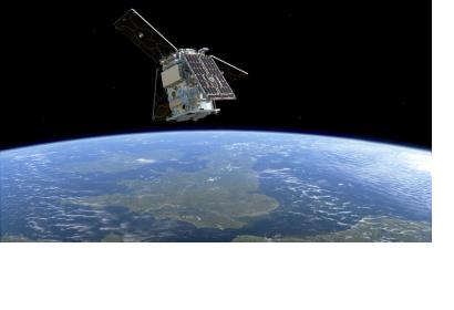
The European Space Agency’s (ESA) HydroGNSS mission will launch on 26 November, 2025 at 19:18 CET aboard a SpaceX Falcon 9 from the Vandenberg Space Force Base. The mission is part of a rideshare that will deploy satellites from Italy’s IRIDE program and two radar satellites developed under Greece’s National Small Satellite Programme, significantly expanding Europe’s environmental and hazard-monitoring capacity.
Monitoring the Global Water Cycle with HydroGNSS
HydroGNSS, part of ESA’s FutureEO program, consists of two microsatellites designed to gather measurements on soil moisture, inundation and wetlands, freeze or thaw states, and above-ground biomass, all of which are closely aligned with Essential Climate Variables used to assess climate risks. These measurements will support weather forecasting, flood prediction, wetland analysis, permafrost studies, and forest carbon assessments, while also producing secondary observations of ocean wind speed and sea-ice extent.
HydroGNSS uses Global Navigation Satellite System reflectometry, a technique that relies on signals transmitted by navigation systems such as Galileo and GPS, which continually broadcast low-power L-band microwave navigation signals toward Earth. When these signals reflect off Earth’s surface, they are altered by the physical properties of terrain, ice, oceans, or vegetation. HydroGNSS will gather information about the Earth’s water cycle by comparing these altered reflected signals to the original GNSS transmissions. The two satellites will enter orbit at roughly 550 kilometers and operate 180 degrees apart to provide stable global coverage.

Expanding European Observation Capabilities: Italy’s IRIDE and Greece’s National Small Satellite Programme
The launch will also deploy satellites from Italy’s IRIDE program, a multi-constellation Earth-observation initiative designed to support mapping, monitoring services, and multi-temporal analysis for the public sector, including civil protection. The satellites launched in this mission form part of the Eaglet II constellation, each equipped with a multispectral high-resolution optical instrument and an Automatic Identification System instrument. IRIDE is coordinated by ESA with support from the Italian Space Agency and is funded through Italy’s National Recovery and Resilience Plan.
Greece’s participation includes two high-resolution ICEYE radar satellites under the National Small Satellite Programme. These will be the first in a broader series of satellites planned for next year, aimed at strengthening national capabilities in satellite technology, disaster management, environmental monitoring, and security. The program is led by the Hellenic Space Center and the Greek Ministry of Digital Governance, with ESA providing the overarching program framework.
Advancing Environmental and Disaster-Related Monitoring Across Europe
Together, HydroGNSS, the IRIDE satellites, and Greece’s radar missions will contribute to expanding Earth-observation resources for hydrological monitoring, land-condition assessments, and hazard analysis. By supporting measurements tied to water-cycle processes and environmental change, these missions will enhance the operational tools available to governments and monitoring agencies. Their combined capabilities will strengthen climate assessment, early warning information, and disaster preparedness efforts across Europe and beyond, reinforcing the role of space-based data in decision-making for disaster risk reduction.

