• English
  • Español
  • Français

United
Nations


Office for Outer Space Affairs
UN-SPIDER Knowledge Portal

  • Home
  • About Us
    • What is UN-SPIDER?
    • About UNOOSA
    • Publications
    • Jobs
    • Meet the Team
    • Contact
  • Space Application
    • Satellite Technology
    • Emergency Mechanisms
    • Recovery Mechanisms
    • International Asteroid Warning Network
    • Space Mission Planning Advisory Group
    • International Space Weather Initiative
    • Space Technologies in the UN
    • User Stories
  • Links & Resources
    • Data Applications
      • Disaster Recovery
    • Data Sources
    • GIS and Remote Sensing Software
    • Online Learning Resources
    • Institutions
  • Risks & Disasters
    • Disaster Risk Management
    • Early Warning Systems
    • Emergency and Disaster Management
    • Natural Hazards
    • Sendai Framework
    • The UN and Disaster Risk Management
    • The UN and Early Warning
    • The UN and Disaster Management
  • Advisory Support
    • Advisory Missions
    • Emergency Support
    • Virtual Advisory Support
    • Recommended Practices
    • Training Activities
    • Practical Uses
  • Network
    • Regional Support Offices
    • GP-STAR
    • MHEWS
    • IWG-SEM
  • Projects
    • SPEAR
    • SEWS-D
    • EvIDENz
    • Flood GUIDE
  • News & Events
    • News
    • Events Calendar
    • UN-SPIDER Events Archive
  • Admin
    • SAM Items

Breadcrumb

  • Home
  • News and Events
  • View Active News
  • GEO Monitors, Analyzes, and Distributes Data On The Japan Disaster
  • GEO Monitors, Analyzes, and Distributes Data on the Japan Disaster

GEO Monitors, Analyzes, and Distributes Data on the Japan Disaster

A new GEO Geohazard Supersite on the Tohoku-oki Event was established immediately after the 11 March earthquake and tsunami to aid rescue efforts and advance scientific understanding. Meanwhile, the International Charter on Space and Major Disasters was activated at the request of the Japanese Cabinet and the Japan Aerospace Exploration Agency (JAXA). JAXA is distributing updated PALSAR, ScanSAR and FBS data via its FTP site, and the Italian Space Agency (ASI) is providing data and data products for use by experts.

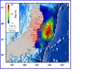
GEO’s Tohoku-oki Event Supersite is pooling the best and most up-to-date images, maps, model results and links on the multiple disasters. The available products address interplate coupling, historic seismicity, and damage; they also include 3D animations of the aftershocks recorded to date.

JAXA has invited modelers and other users of the data it is distributing to share their results with Japan and with the international community as a whole. The agency has also issued a request for available information on the tsunami area, landslide area, deformation pattern (InSAR), future possible dangerous areas, and floating objects in the ocean.

ASI, together with the Italian Department of Civil Protection, is acquiring COSMO-Skymed data and Earth observation data elaborations on the earthquake scenario. It has elaborated maps of the tsunami covered area as well as maps on change, risk, vulnerability, and damage, and it is analyzing deformation patterns using COSMO-SkyMed pre- and post- seismic acquisitions.

The German Aerospace Center (DLR) and other space agencies are continuing to provide imagery and data via the International Charter. The GEO community will remain committed to supporting the efforts of Japan to assess and respond to the tragic disasters it continues to face.
Earthzine on March 23, 2011
Thu, 24 Mar 2011 - 14:29
Japan

Footer menu

  • Contact
  • Terms of Use

User account menu

  • Log in