  • English
  • Español
  • Français

United
Nations


Office for Outer Space Affairs
UN-SPIDER Knowledge Portal

  • Home
  • About Us
    • What is UN-SPIDER?
    • About UNOOSA
    • Publications
    • Jobs
    • Meet the Team
    • Contact
  • Space Application
    • Satellite Technology
    • Emergency Mechanisms
    • Recovery Mechanisms
    • International Asteroid Warning Network
    • Space Mission Planning Advisory Group
    • International Space Weather Initiative
    • Space Technologies in the UN
    • User Stories
  • Links & Resources
    • Data Applications
      • Disaster Recovery
    • Data Sources
    • GIS and Remote Sensing Software
    • Online Learning Resources
    • Institutions
  • Risks & Disasters
    • Disaster Risk Management
    • Early Warning Systems
    • Emergency and Disaster Management
    • Natural Hazards
    • Sendai Framework
    • The UN and Disaster Risk Management
    • The UN and Early Warning
    • The UN and Disaster Management
  • Advisory Support
    • Advisory Missions
    • Emergency Support
    • Virtual Advisory Support
    • Recommended Practices
    • Training Activities
    • Practical Uses
  • Network
    • Regional Support Offices
    • GP-STAR
    • MHEWS
    • IWG-SEM
  • Projects
    • SPEAR
    • SEWS-D
    • EvIDENz
    • Flood GUIDE
  • News & Events
    • News
    • Events Calendar
    • UN-SPIDER Events Archive

Breadcrumb

  • Home
  • News and Events
  • Events Calendar
  • Synthetic Aperture Radar (SAR) Satellite Imagery Training In Gabon
  • Synthetic Aperture Radar (SAR) satellite imagery training in Gabon

Synthetic Aperture Radar (SAR) satellite imagery training in Gabon

 Gabonese Space Agency (AGEOS)

CEOS Working Group on Capacity Development and Data Democracy (WGCapD), UNOOSA, UN-SPIDER, Copernicus Programme, ESA

Mon, 20 Feb - Fri, 24 Feb 2017
Mon 13 Feb 2017

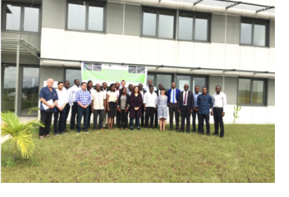
The aim of the workshop was to build capacity in processing and analyzing the SAR imagery in East Africa and Southern African Development Community (SADC) countries. It was attended by 17 participants from Rwanda, Cote d'Ivoire, Senegal, Tunisia, Morocco, Kenya, Ghana, Nigeria and Gabon.  Synthetic aperture radar (SAR) is an active form of remote sensing that does not rely on the sun to acquire images. It has applications in different disciplines from disaster management, weather monitoring to maritime surveillance and others.  SAR experts from NASA, DLR and SAREDU Initiative provided specific lectures and hands-on training, thanks to which the participants learned about the SAR applications in flood mapping, land cover mapping, agriculture, ship detection, oil spills detection and tracking illegal fishing. 

The event was supported by UN-SPIDER, the Copernicus Programme, ESA and CEOS Working Group on Capacity Development and Data Democracy (WGCapD).

Participants from east African and Southern African Development Community (SADC) countries. Stakeholders from disaster management, environmental, food and water security community.
Gabonese Space Agency (AGEOS)
Libreville
Gabon
English

Footer menu

  • Contact
  • Terms of Use

User account menu

  • Log in