  • English
  • Español
  • Français

United
Nations


Office for Outer Space Affairs
UN-SPIDER Knowledge Portal

  • Home
  • About Us
    • What is UN-SPIDER?
    • About UNOOSA
    • Publications
    • Jobs
    • Meet the Team
    • Contact
  • Space Application
    • Satellite Technology
    • Emergency Mechanisms
    • Recovery Mechanisms
    • International Asteroid Warning Network
    • Space Mission Planning Advisory Group
    • International Space Weather Initiative
    • Space Technologies in the UN
    • User Stories
  • Links & Resources
    • Data Applications
      • Disaster Recovery
    • Data Sources
    • GIS and Remote Sensing Software
    • Online Learning Resources
    • Institutions
  • Risks & Disasters
    • Disaster Risk Management
    • Early Warning Systems
    • Emergency and Disaster Management
    • Natural Hazards
    • Sendai Framework
    • The UN and Disaster Risk Management
    • The UN and Early Warning
    • The UN and Disaster Management
  • Advisory Support
    • Advisory Missions
    • Emergency Support
    • Virtual Advisory Support
    • Recommended Practices
    • Training Activities
    • Practical Uses
  • Network
    • Regional Support Offices
    • GP-STAR
    • MHEWS
    • IWG-SEM
  • Projects
    • SPEAR
    • SEWS-D
    • EvIDENz
    • Flood GUIDE
  • News & Events
    • News
    • Events Calendar
    • UN-SPIDER Events Archive
  • Admin
    • SAM Items

Breadcrumb

  • Home
  • National Institute For Space Research (INPE)
  • National Institute for Space Research (INPE)

National Institute for Space Research (INPE)

The partnership between Brazil and China has their own image catalog of remotely-sensed data which lets you download free satellite imagery using the INPE Image Catalog.

The catalog includes satellite imagery from their own China–Brazil Earth Resources Satellite 2 and 2b (CBERS-2, CBERS-2b). It includes satellites from the United States, the United Kingdom and the India from Aqua, CBERS, Landsat, ResourceSat, S-NPP, Terra & UK-DMC 2.

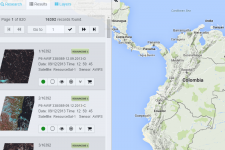
The one caveat is that the data is specific to South America and Africa. You’ll have to create an account because each request you make will be sent to your email. You can use your English translation to translate from Portuguese.

Select your satellite and sensor. Choose a country in South America and Africa. Add it to your cart, and click “Go Ahead”. From there you can download your chosen free satellite imagery from the INPE FTP site.

Footer menu

  • Contact
  • Terms of Use

User account menu

  • Log in