![]()
United
Nations
InaSAFE (Indonesia Scenario Assessment For Emergencies) (Australia-Indonesia Facility for Disaster Reduction, World Bank-GFDRR)
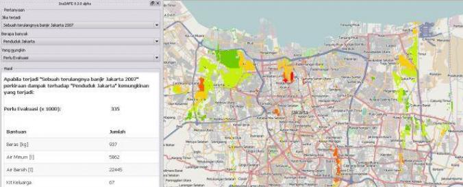
| Description: | InaSAFE is free software that produces realistic natural hazard impact scenarios for better planning, preparedness and response activities. It provides a simple but rigorous way to combine data from scientists, local governments and communities to provide insights into the likely impacts of future disaster events. |
| Software type: | Extension |
| Website: | http://inasafe.org/#concept |
| Accessibility: | Install only |
| Scope: | Image processing, Modelling, Visualisation |
| Vector/Raster: | Vector, Raster |
| Optical data or radar data format: | Optical, Radar |
| Costs: | Free |
![]()