![]()
United
Nations
VIIRS Black Marble Nighttime Lights data (NASA)
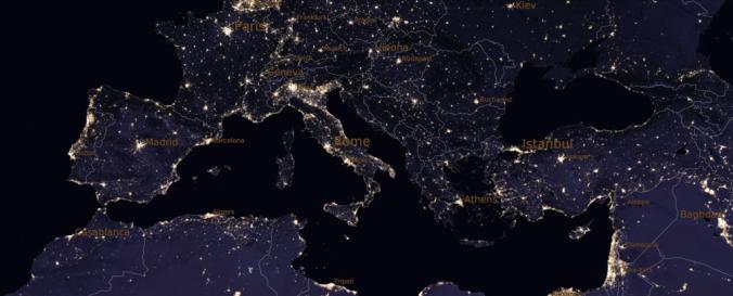
| Data provided by: | National Aeronautics and Space Administration (NASA) |
| Data accessibility: | export data, visualization of data (e.g. web GIS or real time monitoring) |
| Link to the data: | |
| Requirements: | Registration necessary (NASA Earthdata Login) |
| File type: | hdf |
| Data type: | satellite data or aerial image |
| Hazard: | Severe Storm, Earthquake, Flood, Forest Fire, Climatological |
| Disaster cycle phase: | Disaster Risk Management |
| Spatial coverage: | Global |
| Spatial resolution: | 500 m (15 arc-second) |
| Temporal coverage: | Archive, Near-real time |
| Content dates: | 2012-present |
| Technical Specifications: | |
| Costs: | free |
| Contact: | Contact LAADS DAAC |
| Tutorials on the use of data: | Black Marble Learning Resources |
Provider
![]()