![]()
United
Nations
Ocean Color (NASA)
| Data provided by: | National Aeronautics and Space Administration (NASA) |
| Data accessibility: | export data, visualization of data (e.g. web GIS or real time monitoring) |
| Link to the data: | |
| Data type: | hazard specific data |
| Hazard: | Harmful Algal Bloom |
| Disaster cycle phase: | Disaster Risk Management, Response, Recovery |
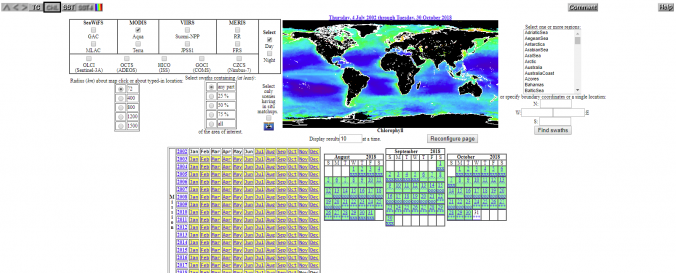
| Space-based Information: | NASA’s Ocean Biology Processing Group (OBPG) provides True Color, Chlorophyll and Sea Surface Temperature for download. |
| Satellites and Sensors: | OrbView-2 (SeaWiFS), Aqua, Terra, Suomi NPP, Sentinel-3A, Nimbus-7 (SMMR) |
| Spatial coverage: | Global |
| Spatial resolution: | Varies by satellite |
| Temporal coverage: | Archive, Near-real time |
| Content dates: | 2002- Present |
| Costs: | free |
| Contact: | Forum |
| Tutorials on the use of data: | Help |
Provider
![]()