![]()
United
Nations
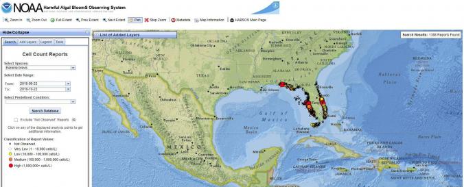
Harmful Algal BloomS Observing System (HABSOS - NOAA)
| Data provided by: | National Oceanic and Atmospheric Administration (NOAA) |
| Data accessibility: | visualization of data (e.g. web GIS or real time monitoring) |
| Link to the data: | |
| Requirements: | Internet Explorer 7+, Mozilla Firefox 3+ or higher, Chrome 10+ or higher or Safari 4+ or higher. JavaScript and pop-ups must be enabled. |
| File type: | webmap |
| Data type: | hazard specific data |
| Hazard: | Harmful Algal Bloom |
| Disaster cycle phase: | Disaster Risk Management, Response, Recovery |
| Space-based Information: | HABSOS combines in-situ measurements, with oceanographic and meteorological data. When clicking on metadata in the website the 15+ integrated data sources can be viewed. |
| Satellites and Sensors: | GOES- 8-15 (IMAGER), GOES-16 |
| Temporal coverage: | Archive, Forecasted, Near-real time |
| Content dates: | 19 Aug 1953 (in Archives) to Present |
| Costs: | free |
| Contact: | Information |
Provider
![]()