![]()
United
Nations
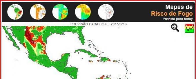
Fire Hotspots and Risk Maps (RedLaTIF)
| Data provided by: | RedLaTIF |
| Data accessibility: | visualization of data (e.g. web GIS or real time monitoring) |
| Link to the data: | |
| Data type: | hazard specific data |
| Hazard: | Forest Fire |
| Disaster cycle phase: | Disaster Risk Management |
| Satellites and Sensors: | Terra, NOAA-15, NOAA-18, GOES- 8-15 (IMAGER) |
| Spatial coverage: | Latin America and the Caribbean |
| Temporal coverage: | Near-real time |
| Content dates: | Near-Real Time - 4 week forecast |
| Costs: | free |
| Restrictions/ Citation of the dataset: | Use the data freely, but quoting its source as: INPE - National Institute For Space Research, 2012. Portal for the monitoring of vegetation fires. Available at http://www.inpe.br/queimadas. |
Provider
![]()