![]()
United
Nations
Volcanic Eruption
 on the Landsat 8 satellite acquired this top image of Mount Etna on December 28, 2018. The image highlights the active vent and thermal infrared signature from lava flows, which can be seen near the newly formed fissure on the southeastern side of the volcano. The image was created with data from OLI (bands 4-3-2) and the Thermal Infrared Sensor (TIRS) on Landsat 8. Image: NASA.")
Definition
Facts and figures
Further information
UN-SPIDER Regional Support Offices with hazard-specific expertise
Related content on the Knowledge Portal
Like many countries in Latin America, Peru is exposed to a variety of natural hazards that have triggered disasters in previous decades. Disaster preparedness, response and recovery efforts are coordinated by the National Civil Defense Institute (INDECI). In recent years, INDECI has benefited from the advisory support provided by Peru’s National Commission for Aerospace Research and Development (CONIDA). Taking advantage of this advisory support, INDECI developed and launched at the end of 2018 its Agenda for Applied Research for the period between 2018 and 2021, addressing the preparedness,…
read moreRegional Support Offices mentioned:03/05/2021 The Copernicus Open Access Hub provides complete, free and open access to Sentinel missions data.Publishing institution:
The European Space Agency is organising the 10th International Workshop on Science and Applications of SAR Polarimetry and Polarimetric Interferometry, POLINSAR 2021.
Date(s)
The workshop will take place online from 26 to 30 April 2021.
Objectives
- Provide a forum for scientific exchange
- Present the latest exploitation results from full-pol airborne and spaceborne systems and assess the state-of-the-art
- Review retrieved bio-geophysical parameters and their accuracy
- Make recommendations for algorithm development and new products
- Support the preparation for ESA and Third Parties full-pol missions exploitation (BIOMASS, NOVASAR-S, RCM, SAOCOM, TerraSAR-L etc.)
- Present innovative polarimetric applications and ideas for future polarimetric mission concepts Report on the status of POLinSAR 2019 recommendations
Sessions…
read more

Volcanic eruptions, as one of Earth’s most dramatic and violent agents of change, can drastically alter land and water for kilometres around a volcano. 99 % of the gas molecules emitted in a volcanic eruption are water vapor (H2O), carbon dioxide (CO2), and sulfur dioxide (SO2). The remaining 1 % comprises small amounts of hydrogen sulfide, carbon monoxide, hydrogen chloride, hydrogen fluoride, and other minor gas species (USGS).
This webinar will focus on the exploitation of Sentinel-5P data to map the SO2 concentrations originated on the occasion of a volcanic eruption in the Volcan de Fuego, Guatemala.
To implement this analysis, participants will be using Python code run in a Jupyter…
read more
Monitoring deformation in active volcanic areas has always been of great interest, but remote sensing data has significantly increased the capability of acquiring more measurements at larger spatial scale and at relatively low cost.
Stromboli, one of the three active volcanoes in Italy, is around 3 km high with at least 2 km to be below the sea level and showing an eruptive persistent activity since almost 200,000 years. As a stratovolcano, the relatively high pressure of the gases ejects basaltic lava and its products from a few tens to hundreds of meters into the air. Many significant explosions and lava flows have been recorded in the last 50 years, the most recent events occurring on November 10 and 16, 2020. From the last one, a dense ash cloud was produced around 1 km high above the volcano’s summit and the pyroclastic current reached rapidly the coastline, expanding on the sea surface for about 200 m.
In this…
read more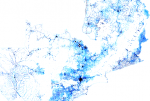 Facebook Connectivity Lab in collaboration with the Center for International Earth Science Information Network (CIESIN) at Colombia University combines machine vision AI with satellite imagery and census information to create population density maps. With the integration of demographic information, specifically related to age and gender, these maps collectively provide information on both the location and the demographic of a population in a certain country. The population density maps cover the majority of countries around the world.Publishing institution:
-
Facebook Connectivity Lab in collaboration with the Center for International Earth Science Information Network (CIESIN) at Colombia University combines machine vision AI with satellite imagery and census information to create population density maps. With the integration of demographic information, specifically related to age and gender, these maps collectively provide information on both the location and the demographic of a population in a certain country. The population density maps cover the majority of countries around the world.Publishing institution:

The European Space Agency is organising the 11th International Workshop on “Advances in the Science and Applications of SAR Interferometry and Sentinel-1 InSAR”, Fringe 2021.
Format
Fringe 2021 is organised around:
- Papers and e-posters selected by the Scientific Committee;
- Invited papers on ESA-funded studies and Sentinel-1 and future ESA SAR mission status reports;
- Round-table discussions with seed questions prepared by the session chairpersons and ESA.
The event will take place from 31 May - June 4 2021. No participation fees will be charged.
Objectives
- To bring together the global InSAR research and development communities and facilitate international exchange between researchers and research groups;
- To present the Sentinel-1 mission status, algorithms and products;
- To review and assess the progress according to the…

In recent years, the frequency and severity of natural hazards has increased dramatically. This development has escalated the risk of disasters and their devastating impact on the environment and communities around the world. Earth observation (EO) data has the potential to mitigate the risks of disasters and support all phases of the disaster management cycle. The international community has created various mechanisms to facilitate the use of EO data for disaster management, such as the International Charter Space and Major Disasters. The Algerian Space Agency (ASAL) has provided EO data to the International Charter for almost two decades.
The International Charter refers to a consortium of space agencies, national and regional disaster monitoring organizations that utilize EO data for…
read more13/04/2021
UN-SPIDER Regional Support Offices with hazard-specific expertise
![]()