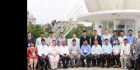
As part of the Institutional Strengthening Mission, a training on ‘Regional Training on Multi-level Flood Risk Mapping’ was jointly organized by International Centre for Integrated Mountain Development (ICIMOD) and UN Platform for Space-based information for Disaster Management and Emergency Response (UN-SPIDER) of the UN Office for Outer Space Affairs. Part of the support for this training course came from “SERVIR-Himalaya”, funded by United States Agency for International Development (USAID) through the National Aeronautics and Space Administration (NASA).
The experts providing the training course included specialists from UN-SPIDER, from ICIMOD, from National Disaster Reduction Centre of China NDRCC (China), and from the National Remote Sensing Centre NRDC (India). 20 participants from disaster management agencies and stakeholder departments of ICIMOD Member States participated in the training programme. All but one ICIMOD Member state attended the programme: Bhutan, Bangladesh, China, India, Myanmar, Nepal, and Pakistan.
The purpose of the training programme was to improve disaster risk management using space based and geospatial information by imparting hands-on training to the officials of member countries supported by ICIMOD and UN-SPIDER. The training covered climate change, disaster risk reduction and space technology, developing hazard and indicators at national and sub-national level, flood inundation modelling using HEC-RAS methods, flood inundation mapping and monitoring using satellite images and landslide hazard mapping using satellite remote sensing. More than 50% time was devoted to the hands-on sessions on flood inundation model (held by an expert of ICIMOD), on flood mapping and monitoring (held by an expert of NDRCC) and on landslide hazard mapping (held by an expert of the National Remote Sensing Centre of India). UN-SPIDER delivered lectures on climate change, disaster risk reduction and space technology and on the role of space technology in the Hyogo Framework of Action (HFA) and HFA2.