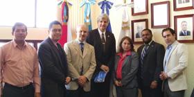
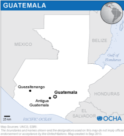
The mission was carried out by an expert from UN-SPIDER who was accompanied by experts from the National Commission for Space Activities of Argentina (CONAE), the Mexican campus of the Regional Centre for Space Science and Technology Education for Latin America and the Caribbean (CRECTEALC), the Panama-based Water Center for the Humid Tropics of Latin America and the Caribbean (CATHALAC) and the Sustainable Unit of the Organization of American States (OAS).
The mission included visits to 11 Government agencies and representatives of United Nations agencies in Guatemala. The mission also included an inter-institutional workshop organized by SEGEPLAN which was attended by representatives of a variety of institutions, including universities and the private sector.
Disaster-risk management is a topic that has been receiving more and more attention in recent years, particularly because of the impacts of events such as tropical storms, droughts and volcanic eruptions. The topic appears in the legislation that was enacted in 1996, and appears also in the National Policy on Social Development established by SEGEPLAN. Furthermore, as a consequence of the large impacts triggered by tropical storm Agatha in June 2010, the government implemented the Programme of Reconstruction with Transformation as a way to avoid the re-creation of risks in public and private infrastructure.
The World Bank is supporting Guatemala through the project entitled Central American Probabilistic Risk Assessment (CAPRA). CAPRA aims to develop a series of software packages to be used to assess probabilistic risks associated with various types of hazards.
The National Geographic Institute (IGN) and SEGEPLAN have been promoting the establishment of a national spatial database infrastructure, and SEGEPLAN recently implemented its National Territorial Information System (SINIT) as a way to promote the use of geo-spatial information in efforts such as territorial ordainment.
Several government ministries and agencies as well as universities have remote sensing capacities, but those ministries and agencies focusing on the environment and agriculture have more strength. The Geographic Planning and Risk Management Unit of the Ministry of Agriculture (UPGGR-MAGA) has been contributing by far more than any other government agency towards the generation of geospatial information concerning risks and disasters.
CONRED operates both a strong Geographic Information Systems (GIS) unit as well as an internal information system that is used to coordinate disaster response within the Emergency Operations Centre (EOC).
The Economic Commission for Latin America and the Caribbean (ECLAC) has been conducting Damage and Loss Assessments (DALAs) in Guatemala as a way to contribute to the estimation of impacts of disasters.
While CONRED and UPGGR-MAGA are aware of the International Charter: Space and Major Disasters the products provided by the Charter seemed to target geographical regions that were not considered as a high priority during the recent activation in connection with both the volcanic eruption and tropical storm Agatha.
As a way to contribute to the generation of information during tropical storm Agatha, several government agencies and universities joined forces to establish an ad-hoc group that processed satellite imagery provided by China and Germany through UN-SPIDER and by Taiwan (PoC).
Taking note of the institutional mandates and arrangements, as well as of the ad-hoc group that was established to process satellite imagery to generate relevant information, SEGEPLAN and IGN should institutionalize such a group through a Memorandum of Understanding or a similar approach and strengthen the skills of the group. UN-SPIDER should also contribute to the strengthening of skills of the group.
The mission recommended to CONRED the institutionalization of a unit targeting remote sensing applications as a way to strengthen its GIS unit.
IGN and SEGEPLAN should elaborate an inventory of satellite imagery which have been acquired by different government agencies in recent years or which have been donated by agencies for development.
CONRED should homogenize a variety of hazard and risk maps that have been developed by a variety of national and international agencies in recent years.
SEGEPLAN and IGN should promote a national policy regarding the exchange of data and information among government agencies and establish the National Geospatial Infrastructure Database of Guatemala.
CONRED, SEGEPLAN and IGN should design strategies to enhance the skills of staff in government agencies on the generation and use of space-based information with particular emphasis on disaster-risk management and emergency response.


