English
Español
Français
United
Nations
Office for Outer Space Affairs
UN-SPIDER Knowledge Portal
Search
Home
About Us
What is UN-SPIDER?
About UNOOSA
Publications
Jobs
Meet the Team
Contact
Space Application
Satellite Technology
Emergency Mechanisms
Recovery Mechanisms
International Asteroid Warning Network
Space Mission Planning Advisory Group
International Space Weather Initiative
Space Technologies in the UN
User Stories
Links & Resources
Data Applications
Disaster Recovery
Data Sources
GIS and Remote Sensing Software
Online Learning Resources
Institutions
Risks & Disasters
Disaster Risk Management
Early Warning Systems
Emergency and Disaster Management
Natural Hazards
Sendai Framework
The UN and Disaster Risk Management
The UN and Early Warning
The UN and Disaster Management
Advisory Support
Advisory Missions
Emergency Support
Virtual Advisory Support
Recommended Practices
Training Activities
Practical Uses
Network
Regional Support Offices
GP-STAR
MHEWS
IWG-SEM
Projects
SPEAR
SEWS-D
EvIDENz
Flood GUIDE
CommonSpace Initiative
Tonga Pilot Project
News & Events
News
Events Calendar
UN-SPIDER Events Archive
AI for Good
UN-SPIDER Highlights GeoAI Innovations at AI for Good Global Summit 2025
Mapping Disaster Resilience
New Global Compendium on GeoAI Best Practices from the UN-SPIDER Network
Digital Twins and Earth Observation: UN-SPIDER and ZFL Present Flood Mapping Innovations at LPS 2025
New Recommended Practice: Flood Mapping with Radar Imagery and Digital Terrain Models
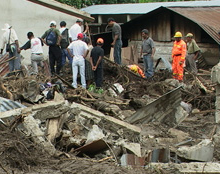
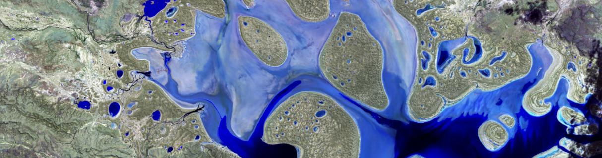
The Recommended Practice was applied during the October 2024 floods in Sri Lanka, demonstrating its value in real-world disaster response.
Wuhan University Joins UN-SPIDER Network to Advance Space-Based Disaster Management
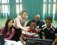
UN-SPIDER Expands Global Network with New Regional Support Office in China
Explore the Knowledge Portal
How can space technology be applied in disaster and risk management?
Where can I access satellite data, products and other resources?
Who are the users of space technology in disaster and risk management?
Which services can UN-SPIDER offer to Member States?
Stay Up to Date
News
29 Feb 2012
MWC: Award for earthquake response
29 Feb 2012
Galileo On The Ground Reaches Some Of Earth’s Loneliest Places
29 Feb 2012
GMES: e-GEOS wins contracts from the European Commission to provide satellite data and maps for emergency management
29 Feb 2012
GIS and Social Media Team to Combat Disasters
29 Feb 2012
A new generation of meteorological satellites
24 Feb 2012
Satellite systems company paves way for defence developments
24 Feb 2012
DOCOMO Eyes Completion of New Disaster-preparedness Measures
24 Feb 2012
Esri and GeoEye Developing Global Crisis Response Service
24 Feb 2012
ISRO sets ball rolling for Indian ‘GPS' / navigation system
24 Feb 2012
Princeton system tracks drought to aid disaster relief
Pagination
First page
« First
Previous page
‹‹
…
Page
237
Page
238
Page
239
Page
240
Current page
241
Page
242
Page
243
Page
244
Page
245
…
Next page
››
Last page
Last »
Upcoming Events
Connect to the Community
Our Regional Support Offices