  • English
  • Español
  • Français

United
Nations


Office for Outer Space Affairs
UN-SPIDER Knowledge Portal

  • Home
  • About Us
    • What is UN-SPIDER?
    • About UNOOSA
    • Publications
    • Jobs
    • Meet the Team
    • Contact
  • Space Application
    • Satellite Technology
    • Emergency Mechanisms
    • Recovery Mechanisms
    • International Asteroid Warning Network
    • Space Mission Planning Advisory Group
    • International Space Weather Initiative
    • Space Technologies in the UN
    • User Stories
  • Links & Resources
    • Data Applications
      • Disaster Recovery
    • Data Sources
    • GIS and Remote Sensing Software
    • Online Learning Resources
    • Institutions
  • Risks & Disasters
    • Disaster Risk Management
    • Early Warning Systems
    • Emergency and Disaster Management
    • Natural Hazards
    • Sendai Framework
    • The UN and Disaster Risk Management
    • The UN and Early Warning
    • The UN and Disaster Management
  • Advisory Support
    • Advisory Missions
    • Emergency Support
    • Virtual Advisory Support
    • Recommended Practices
    • Training Activities
    • Practical Uses
  • Network
    • Regional Support Offices
    • GP-STAR
    • MHEWS
    • IWG-SEM
  • Projects
    • SPEAR
    • SEWS-D
    • EvIDENz
    • Flood GUIDE
  • News & Events
    • News
    • Events Calendar
    • UN-SPIDER Events Archive

Breadcrumb

  • Home
  • News and Events
  • View Active News
  • Thailand: Satellite Data Centre For Disaster Management
  • Thailand: Satellite Data Centre for disaster management

Thailand: Satellite Data Centre for disaster management

The Geo-Informatics and Space Technology Development Agency (GISTDA) and the Ministry of Science and Technology (MOST) has teamed up to establish a Geo-Informatics Operation System and Satellite Data Centre as a response to the problems posed by Thailand’s worst flooding in decades.

The data centre will make use of modern Geo-Informatics technology in order for concerned government authorities to make well-informed decisions during times of natural calamities.

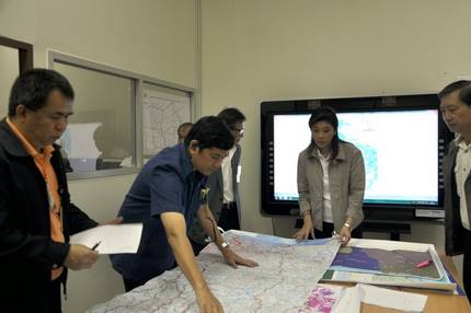
The MOST, Hydro and Agro Informatics Institute, Royal Irrigation Department, Department of Disaster Prevention and Mitigation, are among the many agencies that are actively making use of satellite image maps from GISTDA as a significant tool for monitoring the effects of the recent disaster.

The data centre will make use of high resolution satellite imageries such as RADARSAT, which has the capability to penetrate cloud and haze, and optical satellite data such as THEOS, IKONOS, Quickbird, WorldView, and Geoeye, which will be used to evaluate the damaged agricultural and household areas.

Meanwhile, in order to facilitate relief operations, GISTDA has published online its satellite image maps to disseminate real-time information to the public.

futureGOV Asia Pacific
Thu, 20 Oct 2011 - 17:20
Thailand

Footer menu

  • Contact
  • Terms of Use

User account menu

  • Log in