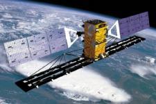
Space technologies play an important role in many areas of activity within the United Nations, both in relation to disaster risk management and emergency response. Various agencies are involved in disaster risk reduction and emergency response efforts, and can therefore greatly benefit from space-based information.
As it is especially challenging for developing countries to access and use space-based information, the United Nations supports these Member States through satellite-derived information products, such as maps, and through capacity building and institutional strengthening.
Many organizations within the UN have utilized space-based technologies to bring relevant disaster information to developing Member States. Nations can better implement mitigation strategies if they have an aerial view of where disasters may occur. There are also a myriad of models, tools, and softwares for spatial analysis of different disasters.
Browse the examples below to learn more about some UN agencies and how environmental monitoring via space technology is applied to disaster management strategies
- ESCAP: Building Disaster Resilience in Asia and the Pacific with Space Applications
- ECA: Promoting Geospatial Data for Disaster Prevention, Preparedness and Monitoring in Africa
- FAO: Watching Agricultural Drought Worldwide - from Space
- UNESCO-IOC: Sharing Sea Level Data for Tsunami Warnings via Satellites
- WFP: Platform for Real-Time Impact and Situation Monitoring (PRISM)

