United States of America

country taxonomy block

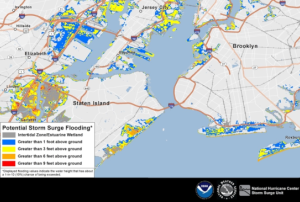
The National Oceanic and Atmospheric Administration (NOAA) has recently upgraded its Probabilistic Storm Surge (P-Surge) model ahead of 2023 Hurricane Season beginning on June 1. The P-Surge is the primary model for predicting storm surge associated with high-impact weather, such as hurricanes and tropical storms. The version 3.0 advances storm surge modeling and forecasting for the continental United States, Puerto Rico, and the Virgin Islands.

The upgrade features several capabilities that will help forecasters understand the risk of storm surge, such as new forecasts for surge, tide and waves for Puerto Rico and the U.S. Virgin Islands. Forecasters can also now run the model simultaneously for two storms, capability that can help during two landfalling storms impacting the CONUS, or one storm impacting the U.S. and one impacting Puerto Rico and/or the U.S. Virgin Islands. Furthermore,…

more
Publishing date 17/05/2023

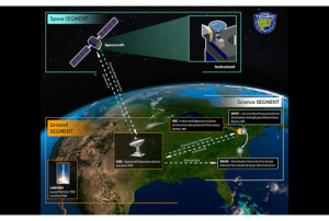
On April 7, 2023, the National Aeronautics and Space Administration (NASA) launched "the Tropospheric Emissions: Monitoring of Pollution" (TEMPO) instrument, from Cape Canaveral Space Force Station, atop a SpaceX Falcon 9 rocket. This high-resolution air quality control instrument will provide unprecedented resolution -down to 10.36 square kilometers- for monitoring major air pollutants, including ozone, nitrogen oxide, sulfur dioxide and formaldehyde, over the continental United States, Canada, Mexico, Cuba, the Bahamas, and part of Hispaniola island.

The data provided by TEMPO will be crucial in the scientific analysis of pollution, including the movement of pollution from volcanoes and forest fires, the impact of fertilisers, the effects of lighting on ozone, and studies of rush hour pollution and the potential for improved air quality alerts,…

more
Publishing date 12/04/2023

As the arrival of spring increases the risk of severe weather, NOAA's geostationary and polar-orbiting satellites, such as GOES East, GOES West, Suomi NPP, and NOAA-20, are closely monitoring the changing weather patterns.

GOES-16 and GOES-18 satellites provide real-time information about cloud properties, such as overshooting tops, gravity waves, and above-anvil cirrus plumes, as well as the temperature of cloud tops. This data helps forecasters track weather conditions, identify the severity of a storm, determine wind speeds, and predict the movement of the storm. In addition, these satellites use the Geostationary Lightning Mapper (GLM) instrument to monitor lightning activity, detecting total lightning activity and providing information about the extent and distance of lightning flashes. Scientists are also using AI to train the ProbSevere LightningCast model, which can predict lightning up to an hour before the first observation of lightning flashes, helping…

more
Publishing date 17/03/2023

This article is republished from The Conversation under a Creative Commons license. Read the original article.

Authors: Zhe Zhu, University of Connecticut and Su Ye, University of Connecticut

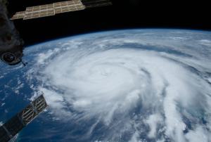
Hurricane Ian left an extraordinarily broad path of destruction across much of South Florida. That was evident in reports from the ground, but it also shows up in satellite data. Using…

more
Publishing date 10/10/2022

In 2021, disasters triggered by different types of hazards impacted developed and developing countries around the world. Different regions of the United States were impacted by tornados, hurricanes, heatwaves, oils spills, and forest fires.  Germany, Belgium, and Luxemburg saw unprecedented floods and other countries like India, Sudan, Togo, Sri Lanka, Somalia, Bolivia, and China also experienced floods. Severe forest fires impacted Greece, Algeria, Turkey, Paraguay, the Russian Federation; while volcanic eruptions impacted Saint Vincent and the Grenadines, Guatemala, the Philippines, and Indonesia. The International Charter Space and Major Disasters was activated 48 times during this year to contribute to disaster response efforts due to these and other disasters. 

The NASA Disasters Programme bridges the gap between the Earth observation scientists and institutions engaged in disaster risk reduction, preparedness, response, and recovery efforts.  The…

more
Publishing date 16/01/2022

The Disasters programme unit at the National Aeronautics and Space Administration (NASA) recently joined a newly launched online platform aimed at placing anticipatory action on the humanitarian agenda. NASA’s involvement in the Anticipation Hub and the subsequent incorporation of Earth observation (EO) tools, serves to improve the capabilities of anticipatory action globally and demonstrates the potential of utilizing satellite-driven data for anticipatory action in disaster management.

Anticipatory action in the humanitarian context describes disaster mitigation activities based on in-depth forecast information and risk analysis. This approach has gained traction amongst the humanitarian community in recent years as it is viewed as a more efficient and affordable alternative to…

more
Publishing date 02/02/2021

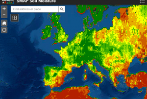
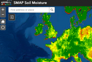
Officially launched in 2015 by the National Aeronautics and Space Administration (NASA), the SMAP mission is an orbiting satellite that measures the amount of wetness in the top layer of soil incrementally every 2-3 days. These Soil Moisture Active Passive (SMAP) measurements rely on radiation frequencies that point to different levels of moisture on the surface of  earth’s soil and are useful for scientists because it allows them to construct maps indicating the level of soil moisture globally. Acknowledging the relevance and usability of this data for the field of disaster management, NASA recently integrated the SMAP data into its Disasters Mapping Portal

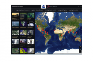
The Disasters Mapping Portal has been developed by the Geographic Informations Systems (GIS) Team at NASA in an effort to make their satellite data…

more
Publishing date 25/11/2020

Officially launched in 2015 by the National Aeronautics and Space Administration (NASA), the SMAP mission is an orbiting satellite that measures the amount of wetness in the top layer of soil incrementally every 2-3 days. These Soil Moisture Active Passive (SMAP) measurements rely on radiation frequencies that point to different levels of moisture on the surface of  earth’s soil and are useful for scientists because it allows them to construct maps indicating the level of soil moisture globally. Acknowledging the relevance and usability of this data for the field of disaster management, NASA recently integrated the SMAP data into its Disasters Mapping Portal

The Disasters Mapping Portal has been developed by the Geographic Informations Systems (GIS) Team at NASA in an effort to make their satellite…

more
Publishing date 25/11/2020

The National Aeronautics and Space Administration (NASA), the European Space Agency (ESA) and the Republic of Korea are working together on a global satellite constellation of three space-based instruments that could track global pollution on an hourly basis. These air quality satellites will measure pollutants, including ozone, nitrogen dioxide, formaldehyde and tiny atmospheric particles called aerosols in order to enhance our understanding of air quality and air pollution. To date, air quality satellites have collected data only once a day. These three new instruments will provide hourly, highly detailed and near-real-time data that will improve air quality science and forecasting around the world, in particular around the most densely populated areas of the Northern Hemisphere. 

Collecting data hourly will…

more
Publishing date 30/03/2020

A recent study, published in the Water Resource Research journal, presents a new method for a spatially realistic national flood risk assessment.

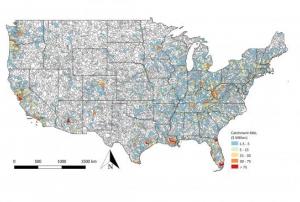
Researchers expanded an existing statistical model, based on U.S. Geological Survey (USGS) river flow data, to simulate a thousand years of potential flood events. By calculating the damage for each event in dollars, they were able to estimate the probability of the United States suffering particular annual flood damages.

Traditional risk flood analysis models assume that the impacts on the entire flood-affected area are the same, but flooding can be more severe in some areas than in others, even during the same flood event. At national scales, traditional risk analyses can only estimate the average annual loss. To estimate the total annual losses that might occur in more extreme flooding…

more
Publishing date 04/07/2019

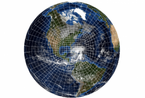
In June 2019, NOAA upgraded its flagship weather model, the Global Forecast System (GFS), with a new dynamic core, called Finite-Volume Cubed-Sphere Dynamical Core (FV3). This upgrade of the GFS will enhance global numerical weather forecasting and better forecast precipitation, heavy rainfall and weather types at both regional and global level. Besides, the FV3-based GFS revealed improvements in predicting the track and intensity of tropical cyclones compared to the older GFS.

Combining the superior dynamics of global climate modeling with the everyday reliability and speed of operational numerical weather forecasting, the latest weather model upgrade makes the new dynamical core to the engine of the GFS. The new dynamic core is an important model component that calculates wind and air pressure in order to obtain a successful numerical weather forecast. This upgrade to the dynamic core of the model is the first major upgrade in almost 40 years. 

more
Publishing date 27/06/2019

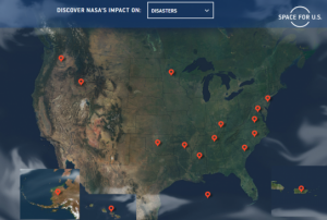
The National Aeronautics and Space Administration (NASA) has recently released a new website, SpaceforUS, which intends to highlight how NASA has used its Earth observation data to better the living conditions of people in all 50 states of the United States of America.

SpaceforUS includes contains a total of 56 stories that illustrate NASA’s science and the impact it has had across the country. The aim is to showcase the power of Earth observation through state-by-state project examples, such as the use of satellite technologies that helped to create high-quality images to identify power averages and guide first responders for life-saving aid during Hurricane Rita.

Through this new and interactive website, NASA highlights the innumerable ways in which its Earth observations has helped administrators make informed decisions in the areas of public health, disaster…

more
Publishing date 08/05/2019

Earthquakes are a major concern in increasingly populated regions, however their prediction is a difficult task. Researchers have recently made progress in the use of complex simulation and modeling techniques to better forecast the occurrences of earthquakes.

In a recent study, researchers used Gradient Boosted Regression Trees, a machine learning technique for regression and classification problems that incorporates training data, to better determine spatiotemporally complex loading histories within subduction zones. The researchers simulated tens of earthquakes using a small‐scale experimental replica of a subduction zone and show that machine learning predicts well the timing and size of laboratory earthquakes by reconstructing and properly interpreting the spatiotemporally complex loading history of the system. These results promise substantial progress in real earthquake forecasting as they suggest that the complex motion recorded by geodesists at…

more
Publishing date 13/03/2019

The  Global Facility for Disaster Reduction and Recovery (GFDRR), a grant-funding mechanism managed by the World Bank, has released a new report that analyzes how machine learning (ML) can be applied in disaster risk management (DRM) projects. The publication provides a concise, demystifying reference that readers - from project managers to data scientists - can easily use. It includes key definitions, case studies and practical considerations for the use of machine learning in disaster risk management.

Machine Learning at a glance

A machine learning (ML) algorithm is a type of computer program that learns to perform specific tasks based on various data inputs or rules provided by its designer. In the context of DRM, machine learning applies predominantly to methods used in the classification or categorization of remotely sensed satellite, aerial, drone and even street-level imagery by capitalizing on a large body of work on image recognition and…

more
Publishing date 26/02/2019

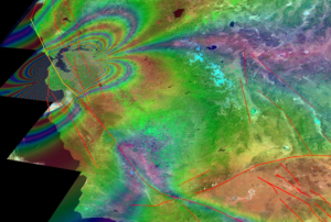
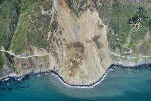
While several studies have already highlighted how global warming and its consequences are predicted to increase the frequency and magnitude of geohazards such as landslides, the relation between ongoing climate shifts and landslide behaviour is still difficult to assess, especially due to uncertainties in both models. In a new research paper, researchers at NASA's Jet Propulsion Laboratory and collaborating institutions have now documented the transition of a stable, slow-moving landslide into catastrophic collapse for the first time.

Their  observations lasted eight years and took place on the California Coast Ranges, which, due to their morphological structure, are an ideal natural laboratory to investigate how stress and fluid pressure changes govern the stable and unstable sliding of landslides. In recent years, more than 650 slow-moving landslides have been identified and mapped in the area. Yet, on May 20, 2017, the Mud Creek landslide…

more
Publishing date 20/02/2019

The United States Geospatial Intelligence Foundation (USGIF) has recently released a new report on “Building Resilient Communities Through Geospatial Intelligence”. The report highlights the importance of raising awareness about the value of space-based information for early warning systems and risk and disaster management. Moreover, it suggests the need for a better definition of GEOINT within the framework of resilience.

The United Nations Platform for Spaced-Based Information for Disaster Management and Emergency Response (UN-SPIDER) contributed a chapter to the study on the role of Geospatial Intelligence (GEOINT) in all phases of risk and disaster management and its value to developing resilient communities.

GEOINT is defined as “the exploitation and analysis of imagery and geospatial information to describe, assess, and visually depict physical features and geographically referenced activities on the Earth.”

Through the perspective of ten experts in the…

more
Publishing date 31/10/2018

Delta State University became the 23rd member of the network of UN-SPIDER Regional Support Offices (RSO) on 1 October. As an RSO, Delta State University will communicate and coordinate with UN-SPIDER on a regular basis, engage in outreach and capacity-building efforts, and contribute to the programme’s technical advisory support activities.

Through its Geospatial Information Technologies Centre (GIT), Delta State University provides in-depth education about the theory, ethics, and practice of GIT that encompasses the use of geographic information systems, remote sensing, global positioning systems (GPS), spatial analysis techniques, and similar approaches to understand problems from a geographic perspective.

Mr. Talbot Brooks, Director of the Geospatial Information Technologies Centre (…

more
Publishing date 23/10/2018

The Argentina National Space Activities Commission (CONAE) launched a new Earth observation satellite that will support disaster management efforts. SAOCOM 1A is the first of a constellation of two radar satellites. The remote sensing mission aims to provide timely information for disaster management as well as monitoring services for agriculture, mining and ocean applications.

The SAOCOM 1A uses L-band Synthetic Aperture Radar (SAR). The mission, which also plans to launch the SAOCOM 1B in 2019, was designed to work within the Italian-Argentinian satellite system for Emergency response (SIASGE), where the two space agencies work together. Argentina’s  SAOCOM and Italy’s COSMO-SkyMed constellations complement each other. The later uses X-band and is designed to collect fine details. Other particularities linked to the SEACOM 1A are related to the heating system since the use of L-band implies that the structure needs to distribute the heat across the antenna.

“You…

more
Publishing date 09/10/2018
Regional Support Offices mentioned:

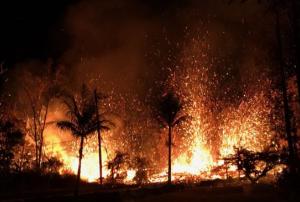
The International Charter Space and Major Disasters has been activated for an earthquake and eruption of the Kilauea Volcano in Hawaii, USA on Monday.

The volcano erupted on 4 May alongside a 6.9 magnitude earthquake, spraying lava up to 70 metres and causing the evacuation of 2000 individuals, in addition to the destruction of several buildings. Dangerous levels of toxic sulfur dioxide from the lava flows also present a hazard. Residents are urged not to return to hazardous areas until the risk has subsided.

This activation was requested by the US Geological Survey on behalf of USGS Hawaii Volcano Observatory/Cascades Volcano Observatory. This project was also managed by the USGS.

 
more
Publishing date 11/05/2018

An advanced weather satellite to track storm systems, lightning, wildfires, coastal fog and other hazards was launched by NASA from the United States of America on 1 March.

The new Geostationary Operational Environmental Satellite-S (GOES-S) represents the second in a series of next generation of weather satellites which will be operated by the National Oceanic and Atmospheric Administration (NOAA). The satellites collect three times more data at four times better resolution, and scan the Earth five times faster than previous geostationary satellites. GOES-S will thus provide forecasters with faster, more accurate and more detailed data, in near real-time on severe weather and other environmental phenomena. Once GOES-S is positioned in…

more
Publishing date 05/03/2018

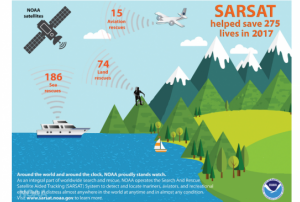
275 people were rescued within the United States of America and its surrounding waters in 2017 with the help of satellites operated by the US National Oceanic and Atmospheric Administration (NOAA).

Of the 275 rescues, 186 were in water, 15 were from aviation incidents and 74 were on land using personal locator beacons (PLBs).

The COSPAS-SARSAT system

NOAA satellites are part of COSPAS-SARSAT (Search and Rescue Satellite Aided Tracking) – an international satellite system for search and rescue. The system which uses a network of international spacecraft to detect and locate distress signals quickly from emergency beacons aboard aircraft, boats and from handheld PLBs. The COSPAS-SARSAT programme provides accurate, timely, and reliable distress alert and location data to help Search and Rescue (SAR) authorities to assist persons in distress. The objective of the programme system is to reduce, as far as possible, delays in the provision of distress alerts to SAR…

more
Publishing date 21/02/2018

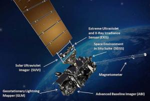
The Geostationary Operational Environmental Satellite-R (GOES-R), recently launched by NASA, is the first in a sequence of highly advanced geostationary weather satellite to serve the National Oceanic and Atmospheric Administration (NOAA). The main goal of this satellite is to generate precise data to be used to create and isue opportune and precise watches, forecasts, and warnings.

After the checkout and validation of its six new instruments, the new satellite will be operational in approximately a year. Among the instruments there is the first operational lightning mapper in geostationary orbit, which forecasters will use to hone in on the greatest threats: storms.

The main instrument, the advanced Baseline Imager, will provide images of Earth’s weather, oceans and environment and climate sensors on board will monitor the sun and provide vital information so forecasters will be able to provide space weather alerts and warnings. The 34 weather products provided…

more
Publishing date 22/11/2016

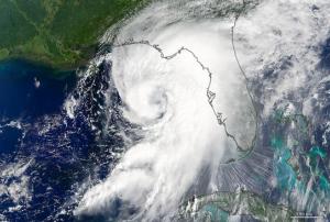
On the 1 September 2016, the Moderate Resolution Imaging Spectroradiometer (MODIS) on the Terra satellite of the National Aeronautics and Space Administration caught this image of Hurricane Hermine reaching Florida.

The storm reached Florida coasts on the 2 of September with winds up to 120 kilometers announced the National Hurricane Center. 

more
Publishing date 03/09/2016
The Moderate Resolution Imaging Spectroradiometer (MODIS) on the Terra satellite of the National Aeronautics and Space Administration (NASA) captured a space image of sediments on 17 August 2016 in Lake Pontchartrain, located in the state of Louisiana, United-States. 
 
Due to the heavy rainfall which affected Louisiana in August 2016, most of the rivers “crested at record-high levels” and some materials coming from Lake Maurepas via Pass Manchac were drained into Lake Pontchartrain. 
 
Those brown sediments are picked up during the streaming of the rivers and are made out of mud, rock and minerals.
more
Publishing date 23/08/2016

On the 16th of August 2016, the Moderate Resolution Imaging Spectroradiometer (MODIS) on the Aqua satellite of the National Aeronautics and Space Administration (NASA) detected smoke and warm surfaces affecting San Bernardino, California. 

 On the 17th, the fire had burned 30,000 acres and forced more than 82,000 people to abandon their houses. 

"In my 40 years of fighting fire, I've never seen fire behavior so extreme," Incident Commander Mike Wakoski told the Associated Press (https://weather.com/news/news/california-wildfire-emergency-bluecut-fire-clayton-fire…

more
Publishing date 19/08/2016