Japan

country taxonomy block

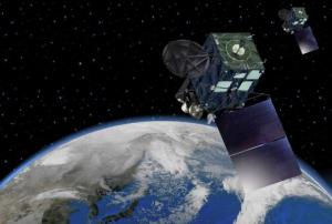
Together with Mitsubishi Electric, the Japanese Space Agency JAXA has developed an Earth Observation Satellite, Daichi-2, which, according to the developers, will be able to detect objects of the size of 80 centimeters.

With this high spatial resolution, Daichi-3 is expected to become a key tool for creating maps for disaster management activities. The ability to detect objects of certain sizes is a key property of satellite sensors. By improving the spatial resolution, the users are enabled to detect small objects such as individual cars or small buildings, and in case of disaster management, can assess damages more accurately and reliably.

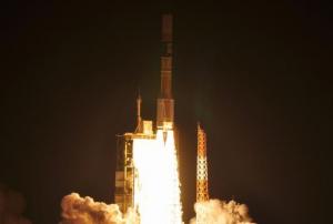
JAXA plans to launch the new satellite by March 2023, using Japan’s next-generation H3 rocket.

Publishing date 11/10/2022

The Japan Aerospace Exploration Agency (JAXA) has released the JAXA Climate Rainfall Watch website to monitor extreme weather and climate over the world. The website provides hourly global measurements of precipitation as well as forecasts about heavy rainfall and drought in different temporal scales (daily, pentad, weekly, 10-days and monthly). The satellite-based global rainfall maps produce highly accurate measurements that can help better understand the changing climate, improve forecasts of extreme weather events, such as floods and droughts, minimize their damage and strengthen early warning systems.

The Climate Rainfall Watch website monitors heavy rainfall and drought in near-real-time and collects and stores data from previous months. The website calculates rainfall in percentile: heavy rain is indicated by…

more
Publishing date 15/04/2020

Earthquakes are a major concern in increasingly populated regions, however their prediction is a difficult task. Researchers have recently made progress in the use of complex simulation and modeling techniques to better forecast the occurrences of earthquakes.

In a recent study, researchers used Gradient Boosted Regression Trees, a machine learning technique for regression and classification problems that incorporates training data, to better determine spatiotemporally complex loading histories within subduction zones. The researchers simulated tens of earthquakes using a small‐scale experimental replica of a subduction zone and show that machine learning predicts well the timing and size of laboratory earthquakes by reconstructing and properly interpreting the spatiotemporally complex loading history of the system. These results promise substantial progress in real earthquake forecasting as they suggest that the complex motion recorded by geodesists at…

more
Publishing date 13/03/2019

The Japanese government is preparing to test a disaster early warning system that uses one of its Quasi-Zenith’s satellites this year. The system aims to better predict disasters in the Asia-Pacific region.

Through the new early warning system, the Government of Japan seeks to prevent “potential impacts of natural disaster on Japanese manufacturers and supply chains”, the Asian Disaster Reduction Center (ADRC) said. Japan also intends to contribute to the disaster prevention management of other Asian countries, and prepares…

more
Publishing date 25/01/2019
Regional Support Offices mentioned:

Japan plans to launch a new disaster prediction system using data from both satellites and the ground, in an effort to enable local governments to efficiently organize evacuations in the event of a natural disaster.

As part of the new system, disaster-prone locations will be designated in advance as monitoring spots, based on relevant information including hazard maps developed by local governments. Sensors will be placed at these locations to observe the amount of rainfall and the condition of the terrain. The Quasi-Zenith Satellite System (QZSS) operated by the Japan Aerospace Exploration Agency (JAXA) will also be utilized in order to obtain regular data from space on a variety of areas including rainfall, changes in terrain and soil saturation. This data and other meteorological information will be examined using artificial intelligence software to determine the risk of disaster. The…

more
Publishing date 31/07/2018

A study conducted by engineers from Tohoku University in Japan sees promising opportunities for LiDAR applications in the context of informing responders after earthquakes. The team investigated the use of LiDAR for earthquake damage assessments following two earthquakes which hit the Island of Kyushu within in 28 hours in April 2016.

Laser support monitoring of city structures

LiDAR, which stands for light detection and ranging, uses a laser to measure the distance between the sensor carrying aircraft and the ground below. The data can then be the basement of high-resolution elevation models, representing both the elevations of city structures and those of the topography. For most cases of disaster response in the past, classic remote sensing and aerial photography played an important role. LiDAR yet outranges these approaches spatial resolution and temporal application possibilities, because it also works during the night and through clouds and dust. The accuracy of…

more
Publishing date 12/03/2018
A group of scientists from the Riken Advanced Institute for Computational Science has undertaken a new project that aims to improve weather forecasting. The project makes use of data from the Japanese Himawari-8 satellite and combines it with a supercomputer programme at the Riken science institute. The project aims to significantly improve weather predictions, particularly in the case of extreme weather, in order to improve official warnings and to ultimately help save lives. In order to predict future weather, weather prediction models run simulations that are based on current conditions coming from various data sources. Accurate predictions are rather difficult to conduct due to the inherently complex nature of weather systems and the lack of precision and timeliness of the data. As a solution to this problem, scientists have tried to run simulations that use more frequently updated and accurate data. The new Riken project uses, for the first time, infrared luminance data. This… more
Publishing date 29/01/2018

The government of Japan plans to provide drivers with disaster information straight to their cars by making use of Japan’s Quasi-Zenith Satellite System (QZSS). The proposed software aims to improve the country’s disaster preparedness such as in the case of similar events to the 2011 Great East Japan Earthquake and Tsunami. The proposed system utilizes Michibiki satellites and has an advantage over other communication infrastructure due to its higher chance of surviving damages during disasters. The government has tested the software in November 2017 in the Wakayama and Kochi prefectures and it is expected to first be officially introduced in Tokyo during the 2018 fiscal year.

Due to its vulnerable location, Japan has been severely and repeatedly affected by natural disasters over the years. For example, in 2011 the Tohoku earthquake that figured 9.1 on the Richter magnitude scale and the subsequent tsunami it triggered caused great human and material losses and extensive…

more
Publishing date 12/01/2018

The Japan Aerospace Exploration Agency (JAXA) and Mitsubishi Heavy Industries have launched the Michibiki-4 communications satellite. The new satellite is part of a terrestrial positioning network system that will allow better communication in case traditional communication networks are unavailable due to a natural disaster.

The satellite complements the Global Positioning System (GPS) and will help reduce its error range from 10 metres to between 1 metre and circa 6 centimetres. It is part of the Quasi-Zenith Satellite System (QZSS). The QZSS will be compatible with GPS satellites and can be used with them in an integrated fashion. The QZSS satellites operate in orbits designed to keep them as close as possible to being directly overhead – near to the zenith point of an observer's frame of reference – of users in Japan for as long as possible. To do so, they use highly-inclined…

more
Publishing date 11/10/2017

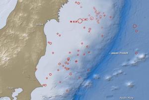
A 6.9 magnitude earthquake struck off the Japanese east coast triggering a tsunami warning. The epicenter was located 67km off the coast of Fukushima prefecture with a depth of approximately 10km. The Japan Meteorological Agency issued tsunami warnings for much of the country’s northern pacific coast.

The tsunami warning was issued because three meters high waves could be expected and the nation’s public broadcaster NHK,  recommended coast residents to evacuate to higher lands because repeated waves were estimated to hit.

The Fukushima prefecture hosts the Daiichi nuclear power plant, which caused the worst nuclear disaster after a powerful earthquake on 9 March 2011 originating a tsunami that left some 18,000 fatalities, reported Aljazeera. 

more
Publishing date 23/11/2016

The Japanese Government will support the replacement of the Karachi meteorological radar with 1.95 billion Yen (approximately 14.2 million Euros). This assistance belongs to a wider aid plan called National Multi Hazard Early Warning System Plan which was a part of the National Disaster Management Plan (NDMP) formulated through Japan’s assistance in 2012. This included the replacement of another weather radar in Islamabad and the installation of a Flood Forecasting System in conjunction with UNESCO.

The Karachi radar was established in 1991 under the grant of Japan together with other three radars that are part of the meteorological radar system of Pakistan, that currently counts on seven radars. Its mission was the monitoring of precipitations and tropical cyclones in the country’s Southern area. Nevertheless, the device has become obsolete during the last 24 years and needs to be replaced by a digital Doppler mode radar that would deliver more precise weather…

more
Publishing date 13/07/2015

The Tohoku University and Fujitsu Laboratories jointly developed a real-time flood analysis system with the help of the Fujitsu's supercomputer, K.

Disaster risk reduction has become a priority for Japan after 2011 tsunami, which devastated the coast and left more than 15,000 killed. With the help of K, this new system will allow calculating the estimated arrival time of tsunamis and the probability and extent of infrastructural damage.

The website Nikkei Asian Review reported: "The new system automatically predicts and simulates models of tectonic shifts and sea surface deformation at the time of earthquakes, using relevant data. Then, it performs parallel computations using the supercomputer K to thoroughly estimate the tsunami's effects on areas. The K is capable of 10-quadrillion computations per second. It can figure out how far inland will be affected within 10…

more
Publishing date 14/05/2015

A joint funding programme between the U.S. National Science Foundation (NSF) and the Japan Science and Technology Agency (JST) will support the use of Big Data and data analytics to improve future disaster management.

Six different projects will be developed to enable experts, decision makers and emergency personnel accessing real-time information in order to assess the situation and respond appropriately in disaster situations. Individuals and organizations will also have the capacity to analyse data and produce own warnings through mobile app and social media platforms, among others.

According to the National Science Foundation, the projects aim to address two specific challenges in disaster management: capturing and processing data associated with disasters and improving the resilience and responsiveness of emerging computer systems and networks in the face of disasters to facilitate real-…

more
Publishing date 31/03/2015

After 30 hours of negotiations, the 187 Member States that attended the Third UN World Conference on Disaster Risk Reduction (WCDRR) in Sendai, Japan, agreed in the evening of 18 March (local time) on the post-2015 framework for disaster risk reduction, valid for the period 2015 to 2030. It contains seven targets and four priorities for action. The agreement on the text was announced by Conference President, Ms. Eriko Yamatani, Minister of State for Disaster Management.

Margareta Wahlström, the Secretary-General’s Special Representative for Disaster Risk Reduction and the Head of the UN Office for Disaster Risk Reduction, said: “The adoption of this new framework for disaster risk reduction opens a major new chapter in sustainable development as it outlines clear targets and priorities for action which will lead to a substantial reduction of disaster risk and losses in lives…

more
Publishing date 18/03/2015

On 17 March 2015, UNOOSA/UN-SPIDER contributed to a side event at the Third United Nations World Conference for Disaster Risk Reduction (WCDRR), organized by the CANEUS (Canada-Europe-US-Asia-Africa) International Organization.

The forum entitled "New global framework for sharing of Space technology and data standards to serve nation's disaster management needs" focused on the need to collaborate and share information on an international level in order to mutually enhance the capabilities of nations to cope with disasters. This is crucial as no single country can afford to develop such complete set of sensors and satellite system needed for forecasting, monitoring and mitigating disasters like floods, drought, typhoons, earthquakes, wild fires, windstorms, or tidal events.

The workshop attempted to define technical, policy, financial issues, and a frame public/private partnership implementation plan for the CANEUS-led UN…

more
Publishing date 18/03/2015

On Sunday, 15 March 2015, UNOOSA/UN-SPIDER co-organized a public forum on the sidelines of the Third UN World Conference for Disaster Risk Reduction (WCDRR). The forum themed "Enhancing Disaster Resilience by Fusion of Simulation, Sensing and Geospatial Information" focused on enhancing society's resilience towards future catastrophic disaster by providing the possible and severe disaster scenarios and leading actions of citizens. It provided an opportunity to share the advances of disaster management system by fusion of simulation, sensing and geo-informatics, and to discuss its utilization and future perspectives. Additionally to UN-SPIDER, co-organizers of the forum included IRIDeS of Tohoku University, the German Aerospace Center DLR, and UN-SPIDER's Regional Support ADRC (Asian Disaster Reduction Center).

UNOOSA's director Simonetta Di Pippo and UN-SPIDER's expert Joachim Post made presentations in this session highlighting the role of Earth…

more
Publishing date 17/03/2015

The UN Development Programme (UNDP) and the International Research Institute of Disaster Science (IRIDeS) at Tohoku University launched the "Global Centre for Disaster Statistics" on 15 March 2015 at the Third UN World Conference for Disaster Risk Reduction (WCDRR) in Sendai, Japan. As a result of a long partnership, the new Centre will help deliver quality, accessible and understandable disaster data to Member States as they endeavor to achieve the goals of the Post-2015 Framework for Disaster Risk Reduction.

Susumu Satomi, President of Tohoku University, announced that the new centre would generate sound evidence and scientific analysis to support the integration of disaster risk reduction information into development planning and support accountability by generating user-friendly data that countries and people can use to monitor and report on progress.

“The messages which UNDP brings to Sendai and the World Conference are that disaster risk reduction…

more
Publishing date 17/03/2015

UNOOSA/UN-SPIDER successfully co-organized a working session on Earth observation and high technology to reduce disaster risks on Sunday, 15 March 2015. 200 participants attended the session. The working session was conducted during the Third UN World Conference on Disaster Risk Reduction (WCDRR) taking place from 14 to 18 March 2015 in Sendai, Japan.

The session aimed to discuss focused on the roles of Earth Observation, Geospatial Information, Information and Communication Technologies (ICT) and Robotics in disaster risk reduction, and their contribution to quantitatively monitoring the progress in the implementation of the post-2015 framework for disaster risk reduction.

The session was used to showcase how Space technologies have contributed to the implementation of the Hyogo Framework for Action and how they are actually used at local, national and regional levels, and provide knowledge and timely data and information. Renowned…

more
Publishing date 16/03/2015

Experts of UN-SPIDER as well as UNOOSA's director Simonetta Di Pippo have co-organized and contributed to a working group on early warning during the Third UN World Conference on Disaster Risk Reduction (WCDRR) on Saturday, 14 March. WCDRR was opened on 14 March and will continue until 18 March.

In her statement, Di Pippo stressed the significant progress in strengthening multi-hazard, end-to-end early warning systems over the past ten years. "Progress has been particularly evident in the development of observation and monitoring systems and the strengthening of communication/information on risks, as part of the overall efforts to strengthen disaster resilience."

She elaborated: "Earth observation is more and more contributing to track the temporal and spatial evolution of hazards such as tropical storms, hurricanes and typhoons with novel sensors and…

more
Publishing date 16/03/2015

The Third United Nations World Conference on Disaster Risk Reduction (WCDRR) was kicked off today in Sendai, Japan. It will be held from 14 to 18 March 2015 in Sendai City, Miyagi Prefecture. Several thousand participants including world leaders are attending the event as well as related events linked to the World Conference under the umbrella of building the resilience of nations and communities to disasters.

In his opening remarks, UN Secretary General Ban Ki-moon highlighted the importance of the conference: "The Hyogo Framework for Action adopted a decade ago has saved thousands of people’s lives. Now we must respond to the world’s growing needs by empowering individuals, supporting communities and backing promises with resources. We must especially help the poorest and most vulnerable people. Disaster risk reduction is a frontline defence against…

more
Publishing date 14/03/2015

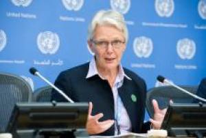
Ahead of the Third United Nations World Conference on Disaster Risk Reduction, which will take place 14 to 18 March in Sendai, Japan, the Head of the UN Office for Disaster Risk Reduction (UNISDR) Margareta Wahlström appealed to Member States to tackle the underlying drivers of disaster risks. The biggest of those drivers is climate change, accounting for 87 per cent of disasters, with other factors being poverty, land use and biodiversity degradation.

“Despite many successes and greatly improved performance in disaster management, it is sobering to note that 700,000 people have died in disaster events over the last ten years,” said Wahlström in a press release of 6 March. She explained that while 70 per cent of deaths are caused by earthquakes, climate-related disasters contribute enormously to economic losses and short and long-term population displacement triggered by disaster events.

Additionally to loss of lives, economical losses up to $1.4 trillion…

more
Publishing date 10/03/2015

More than 50 percent of the most exposed cities in the world for natural disasters are located in Philippines, China, Japan and Bangladesh, according to a recent publication by the global risk analytics company Verisk Maplecroft.

The 5th annual Natural Hazards Risk Atlas (NHRA) shows that of the 100 cities with the greatest exposure to natural hazards, 21 are located in the Philippines, 16 in China, 11 in Japan and 8 in Bangladesh. The combined risk of tropical storms and cyclones, floods, earthquakes, tsunamis and severe storms or extra-tropical cyclones, among others, has placed the small capital city of Port Vila, on the isolated South Pacific island nation of Vanuatu, on top as the world's riskiest ones.

The Philippines is the most exposed country with eight cities among the ten most risky at global level due to a high risk of tropical storms, earthquakes and landslides.…

more
Publishing date 09/03/2015

After the calibration and validation of ALOS-2/CIRC, the Japanese Space Agency JAXA confirmed that the data quality of ALOS-2/CIRC is adequate. All ALOS-2/CIRC data is therefore now available to the public. The data can be obtained via the CIRC observation data search. The only requirement is that the user follows the CIRC data policy.

The ultimate goal of the CIRC project is to minimize the damage and impact caused by forest fires, as well as contributing to urban planning and the management of volcanic disasters.

Publishing date 09/02/2015

The Asian Disaster Reduction Center (ADRC) has been a UN-SPIDER Regional Support Office (RSO) since 2009. In 2015, the ADRC will continue to promote and support the use of space-based information for disaster risk reduction in its role as a UN-SPIDER RSO.

In doing do, ADRC will continue to participate in the Sentinel Asia project. 

The project was launched in 2006 with the objective of establishing a disaster risk management system by making use of satellite images in Asia. ADRC functions as the focal point to receive emergency observation requests in the framework of Sentinel Asia. Upon receiving a request, ADRC decides whether the request is appropriate and whether the emergency observation should be implemented mainly based on the assessment of damages and casualties. Based on its own judgment, ADRC will forward the request to six…

more
Publishing date 29/01/2015
Regional Support Offices mentioned:

The Japanese government is currently planning the development of an operationally responsive small observation satellite to be launched in case of a disaster or military emergencies.

The creation of this disposable satellite is part of the draft Basic Plan on Space Policy, released by the Japanese government's Committee on National Space Policy.

As per the Basic Plan, a pre-assembled satellite, measuring 70 centimeters in length, width and height, and weighing between 100 and 150 kilograms, would be sent into orbit in case of an emergency.

The satellite would fly at a relatively low altitude to provide detailed information of the damages occurred in a specific area.

more
Publishing date 13/01/2015