, processed by ESA, CC BY-SA 3.0 IGO.")
Early warning systems have been around for a long time. Ancient tribes in the Pacific observed the precursory signs of tsunamis in the ocean to warn their communities. In a similar fashion, tribes in Africa and in the Americas watched the skies to warn about potentially catastrophic weather. In the recent past, an improved understanding of the natural hazards that trigger disasters and the deployment of improved sensors and means of communication to transmit the data to observatories in countries have allowed for the improvement of early warning systems and to extend the list of hazards under surveillance.
The relevance of early warning systems has been recognized by the disaster management community and is mentioned explicitly in the Sendai Framework for Disaster Risk Reduction 2015-2030 in Priority 4 (Enhancing disaster preparedness for effective response, and to "Build Back Better" in recovery, rehabilitation and reconstruction) and in Target G (Substantially increase the availability of and access to multi‑hazard early warning systems and disaster risk information and assessments to the people by 2030).
The climate change community also recognized the relevance of early warning systems and included the need to conduct such efforts in the Paris Climate Agreement (Article 7, paragraph 7c).
Early warning systems have been implemented and are now operated at the local level for some hazards such as floods; and at the national level to address a variety of hazards. In addition, efforts have been carried out under the umbrella of the United Nations since the nineties to promote the implementation or improvement of early warning systems around the world, including through international cooperation.
The United Nations Office for Disaster Risk Reduction (UNDRR) defines an early warning systems as "an integrated system of hazard monitoring, forecasting and prediction, disaster risk assessment, communication and preparedness activities systems and processes that enables individuals, communities, governments, businesses and others to take timely action to reduce disaster risks in advance of hazardous events".
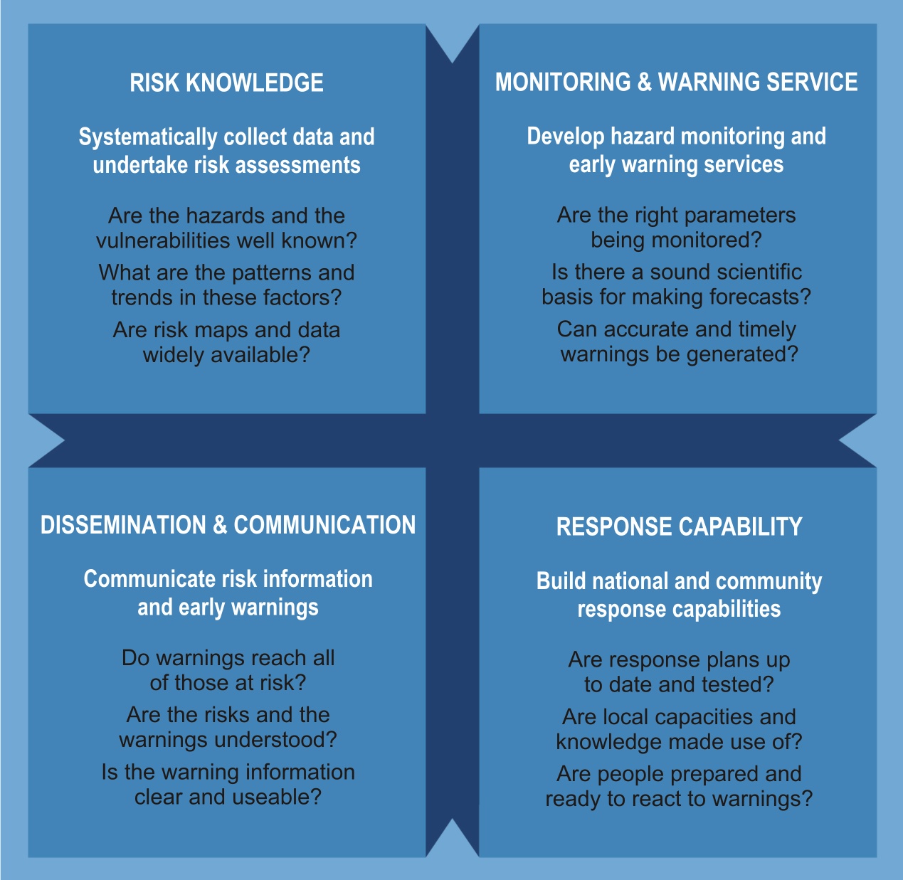
Image: UNDRR.
In 2003, experts taking part in the 2nd International Early Warning Conference introduced the current concept of efficient or people-centred early warning systems based on four elements:
- Disaster risk knowledge based on the systematic collection of data and disaster risk assessments
- Detection, monitoring, analysis and forecasting of the hazards and possible consequences
- Dissemination and communication, by an official source, of authoritative, timely, accurate and actionable warnings and associated information on likelihood and impact
- Preparedness at all levels to respond to the warnings received
In recent years, the concept of multi-hazard early warning systems has been promoted at the international level. Such systems address several hazards and/or impacts of similar or different type in contexts where hazardous events may occur alone, simultaneously, cascadingly or cumulatively over time, considering the potential interrelated effects. During the Third UN World Conference on Disaster Risk Reduction held in Sendai, Japan, in March 2015, various UN organizations, including UNOOSA, and other regional and national organizations joined forces to launch the International Network on Multi-Hazard Early Warning Systems (IN-MHEWS).
Space technologies are playing their role in contributing to early warning systems including through satellite telecommunications, Earth observation and research efforts that are underway to implement the use of Global Navigation Satellite Systems (GNSS). In addition, the space community began is dedicating efforts towards the implementation of early warning systems for space weather and Near-Earth Objects (NEOs).
UN-SPIDER contributes to early warning efforts by raising awareness about the applications of the different types of space technologies in combination with in situ data to improve existing early warning systems. In addition, it is a member of the International Network on Multi-Hazard Early Warning Systems (IN-MHEWS).
Types of early warning systems
There are various ways of classifying early warning systems.
By type of hazard
Early warning systems have been developed and implemented for:
- Geological hazards like tsunamis, earthquakes, volcanic activity, and landslides
- Hydrometeorological hazards including severe weather in land and at sea, floods, droughts, hurricanes, typhoons and cyclones, tornados, cold and heat waves, etc.
- Forest fires
- Biological hazards including insect plagues like locust outbreaks and harmful algae blooms
- Health hazards including vector-borne diseases, viruses and other types of diseases
- For pests and diseases on crops and livestock
By the level at which it is operated
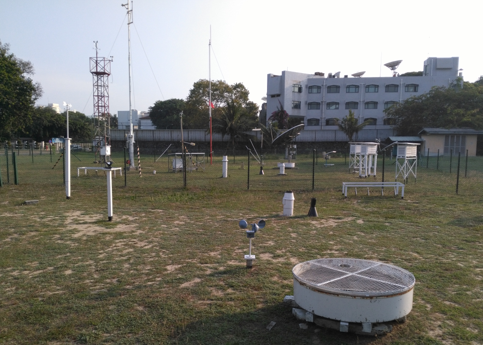
at the Sri Lanka Department of Meteorology
- Community or people-centred early warning systems, operated at a more locallevel by a municipal government or a community. The most typical systems of this kind address flood.
- National early warning systems operated by a national-level government agency like a meteorological department, a geological observatory or institute, a health or an agricultural ministry.
- Regional systems operated at a more regional level. Two examples in this category are the Famine Early Warning System Network (FEWSNET) operated by the United States of America in various regions of the world and the European Meteoalarm.
- Global systems operated at the international level by international organizations like the WHO and FAO.
As a single or multi-hazard system
- Single-hazard: Community-operated systems usually address only one type of hazard.
- Multi-hazard: Meteorological departments, ministries of health and agriculture operate early warning systems address a variety of hazards or cascading hazards.
Space technologies for early warning
While there are three types of space technologies including satellite telecommunications, Earth observation and GNSS, at this time satellite telecommunications and Earth observation are being used more frequently in several types of early warning systems.
Satellite telecommunications are used in two ways:
- To transmit data from sensors deployed in remote areas to observatories, where it is analyzed and used to elaborate forecasts regarding potentially catastrophic events
- To transmit warnings from one geographic region to another region, particularly in the case of tsunamis.
Earth observation is used in various types of early warning systems. Some examples of applications include:
- To track the path of cyclones, typhoons and hurricanes at sea before they make landfall
- To assess the severity of droughts in comparison to historic droughts
- To determine the presence of hot spots in active volcanoes
- To monitor the progress of floods in very large basins
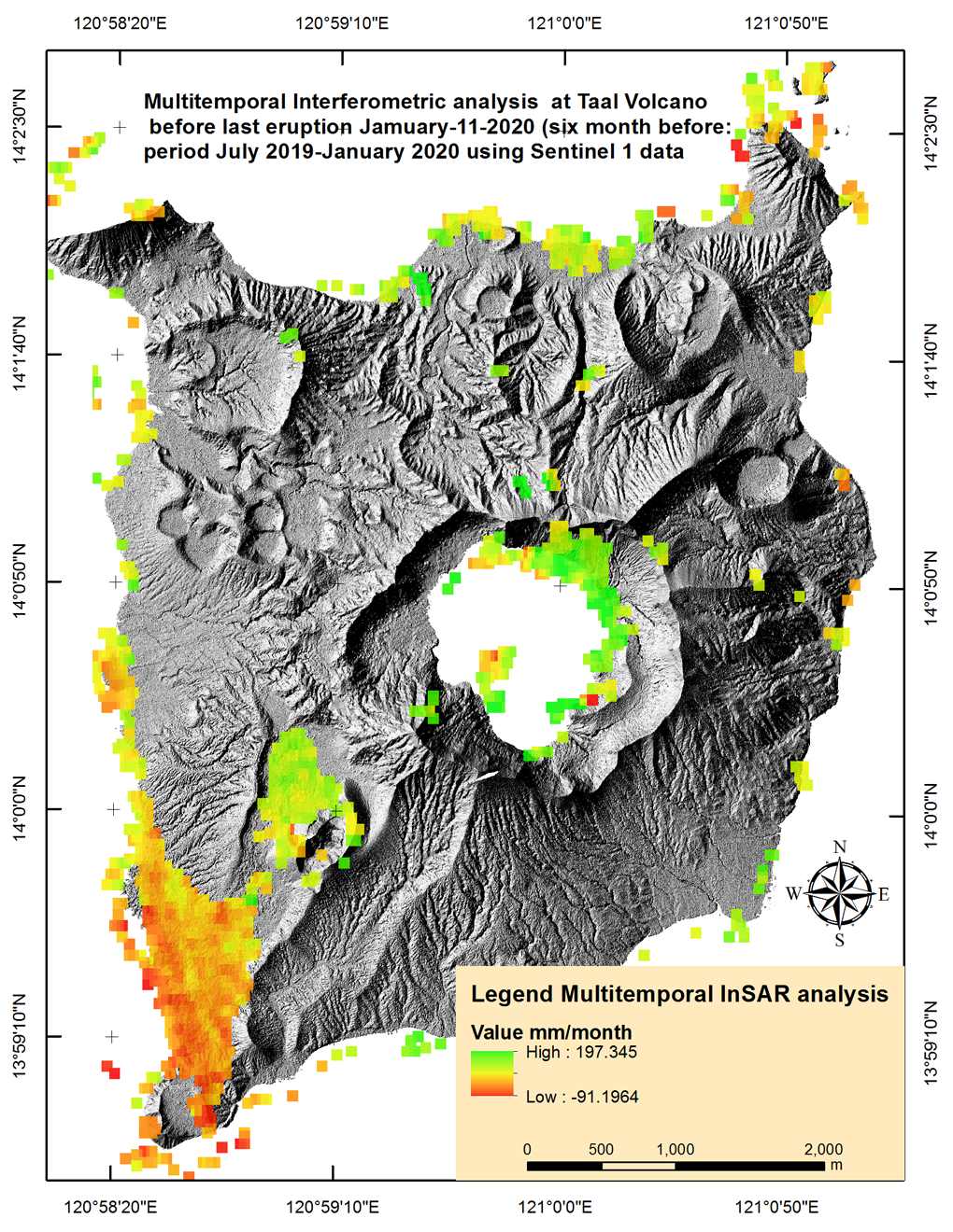
- To determine the potential expansion or deformation of a volcanic cone before an eruption
- To track active mass movements including landslides
Space agencies have set up applications to combine satellite imagery to generate relevant products that can be used in early warning systems around the world.
For example, the Copernicus programme of the European Commission operates several useful applications:
In addition, the Copernicus programme offers access free-of-charge to satellite imagery collected by the fleet of European Sentinel satellites. The higher resolution and frequency of visit allow for applications in specific types of early warning systems. Further repositories of satellite imagery can be found through the data sources page of the Knowledge Portal.
In the United States, the National Oceanographic and Atmospheric Administration (NOAA) and the United States Geological Survey (USGS) provide access to satellite imagery from satellites launched by the United States to users around the world, free of charge. The combination of archived and up-to date satellite imagery is finding its way into several early warning systems including those for drought. In addition, NOAA operates the Global Drought Information System (GDIS). Furthermore, information generated by the National Hurricane Centre (NHC) is used in Caribbean and Central American countries as part of their early warning efforts.
This table provides an overview of the uses of space-based technologies in tsunami early warning systems.
Early warning of outer space hazards
Several space agencies are joining forces with astronomical observatories to monitor extraterrestrial hazards including NEOs and space weather.
The International Asteroid Warning Network (IAWN) was established along with the Space Mission Planning Advisory Group (SMPAG) as an international effort, supported by UNOOSA, to deal with NEOs including meteorites.
In addition, space agencies and astronomical observatories are also joining forces to monitor space weather including solar or geomagnetic storms with the support of WMO.