• English
  • Español
  • Français

United
Nations


Office for Outer Space Affairs
UN-SPIDER Knowledge Portal

  • Accueil
  • À propos
    • Qu'est-ce que l'ONU-SPIDER?
    • À propos d’UNOOSA
    • Publications
    • Offres d'emploi
    • Rencontrez l'équipe
    • Contact
  • Applications spatiales
    • Technologie satellitaire
    • Mécanismes d’urgence
    • Recovery Mechanisms
    • Réseau international d'alerte aux astéroïdes
    • Space Mission Planning Advisory Group
    • Initiative internationale sur la météorologie spatiale
    • Les technologies spatiales à l'ONU
    • Comptes-rendus d'utilisateurs
  • Liens & ressources
    • Application de données du mois
      • Disaster Recovery
    • Sources de données
    • SIG et logiciels de télédétection
    • Online Learning Resources
    • Institutions
  • Risques & catastrophes
    • Prévention des risques de catastrophe
    • Systèmes d'alerte précoce
    • Gestion des catastrophes et des interventions d'urgence
    • Aléas naturels
    • Cadre d'action de Sendai
    • L'ONU et la prévention des risques de catastrophe
    • L'ONU et les alertes précoces
    • L'ONU et la gestion des catastrophes
  • Appui technique
    • Missions Conseil
    • Appui d’urgence
    • Appui à distance
    • Pratiques recommandées
    • Activités de formation
    • Utilisations pratiques
  • Réseaux
    • Bureaux régionaux d’appui
    • GP-STAR
    • MHEWS
    • IWG-SEM
  • Projets
    • SPEAR
    • SEWS-D
    • EvIDENz
    • Flood GUIDE
  • Actualités
    • Actualités
    • Événements
    • Événements passés

Breadcrumb

  • Home
  • Franco-Haitian Convention On Satellite-based Environmental Monitoring Signed
  • Franco-Haitian convention on satellite-based environmental monitoring signed

Franco-Haitian convention on satellite-based environmental monitoring signed

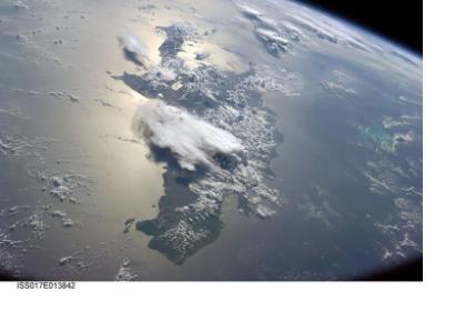
Satellite image of Haiti and the Greater AntillesSatellite image of Haiti and the Greater Antilles (Image: NASA)

On 17 November 2014, the Convention on Satellite-based Environmental Monitoring in Haiti (SEAS-Haiti) was signed by representatives of France and of Haiti.

At the agreement's core is the implementation of a technological platform for sustainable environmental management in Haiti and the Caribbean, using satellite imagery for research, training, innovation and sustainable development.

Part of the agreement is the establishment of a Remote Sensing Center on the Henri Christophe of Limonade campus of the State Universiy of Haiti (UEH), which will collect data from various satellites in order to assist a wide range of activities, such as monitoring deforestation, weather forecasting, creating epidemiological real-time maps and vulnerability mapping. The data collected will be accessible freely for researchers and public institutions. Specific training activities as well as regional research programmes will be offered to Haitian researchers.

According to Jean Marie Theodates, President of the Provisional Board of Management of the Henri Christophe of Limonade campus: "This giant step will provide Haiti with scientific and technological mapping techniques."

SEAS-Haiti was formally signed in the presence of Haitian government officials, French diplomates, Haitian and French academics, the rector of UEH, Jean Vernet Henry and the president of the Research for Development Institute (IRD), Michel Laurent.
alterpresse (french)
Thu, 20 Nov 2014 - 09:16
Haiti

Footer menu

  • Contact
  • Terms of Use

User account menu

  • Log in