English
Español
Français
Search form
Search
Menu
Main menu
Accueil
Applications Spatiales
Mécanismes d’urgence
Technologie satellitaire
Comptes-rendus d'ultilisateurs
Initiative internationale sur la météorologie spatiale
Les technologies spatiales à l'ONU
Réseau international d'alerte aux astéroïdes
Risques&Catastrophes
Gestion des catastrophes et interventions d'urgence
Prévention des risques de catastrophe
L'ONU et la gestion des catastrophes
L'ONU et la prévention des risques de catastrophe
Aléas naturels
Les Nations Unies et les alertes précoces
Systèmes d'alerte précoce
Liens & Ressources
Sources de données
SIG et logiciels de télédétection
Opportunités de formation externes
Opportunités de formation en ligne externes
Institutions
Appui Technique
Pratiques recommandées
Activités de formation
Appui d'urgence
Missions Conseil
Réseaux
Bureaux régionaux d’appui
GP-STAR
MHEWS
Projets
Actualités
Événements
Mises à jour mensuelles
Événements passés
Actualités
Bulletins
A propos
Qu'est-ce que c'est ONU-SPIDER?
A Propos d'UNOOSA
Publications
Offres d'emploi
Rencontrez l'Équipe
Contact
UN-SPIDER contributes to virtual training on the use of Google Earth Engine for forest fire management
Image: NASA Worldview.
UNOOSA and UNDRR conduct conference on space-based technologies for disaster risk reduction
Typhoon Vamco on November 11, a few hours before making landfall on the Philippines. Image: NASA.
UN-SPIDER supports disaster response efforts to Hurricane Eta in Central America
The Geostationary Operational Environmental Satellite 16 (GOES-16) captured this image of Eta on November 3. Image: NASA Earth Observatory.
UNOOSA and Centre for Space Science and Technology Education for Asia and the Pacific launch online course on Geospatial Applications for Disaster Risk Management
Floods in northern parts of Madagascar in late January 2020. Image: NASA.
UNOOSA and Ben-Gurion University of the Negev agree to establish UN-SPIDER RSO in Israel
Image: Ben-Gurion University of the Negev.
Précédent
Pause
Next
1
of
5
Explorer le Portail de Connaissances
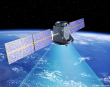
Comment la technologie spatiale peut-elle être appliquée aux catastrophes?
Où puis-je accéder à des données satellitaires et d'autres ressources?
Qui sont les utilisateurs de la technologie spatiale pour les risques et les catastrophes?
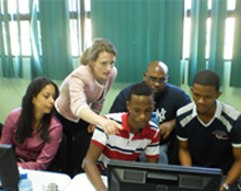
Quels services peut fournir ONU-SPIDER aux Etats Membres?
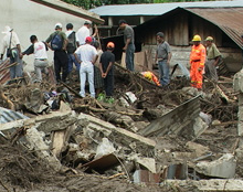
Se tenir au courant
Actualités
Lun Jan 11 2021
UNOOSA and NASA sign landmark Memorandum of Understanding to advance peaceful...
Ven Jan 8 2021
EUMETSAT releases new pilot data services
Mer Jan 6 2021
Copernicus releases 30m Digital Elevation Model
Lun Jan 4 2021
UN-SPIDER contributes to virtual training on the use of Google Earth Engine for...
Dim Déc 20 2020
Mexico and Argentina align satellite networks to resolve regional challenges
Prochains événements
21/01/2021
Virtual launch of Atlas of Human Planet 2020
21/01/2021
AI for good Webinar: Towards Responsible AI for Disaster Risk Management
03/02/2021
Digital Earth Africa Webinar: Capacity Development for Using EO Data to Drive...
08/02/2021 to 05/03/2021
Taller Gestión de Incendios Forestales Mediante el Uso de la Plataforma Google...
09/02/2021
Mapping and Monitoring Lakes and Reservoirs with Satellite Observations
Se connecter à la communauté
Bureaux Régionaux d’Appui
Leave this field blank
Zircon - This is a contributing Drupal Theme
Design by
WeebPal
.