![]()
United
Nations
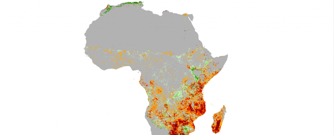
Actual Evapotranspiration Anomaly and NDVI (FEWS NET - USGS, USAID)
| Data provided by: | United States Geological Survey (USGS) |
| Data accessibility: | export data, visualization of data (e.g. web GIS or real time monitoring) |
| Link to the data: | |
| File type: | tiff |
| Data type: | baseline data, hazard specific data, land use, land cover data |
| Hazard: | Drought |
| Disaster cycle phase: | Disaster Risk Management |
| Space-based Information: | MODIS |
| Satellites and Sensors: | Terra |
| Spatial coverage: | Africa |
| Spatial resolution: | 40.00 |
| Temporal coverage: | Archive, Near-real time |
| Content dates: | 2001-today |
| Technical Specifications: | |
| Costs: | free |
| Contact: | USGS contacts |
| Restrictions/ Citation of the dataset: |
Provider
![]()